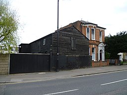
London Borough of Enfield
| London Borough of Enfield | ||
| Borough | ||
|
|
||
| Motto: By Industry Ever Stronger (engelska: Av industri någonsin mer stark) | ||
| Land | ||
|---|---|---|
| Riksdel | ||
| Region | London | |
| Läge | 51°38′42″N 0°03′36″V / 51.645°N 0.06°V | |
| Area | 81 km²[1] | |
| Folkmängd | 327 224 (2022)[2] | |
| Befolkningstäthet | 4 040 invånare/km² | |
| GSS-kod | E09000010 | |
| Geonames | 3333146 | |
Enfields läge i Storlondon. | ||
| Webbplats: www.enfield.gov.uk | ||
London Borough of Enfield är en kommun (borough) i norra London. Bland annat ligger delområdena Edmonton, Southgate och Enfield Town i Enfield. I augusti 2011 drabbades Enfield hårt av London-kravallerna som spridit sig från Tottenham och senare spred sig till stora delar av London.
Stadsdelen har stora problem med fattigdom, arbetslöshet och ungdomsbrottslighet.
Distrikt
Distrikt som helt eller delvis ligger i Enfield:
- Arnos Grove
- Botany Bay
- Brimsdown
- Bulls Cross
- Crews Hill
- Enfield Town
- Enfield Lock
- Enfield Highway
- Edmonton
- Freezywater
- Enfield Wash
- Grange Park
- Hadley Wood
- Palmers Green
- Ponders End
- Southgate
- Winchmore Hill
Källor
- ^ ”Estimates of the population for the UK, England, Wales, Scotland, and Northern Ireland (Mid-2022)” (på engelska) (xls). Landyta, avrundad till hela km². Office for National Statistics. 26 mars 2024. https://www.ons.gov.uk/peoplepopulationandcommunity/populationandmigration/populationestimates/datasets/populationestimatesforukenglandandwalesscotlandandnorthernireland. Läst 25 juni 2024.
- ^ ”Estimates of the population for the UK, England, Wales, Scotland, and Northern Ireland (Mid-2022)” (på engelska) (xls). Office for National Statistics. 26 mars 2024. https://www.ons.gov.uk/peoplepopulationandcommunity/populationandmigration/populationestimates/datasets/populationestimatesforukenglandandwalesscotlandandnorthernireland. Läst 25 juni 2024.
Externa länkar
 Wikimedia Commons har media som rör London Borough of Enfield.
- Enfields councils officiella webbplats
| |||||||||||


