
Kategoria:Grafiki do przetłumaczenia
Kategoria grupuje grafiki oznaczone szablonem {{Do tłumaczenia}} wskazującym na pliki używane w polskojęzycznej Wikipedii, które wymagają przetłumaczenia na język polski.
Pliki w kategorii „Grafiki do przetłumaczenia”
Poniżej wyświetlono 101 spośród wszystkich 101 plików w tej kategorii.
 AntikeGriechen1.jpg 2836 × 1616; 1,96 MB
 Arasrivermap.jpg 1484 × 866; 1,57 MB
 Atmosphärische Absorption.png 667 × 426; 5 KB
 Battle of Wizna.png 884 × 577; 33 KB
 Bulgaria Simeon I (893-927).svg 752 × 719; 232 KB
 Ca-map.png 631 × 321; 31 KB
 Canada provinces evolution.gif 1000 × 864; 247 KB
 Canada topo.jpg 1400 × 1211; 791 KB
 Carte Lewis-Clark Expedition.png 849 × 530; 204 KB
 Cilician Armenia-en.svg 2508 × 1789; 733 KB
 Corfu topographic map-en.svg 2096 × 2341; 2,19 MB
 Croatia map with updated borders.gif 328 × 353; 21 KB
 Danubemap.png 747 × 480; 601 KB
 Daubechies4-functions.png 360 × 252; 9 KB
 Daubechies4-spectrum.png 360 × 252; 10 KB
 Daubechies12-functions.png 360 × 252; 8 KB
 Daubechies12-spectrum.png 360 × 252; 10 KB
 Daubechies20-functions.png 360 × 252; 9 KB
 Daubechies20-spectrum.png 360 × 252; 9 KB
 Dywizje wrzesien 1.png 883 × 933; 230 KB
 Easter Island map-en.svg 1750 × 1245; 878 KB
 Electron scattering.png 960 × 720; 10 KB
 Emsverlauf.png 794 × 1020; 34 KB
 Eurogipsy.PNG 1166 × 1036; 117 KB
 European union emu map en.png 1165 × 1200; 858 KB
 Falkland Islands topographic map-en.svg 2550 × 1990; 1,97 MB
 Fluss-lv-Abava.png 1310 × 826; 1,02 MB
 Fluss-lv-Gauja.png 1310 × 826; 1,02 MB
 Fluss-lv-Lielupe.png 1310 × 826; 1,02 MB
 Fluss-lv-Mūsa.png 1310 × 826; 1,02 MB
 Fluss-lv-Venta.png 1310 × 826; 1,02 MB
 France map with Loire highlighted.jpg 1797 × 1796; 845 KB
 Godavari River.png 306 × 240; 19 KB
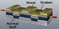 Horst graben.jpg 271 × 135; 41 KB
 Hydrostatic equilibrium.svg 458 × 272; 8 KB
 Illu08 thyroid.jpg 372 × 348; 43 KB
 Iran-ilkhanids.jpg 3596 × 2302; 2,01 MB
 Isle of Man topographic map-en.svg 1200 × 1100; 642 KB
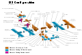 ISS configuration apr-2006 en.svg 1252 × 845; 312 KB
 Jaw joint - double.png 250 × 139; 10 KB
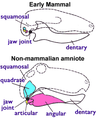 Jaw joint - mammal n non-mammal.png 250 × 313; 21 KB
 JordanRiver en.svg 1016 × 1285; 809 KB
 Karte bauernkrieg3.jpg 900 × 922; 239 KB
 Karte Taimyr.png 789 × 647; 21 KB
 Kaschubei heute.png 358 × 563; 111 KB
 KGG 02 Viergelenk 01.png 600 × 600; 16 KB
 Kosovo map-en.svg 1777 × 1830; 3,81 MB
 Laptev Sea map.png 1500 × 841; 382 KB
 LeftHandOutline.png 354 × 258; 28 KB
 Local Group.JPG 640 × 480; 29 KB
 M30 components.jpg 600 × 442; 32 KB
 Map indicating Ellesmere Island, Nunavut, Canada.png 428 × 380; 56 KB
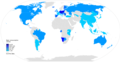 Map of world by beer consumption.png 2000 × 1027; 285 KB
 Map-alexander-empire.png 929 × 605; 87 KB
 MapAllier.jpg 668 × 600; 449 KB
 Mauna Loa Carbon Dioxide.png 800 × 549; 35 KB
 Milwaukeerivermap.png 497 × 500; 159 KB
 MobileAlabamaCoosa3.png 1360 × 1822; 458 KB
 MODIS ATM solar irradiance.jpg 590 × 352; 35 KB
 Neva map.png 450 × 305; 29 KB
 Noneuclid.png 663 × 167; 3 KB
 Numa.svg 569 × 225; 22 KB
 NZ-kiwimap.png 824 × 1230; 124 KB
 Okresy97 Slovakia.svg 841 × 596; 1,97 MB
 PAL-NTSC-SECAM.svg 940 × 477; 1,67 MB
 Parallelization graph.jpg 718 × 466; 38 KB
 Poles in lithuania.png 500 × 500; 47 KB
 PowerStation3.svg 512 × 358; 166 KB
 Pre Migration Age Germanic.png 600 × 436; 94 KB
 PsiFunctions.png 400 × 300; 8 KB
 Pyrenees topographic map-fr.svg 3200 × 1900; 6,38 MB
 Resolution chart.svg 2000 × 900; 182 KB
 Resonanzueberhoehung.png 3249 × 2351; 71 KB
 RhoFunctions.png 400 × 300; 10 KB
 Riodelaplatabasinmap.png 1500 × 1510; 3,14 MB
 Scotland map-fr.jpg 2400 × 3450; 2,21 MB
 Scotland topographic map-fr.jpg 2400 × 3450; 2,29 MB
 SEM principle.GIF 634 × 601; 6 KB
 Senufo languages.png 800 × 906; 113 KB
 Sirenians evolution.gif 500 × 881; 50 KB
 Smine-diagram.jpg 300 × 380; 40 KB
 Solar-cycle-data.png 700 × 466; 37 KB
 SpeedOfLight.png 406 × 306; 12 KB
 SpeedOfLightScale.png 400 × 300; 8 KB
 Sprawling and erect hip joints - horiz.png 492 × 218; 16 KB
 Suedweststaat.png 628 × 729; 25 KB
 Sun parts big.jpg 468 × 334; 83 KB
 Supercell02.svg 1821 × 1128; 384 KB
 TangentGraphic2.svg 448 × 383; 3 KB
 TDistPsi.png 400 × 300; 9 KB
 The evolution of the PSR B1620-26 system.jpg 2850 × 1865; 1012 KB
 TheKuiperBelt 42AU Centaurs.svg 600 × 450; 41 KB
 Tigr-euph.png 1000 × 1005; 264 KB
 Tinctures.svg 875 × 2250; 30 KB
 Tornadic classic supercell radar.gif 502 × 473; 62 KB
 Trichinella LifeCycle.gif 551 × 548; 63 KB
 Using sextant swing.gif 787 × 393; 2,1 MB
 VietnameseRegionsRRD.PNG 300 × 443; 36 KB
 Yellow Sea.PNG 771 × 538; 172 KB
 Yeniseirivermap.png 988 × 986; 325 KB
 YoungsDoubleSlit.png 646 × 375; 41 KB


