Rajbalhat
Rajbalhat | |
|---|---|
Census Town | |
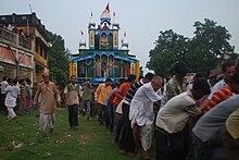
 Radhakantajiu Temple, Rajbalhat | |
| Coordinates: 22°46′33″N 88°00′19″E / 22.7758°N 88.0054°E | |
| Country | |
| State | West Bengal |
| District | Hooghly |
| Elevation | 14 m (46 ft) |
| Population (2011) | |
• Total | 16,479 |
| Languages | |
| • Official | Bengali, English |
| Time zone | UTC+5:30 (IST) |
| PIN | 712408 |
| Telephone code | 03212 |
| ISO 3166 code | IN-WB |
| Vehicle registration | WB |
| Website | wb |
Rajbalhat is a census town in Jangipara, a Community development block of Srirampore subdivision in Hooghly district in the Indian state of West Bengal.
Geography

3miles
M: municipal city/ town, CT: census town, R: rural/ urban centre,
Owing to space constraints in the small map, the actual locations in a larger map may vary slightly
Location
Rajbalhat is located at 22°46′33″N 88°00′19″E / 22.7758°N 88.0054°E
Villages in Rajbalhat panchayat are as follows: Rajbalhat, Shib Chak, Morhal, Mukundapur, Kuliara, Jhanda, Binodbati, Chaiman Chak, Naskardanga, Gultia, Dakshin Gultia, Tripan, Nabagram, Jabni and Rahimpur.[1]
Urbanisation
Srirampore subdivision is the most urbanized of the subdivisions in Hooghly district. 73.13% of the population in the subdivision is urban and 26.88% is rural. The subdivision has 6 municipalities and 34 census towns. The municipalities are: Uttarpara Kotrung Municipality, Konnagar Municipality, Serampore Municipality, Baidyabati Municipality, Rishra Municipality and Dankuni Municipality. Amongst the CD Blocks in the subdivision, Uttarapara Serampore (census towns shown in a separate map) had 76% urban population, Chanditala I 42%, Chanditala II 69% and Jangipara 7% (census towns shown in the map above).[2][3] All places marked in the map are linked in the larger full screen map.
Demographics
As per 2011 Census of India, Rajbalhat had a total population of 16,479 of which 8,405 (51%) were males and 8,074 (49%) were females. Children under 6 made up 1,419 people. The number of literate people in Rajbalhat was 12,530 (83.20% of the population over 6 years).[3]
Culture
The garh (fort) of Bhursut Raj at Rajbalhat covers about seven bighas of land (roughly 4.3 acres) and 500 bighas of land was a debottar property for the maintenance of the temple of Rajballavi Thakurani at Rajbalhat. No signs remain of the king's garh, or palace.[4] Rajballavi Temple dates to approximately the early 16th century.[5]
Radhakantajiu (1733) and Sridhar Damodar (1724) are 18th century temples with terracotta decorations in Rajbalhat village.[6]


References
- ^ "Census Data District Name: Hugli(12) Block Name: Jangipara (0016)". West Bengal Govt. Retrieved 4 February 2009. [dead link]
- ^ "District Statistical Handbook 2014 Hooghly". Table 2.2, 2.4(a). Department of Statistics and Programme Implementation, Government of West Bengal. Retrieved 3 October 2018.
- ^ a b "C.D. Block Wise Primary Census Abstract Data(PCA)". 2011 census: West Bengal – District-wise CD Blocks. Registrar General and Census Commissioner, India. Retrieved 3 October 2018.
- ^ "The Temples in Hooghly". hindubooks.org. Archived from the original on 16 October 2016. Retrieved 5 February 2009.
- ^ "Next weekend you can be at ... Antpur". The Telegraph, 24 July 2005. Archived from the original on 12 September 2012. Retrieved 4 February 2009.
- ^ "Rajbalhat". india9.com. Retrieved 4 February 2009.


