
File:Puertogalera chart 4344 1917.jpeg
Size of this preview: 677 × 600 pixels. Other resolutions: 271 × 240 pixels | 542 × 480 pixels | 867 × 768 pixels | 1,156 × 1,024 pixels | 2,311 × 2,048 pixels | 3,626 × 3,213 pixels.
Original file (3,626 × 3,213 pixels, file size: 1.69 MB, MIME type: image/jpeg)
Summary
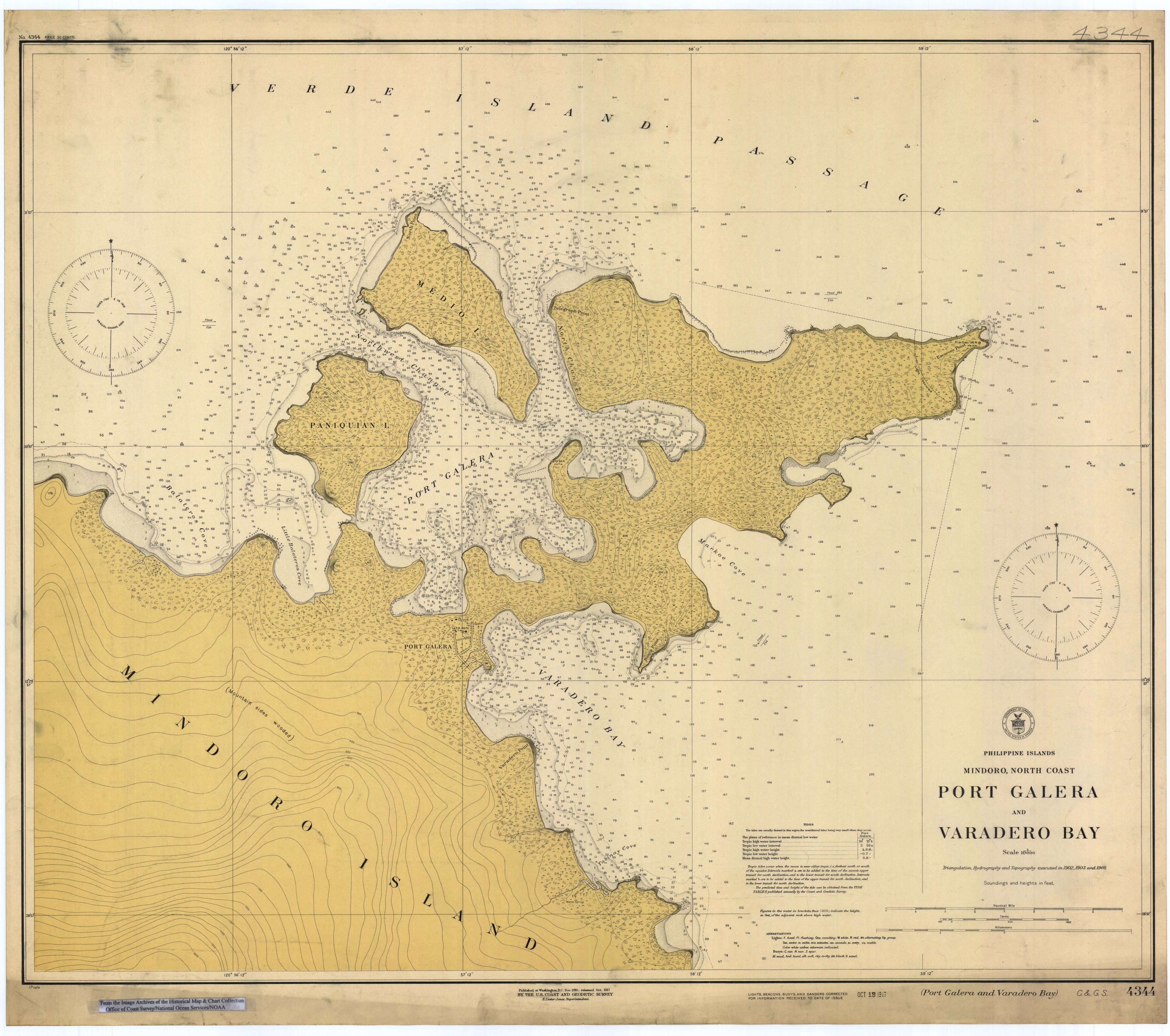
- Map of Port Galera (Puerto Galera) and Varadero Bay, Mindoro island, Philippines, 1917.
- Scanned image of US Coast & Geodetic Survey (Manila Office) nautical chart #4344.
- Credits
From the Image Archives of the Historical Map & Chart Collection archive copy at the Wayback Machine/Office of Coast Survey/National Ocean Service/NOAA/United States government. Converted from MrSID to JPEG format for upload to Commons.
Licensing
This image is in the public domain because it contains materials that originally came from the U.S. National Oceanic and Atmospheric Administration, taken or made as part of an employee's official duties.
|
File history
Click on a date/time to view the file as it appeared at that time.
| Date/Time | Thumbnail | Dimensions | User | Comment | |
|---|---|---|---|---|---|
| current | 01:51, 17 March 2006 | | 3,626 × 3,213 (1.69 MB) | Cdc~commonswiki | Scanned image of US Coast & Geodetic Survey (Manila Office) nautical chart #4344 Port Galera (Puerto Galera) and Varadero Bay, Mindoro, Philippines, 1917. From the Image Archives of the [http://chartmaker.ncd.noaa.gov/csdl/ctp/abstract.htm Historical Ma |
File usage
The following page uses this file:
Global file usage
The following other wikis use this file:
- Usage on id.wikipedia.org
- Usage on pam.wikipedia.org
- Usage on sv.wikipedia.org
- Usage on zh.wikipedia.org