
File:NepalBajuraDistrictmap.png
Original file (2,479 × 3,508 pixels, file size: 249 KB, MIME type: image/png)
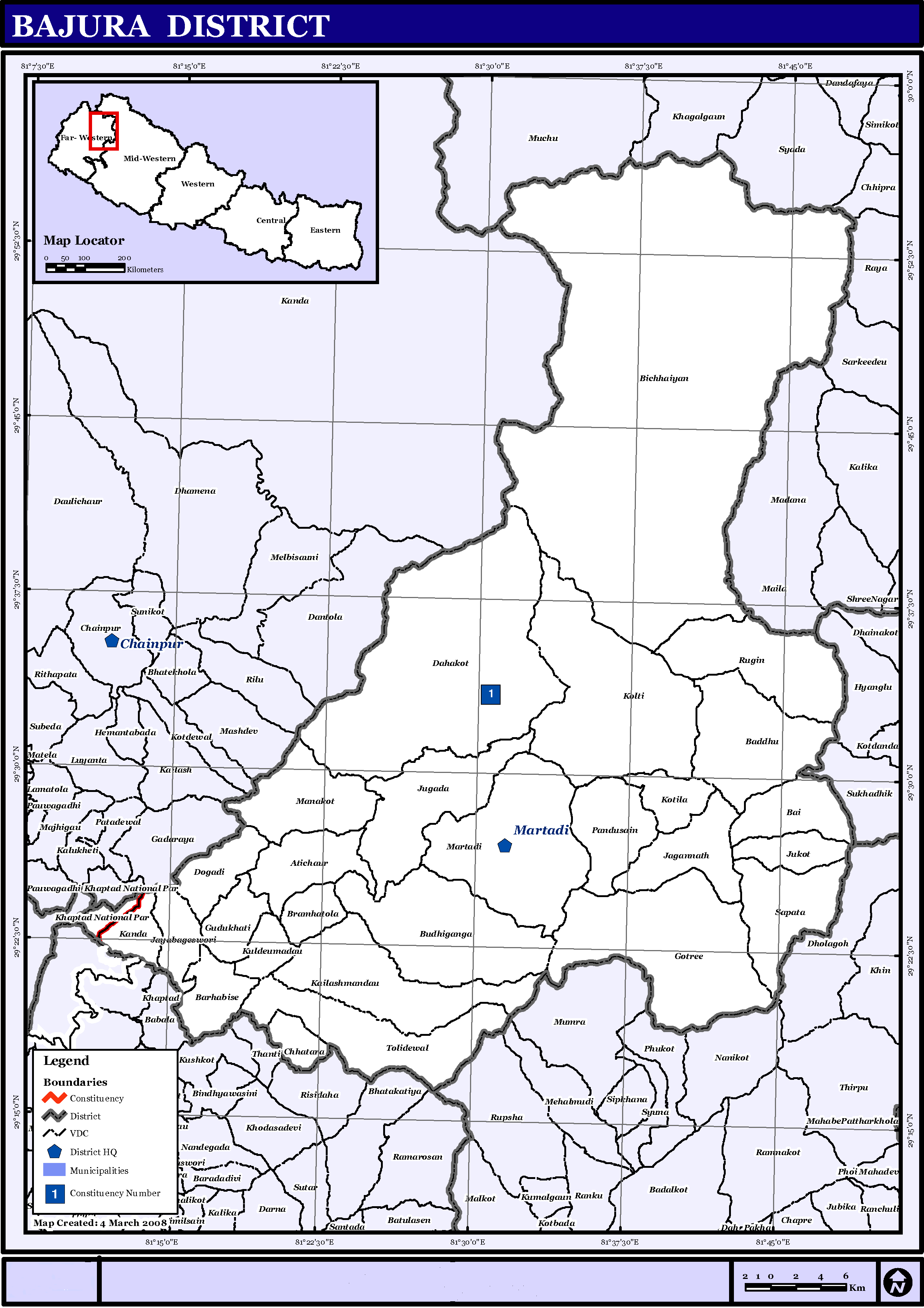
| Description | English: Map displaying Village Development Committees in Bajura District, Nepal |
|||
| Date | ||||
| Source | http://www.un.org.np/maps/district-maps/far-western/Bajura.pdf | |||
| Author | United Nations | |||
| Permission (Reusing this file) |
|

File history
Click on a date/time to view the file as it appeared at that time.
| Date/Time | Thumbnail | Dimensions | User | Comment | |
|---|---|---|---|---|---|
| current | 15:21, 21 May 2016 | | 2,479 × 3,508 (249 KB) | Timeshifter | Removed UN logo and info. Only UN maps without UN info are allowed. |
| 01:40, 6 November 2008 |  | 2,479 × 3,508 (272 KB) | Sadalmelik | {{Information |Description={{en|1=Map displaying Village Development Committees in Bajura District, Nepal}} |Source=http://www.un.org.np/maps/district-maps/far-western/Bajura.pdf |Date=March 4, 2008 |Author=United Nations |Permission={{PD-UN}} |other_ |
File usage
The following 2 pages use this file:
Global file usage
The following other wikis use this file:
- Usage on de.wikipedia.org
- Usage on fi.wikipedia.org
- Usage on it.wikipedia.org
- Usage on mai.wikipedia.org
- Usage on ms.wikipedia.org
- Usage on ne.wikipedia.org
View more global usage of this file.