
File:Mapa de relevo do Sul do Brasil.png
Size of this preview: 474 × 599 pixels. Other resolutions: 190 × 240 pixels | 501 × 633 pixels.
Original file (501 × 633 pixels, file size: 523 KB, MIME type: image/png)
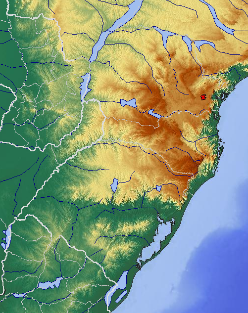
| Description | English: Relief map of the South of Brazil Português: Mapa de relevo do Sul do Brasil |
||
| Date | |||
| Source | http://www.maps-for-free.com/ | ||
| Author | snapshot from http://www.maps-for-free.com/ | ||
| Permission (Reusing this file) |
|

File history
Click on a date/time to view the file as it appeared at that time.
| Date/Time | Thumbnail | Dimensions | User | Comment | |
|---|---|---|---|---|---|
| current | 22:37, 28 December 2009 | | 501 × 633 (523 KB) | Pdms | {{Information |Description={{en|1=Relief map of the South of Brazil}} {{pt|1=Mapa de relevo do Sul do Brasil}} |Source=http://www.maps-for-free.com/ |Author=snapshot from http://www.maps-for-free.com/ |Date=2009-12 |Permission={{GFDL}} |other_versions= }} |
File usage
The following 2 pages use this file:
Global file usage
The following other wikis use this file:
- Usage on ca.wikipedia.org
- Usage on de.wikipedia.org
- Usage on es.wikipedia.org
- Usage on fr.wikipedia.org
- Usage on hr.wikipedia.org
- Usage on it.wikipedia.org
- Usage on lt.wikipedia.org
- Usage on pt.wikipedia.org
- Usage on sh.wikipedia.org
- Usage on sr.wikipedia.org
- Usage on www.wikidata.org
- Usage on zh.wikipedia.org