
File:Map of Biak Island.jpg

Size of this preview: 800 × 534 pixels. Other resolutions: 320 × 214 pixels | 640 × 427 pixels | 1,024 × 684 pixels | 1,280 × 855 pixels | 1,742 × 1,163 pixels.
Original file (1,742 × 1,163 pixels, file size: 175 KB, MIME type: image/jpeg)
Summary
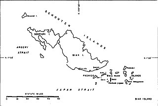
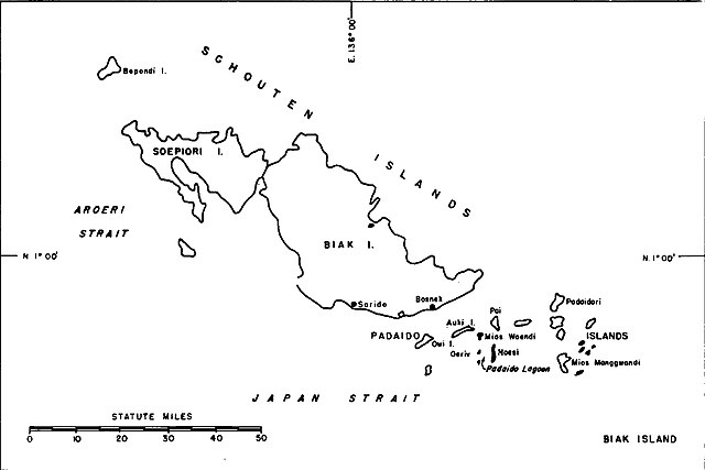
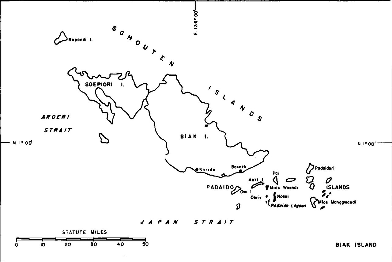
| Description | English: Map of Biak Island |
| Date | |
| Source | Building the Navy's Bases in World War II, Volume II |
| Author | United States Bureau of Yards and Docks |
Licensing
This work is in the public domain in the United States because it is a work prepared by an officer or employee of the United States Government as part of that person’s official duties under the terms of Title 17, Chapter 1, Section 105 of the US Code.
Note: This only applies to original works of the Federal Government and not to the work of any individual U.S. state, territory, commonwealth, county, municipality, or any other subdivision. This template also does not apply to postage stamp designs published by the United States Postal Service since 1978. (See § 313.6(C)(1) of Compendium of U.S. Copyright Office Practices). It also does not apply to certain US coins; see The US Mint Terms of Use. |
 | |
| This file has been identified as being free of known restrictions under copyright law, including all related and neighboring rights. | ||
File history
Click on a date/time to view the file as it appeared at that time.
| Date/Time | Thumbnail | Dimensions | User | Comment | |
|---|---|---|---|---|---|
| current | 15:07, 5 April 2021 | | 1,742 × 1,163 (175 KB) | Zoozaz1 | Uploaded a work by United States Bureau of Yards and Docks from Building the Navy's Bases in World War II, Volume II with UploadWizard |
File usage
The following 3 pages use this file:
Global file usage
The following other wikis use this file:
- Usage on nl.wikipedia.org
- Usage on sv.wikipedia.org
- Usage on vi.wikipedia.org