
File:Madikeri map.jpg

Size of this preview: 800 × 583 pixels. Other resolutions: 320 × 233 pixels | 640 × 466 pixels | 1,024 × 746 pixels | 1,280 × 933 pixels | 2,684 × 1,956 pixels.
Original file (2,684 × 1,956 pixels, file size: 5.91 MB, MIME type: image/jpeg)
Summary
Licensing
This is a faithful photographic reproduction of a two-dimensional, public domain work of art. The work of art itself is in the public domain for the following reason:
The official position taken by the Wikimedia Foundation is that "faithful reproductions of two-dimensional public domain works of art are public domain". This photographic reproduction is therefore also considered to be in the public domain in the United States. In other jurisdictions, re-use of this content may be restricted; see Reuse of PD-Art photographs for details. | ||||
File history
Click on a date/time to view the file as it appeared at that time.
| Date/Time | Thumbnail | Dimensions | User | Comment | |
|---|---|---|---|---|---|
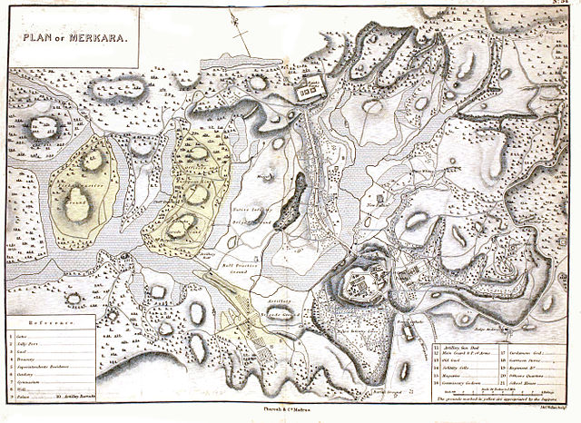
| current | 08:30, 25 April 2015 | | 2,684 × 1,956 (5.91 MB) | Shyamal | {{Information |Description=Plan of Madikeri in 1854 |Source=An atlas of the southern part of India including all the principal towns and cantonments. 1854. J & C Walker engravers, London. Pharaoh and Co, Madras. |Date=1854 |Author=J & C Walker |Permiss... |
File usage
The following 2 pages use this file:
Global file usage
The following other wikis use this file:
- Usage on kn.wikipedia.org