
File:Huer's House, Newquay Geograph-2510886-by-Steve-Daniels.jpg
Size of this preview: 800 × 533 pixels. Other resolutions: 320 × 213 pixels | 640 × 427 pixels | 1,024 × 683 pixels | 1,500 × 1,000 pixels.
Original file (1,500 × 1,000 pixels, file size: 141 KB, MIME type: image/jpeg)
Summary
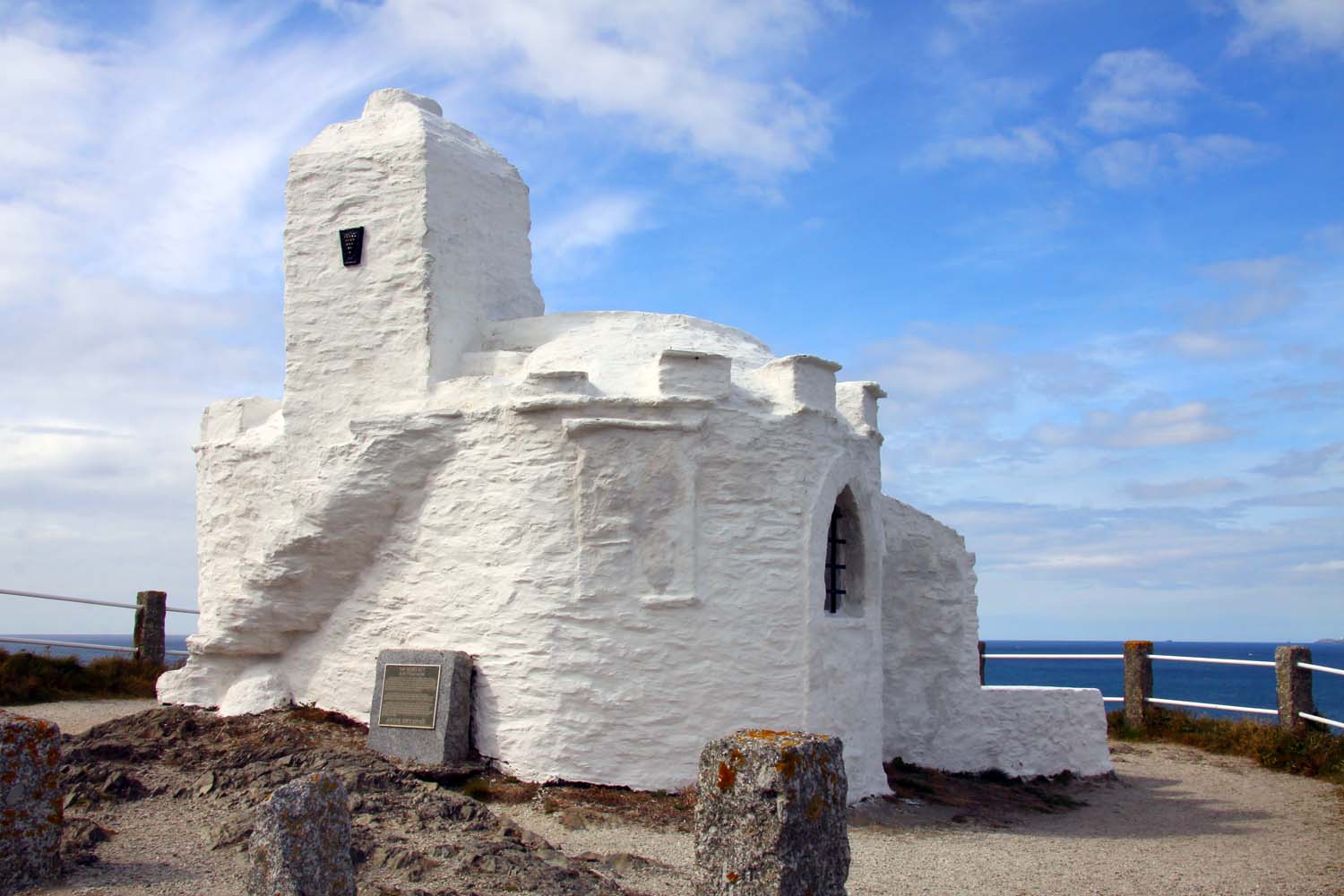
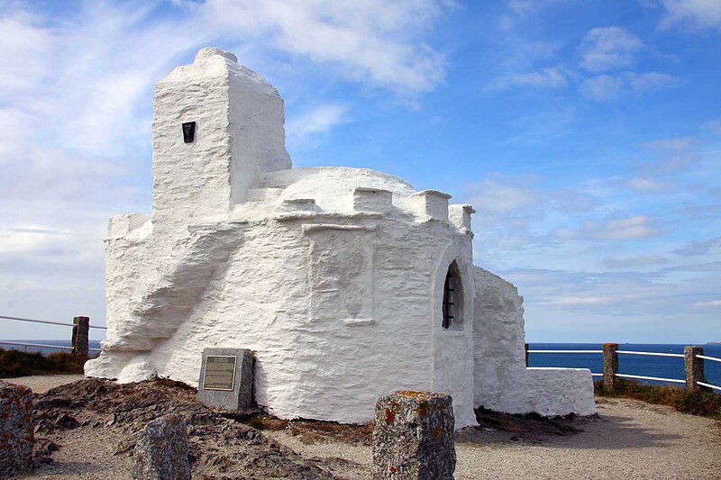
| Description | English: The Huer's Hut on King Edward Crescent
|
|
| Date | ||
| Source | From geograph.org.uk | |
| Author | Steve Daniels | |
| Permission (Reusing this file) |
Creative Commons Attribution Share-alike license 2.0 | |
| Attribution (required by the license) | Steve Daniels / The Huer's Hut on King Edward Crescent / | |
| Camera location | | View this and other nearby images on: OpenStreetMap |
|---|
Licensing

|
This image was taken from the Geograph project collection. See this photograph's page on the Geograph website for the photographer's contact details. The copyright on this image is owned by Steve Daniels and is licensed for reuse under the Creative Commons Attribution-ShareAlike 2.0 license. |
This file is licensed under the Creative Commons Attribution-Share Alike 2.0 Generic license.
Attribution: Steve Daniels
- You are free:
- to share – to copy, distribute and transmit the work
- to remix – to adapt the work
- Under the following conditions:
- attribution – You must give appropriate credit, provide a link to the license, and indicate if changes were made. You may do so in any reasonable manner, but not in any way that suggests the licensor endorses you or your use.
- share alike – If you remix, transform, or build upon the material, you must distribute your contributions under the same or compatible license as the original.
File history
Click on a date/time to view the file as it appeared at that time.
| Date/Time | Thumbnail | Dimensions | User | Comment | |
|---|---|---|---|---|---|
| current | 20:12, 13 September 2017 | | 1,500 × 1,000 (141 KB) | Geograph Update Bot | Higher-resolution version from Geograph. |
| 17:00, 18 October 2015 |  | 640 × 427 (59 KB) | Dave.Dunford | == {{int:filedesc}} == {{Information |Description={{en|1=The Huer's Hut on King Edward Crescent}}{{Listed building England|1144136}} |Source=From [http://www.geograph.org.uk/photo/2510886 geograph.org.uk] |Date=2011-06-14 |Author=[http://www.geograph.... |
File usage
The following 7 pages use this file:
Global file usage
The following other wikis use this file:
- Usage on dag.wikipedia.org