
File:Hadlow Church.jpg
Size of this preview: 450 × 600 pixels. Other resolutions: 180 × 240 pixels | 480 × 640 pixels.
Original file (480 × 640 pixels, file size: 85 KB, MIME type: image/jpeg)
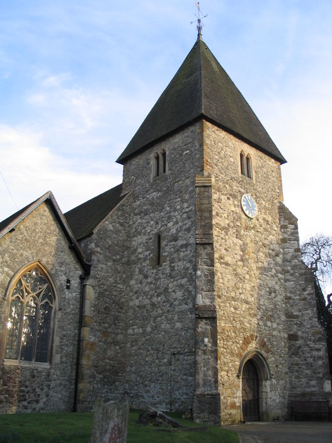
| Description | St. Mary's Church, Hadlow, built before 1588 |
| Date | |
| Source | From geograph.org.uk |
| Author | Angela Tuff |
| Permission (Reusing this file) |
Creative Commons Attribution Share-alike license 2.0 |
| Camera location | | View this and other nearby images on: OpenStreetMap |
|---|

|
This image was taken from the Geograph project collection. See this photograph's page on the Geograph website for the photographer's contact details. The copyright on this image is owned by Angela Tuff and is licensed for reuse under the Creative Commons Attribution-ShareAlike 2.0 license. |
This file is licensed under the Creative Commons Attribution-Share Alike 2.0 Generic license.
Attribution: Angela Tuff
- You are free:
- to share – to copy, distribute and transmit the work
- to remix – to adapt the work
- Under the following conditions:
- attribution – You must give appropriate credit, provide a link to the license, and indicate if changes were made. You may do so in any reasonable manner, but not in any way that suggests the licensor endorses you or your use.
- share alike – If you remix, transform, or build upon the material, you must distribute your contributions under the same or compatible license as the original.
Original upload log
The original description page was here. All following user names refer to en.wikipedia.
- 2007-12-17 09:07 Mjroots 120×160×8 (7738 bytes) St. Mary's Church, Hadlow. {{geograph|136997|Angela Tuff}}
File history
Click on a date/time to view the file as it appeared at that time.
| Date/Time | Thumbnail | Dimensions | User | Comment | |
|---|---|---|---|---|---|
| current | 12:58, 15 July 2008 | | 480 × 640 (85 KB) | Angusmclellan | {{Information |Description=St. Mary's Church, Hadlow, built before 1588 |Source=From [http://www.geograph.org.uk/photo/136997 geograph.org.uk] |Date=2006-03-13 |Author=[http://www.geograph.org.uk/profile/4444 Angela Tuff] |Permission=Creative Commons Attr |
File usage
The following 3 pages use this file:
Global file usage
The following other wikis use this file:
- Usage on arz.wikipedia.org
- Usage on ceb.wikipedia.org
- Usage on fi.wikipedia.org
- Usage on it.wikipedia.org
- Usage on lld.wikipedia.org
- Usage on nl.wikipedia.org
- Usage on tr.wikipedia.org
- Usage on www.wikidata.org