
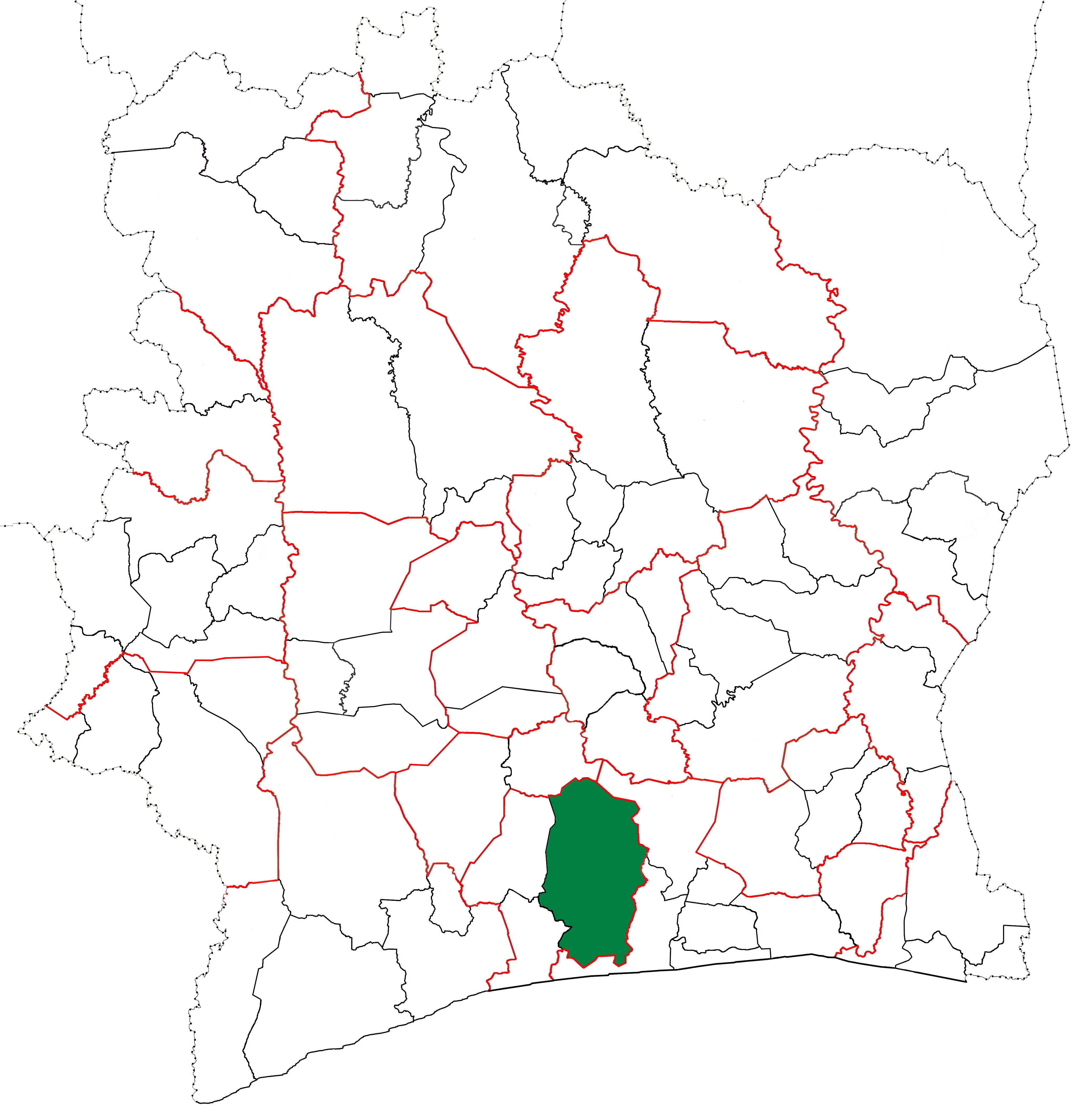
File:Divo Department locator map Côte d'Ivoire (2008-09).jpg
Size of this preview: 583 × 600 pixels. Other resolutions: 233 × 240 pixels | 466 × 480 pixels | 746 × 768 pixels | 995 × 1,024 pixels | 1,990 × 2,048 pixels | 4,137 × 4,257 pixels.
Original file (4,137 × 4,257 pixels, file size: 1.49 MB, MIME type: image/jpeg)
Summary
| Description | English: Locator map for Divo Department in Côte d'Ivoire in 2008. Divo Department kept these boundaries until 2009. |
| Date | |
| Source | Own work |
| Author | Good Olfactory |
Licensing
I, the copyright holder of this work, hereby publish it under the following license:
This file is licensed under the Creative Commons Attribution-Share Alike 4.0 International license.
- You are free:
- to share – to copy, distribute and transmit the work
- to remix – to adapt the work
- Under the following conditions:
- attribution – You must give appropriate credit, provide a link to the license, and indicate if changes were made. You may do so in any reasonable manner, but not in any way that suggests the licensor endorses you or your use.
- share alike – If you remix, transform, or build upon the material, you must distribute your contributions under the same or compatible license as the original.
File history
Click on a date/time to view the file as it appeared at that time.
| Date/Time | Thumbnail | Dimensions | User | Comment | |
|---|---|---|---|---|---|
| current | 09:10, 22 February 2016 | | 4,137 × 4,257 (1.49 MB) | Good Olfactory | Fixed Tanda–Koun-Fao border |
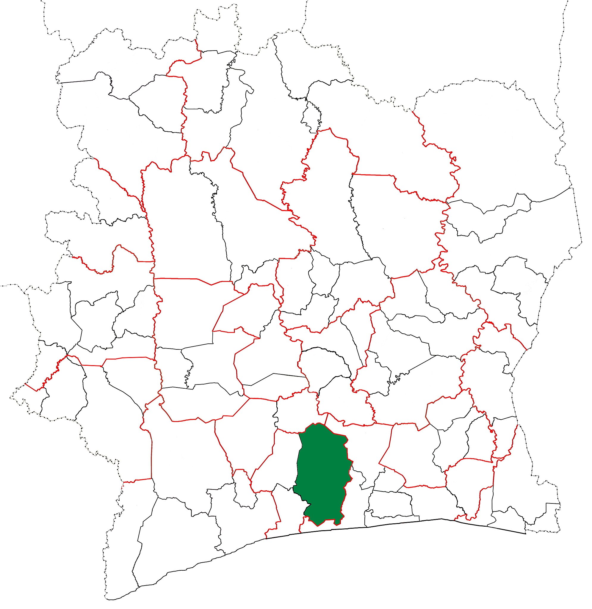
| 23:46, 21 February 2016 |  | 4,137 × 4,257 (1.49 MB) | Good Olfactory | Fixing boundary error—territory which became Transua Dept should be in Tanda Dept, not in Bondoukou Dept. | |
| 09:20, 21 February 2016 |  | 4,137 × 4,257 (1.5 MB) | Good Olfactory | User created page with UploadWizard |
File usage
The following page uses this file:
.jpg)