
File:Clingman's Dome Tower on a Sunny, Snowy Day.JPG

Size of this preview: 800 × 600 pixels. Other resolutions: 320 × 240 pixels | 640 × 480 pixels | 1,024 × 768 pixels | 1,280 × 960 pixels | 2,592 × 1,944 pixels.
Original file (2,592 × 1,944 pixels, file size: 959 KB, MIME type: image/jpeg)
|
This is an image of a place or building that is listed on the National Register of Historic Places in the United States of America. Its reference number is 12000515. |
Summary
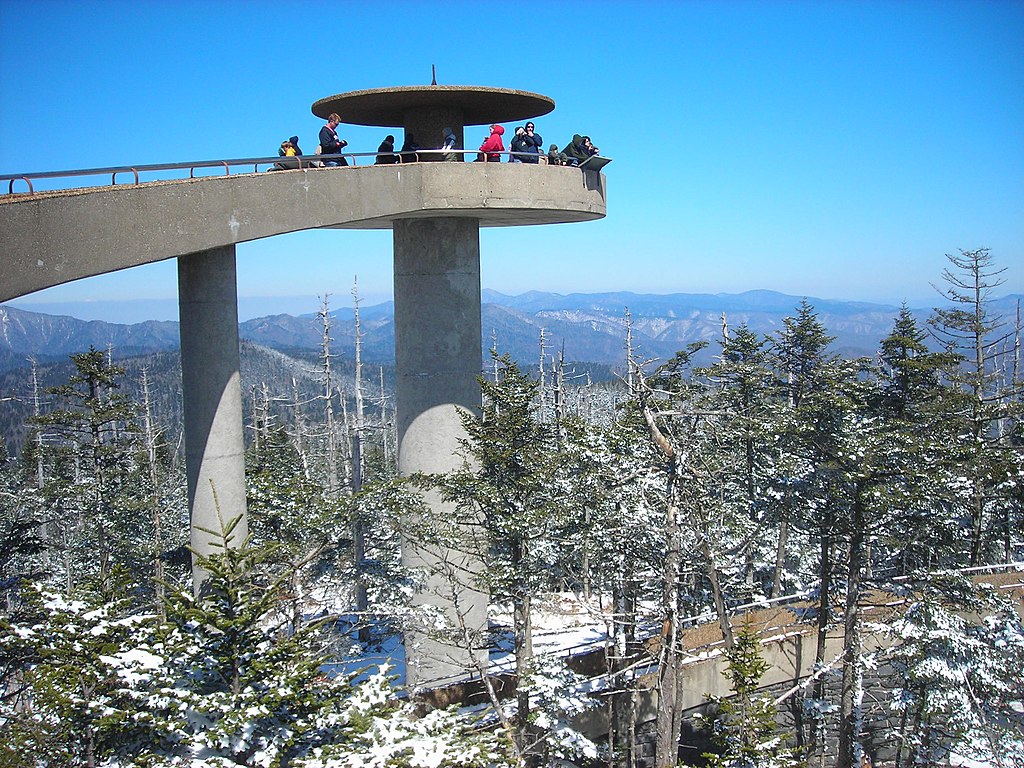
| Description | English: The Clingman's Dome Observation Tower rises 50 feet (15 m) from the summit of Clingman's Dome, the highest point both in the state of Tennessee and along the Appalachian Trail, in Great Smoky Mountains National Park. |
| Date | |
| Source | Own work |
| Author | Scott Basford |
| Object location | | View this and other nearby images on: OpenStreetMap |
|---|
Licensing
| This work has been released into the public domain by its author, Blinutne. This applies worldwide. In some countries this may not be legally possible; if so: Blinutne grants anyone the right to use this work for any purpose, without any conditions, unless such conditions are required by law. |
File history
Click on a date/time to view the file as it appeared at that time.
| Date/Time | Thumbnail | Dimensions | User | Comment | |
|---|---|---|---|---|---|
| current | 23:37, 23 July 2007 | | 2,592 × 1,944 (959 KB) | Blinutne | {{Information |Description= The Clingman's Dome Observation Tower rises fifty feet from the pinnacle of Clingman's Dome, the highest point both in the state of Tennessee and along the Appalachian Trail, in the Great Smoky Mountains National Park. |Source= |
File usage
The following 10 pages use this file:
- Continental climate
- Great Smoky Mountains National Park
- Kuwohi
- List of federal lands in Tennessee
- Mission 66
- Mountains-to-Sea Trail
- National Register of Historic Places listings in Great Smoky Mountains National Park
- National Register of Historic Places listings in Sevier County, Tennessee
- National Register of Historic Places listings in Swain County, North Carolina
- Protected areas of North Carolina
Global file usage
The following other wikis use this file:
- Usage on ar.wikipedia.org
- Usage on ca.wikipedia.org
- Usage on da.wikipedia.org
- Usage on de.wikipedia.org
- Usage on fr.wikipedia.org
- Usage on he.wikipedia.org
- Usage on he.wikivoyage.org
- Usage on hy.wikipedia.org
- Usage on it.wikipedia.org
- Usage on ja.wikipedia.org
- Usage on kk.wikipedia.org
- Usage on la.wikipedia.org
- Usage on mt.wikipedia.org
- Usage on nl.wikipedia.org
- Usage on no.wikipedia.org
- Usage on pl.wikipedia.org
- Usage on pt.wikipedia.org
- Usage on ru.wikipedia.org
- Usage on sk.wikipedia.org
- Usage on tr.wikipedia.org
- Usage on uk.wikipedia.org
- Usage on ur.wikipedia.org