Speedway

File:Carterhaugh.jpg

Carterhaugh.jpg (640 × 480 pixels, file size: 71 KB, MIME type: image/jpeg)

Summary

Description
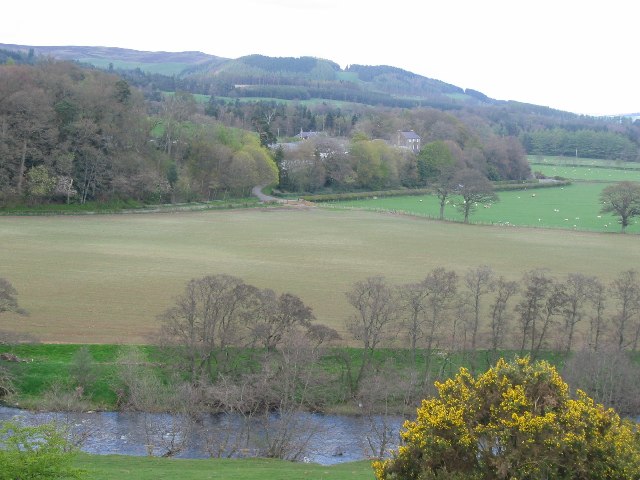
English: Carterhaugh "O I forbid you, maidens a',

That wear gowd on your hair, To come or gae by Carterhaugh, For young Tam Lin is there."

Famed in the Border ballad, Carterhaugh is a farm on the Buccleuch Estate. Seen across the Ettrick Water from NT433263.

You can still visit Tam Lin's Well.
Date
Source From geograph.org.uk
Author Richard Webb
Camera location55° 31′ 44.21″ N, 2° 53′ 47.77″ W Kartographer map based on OpenStreetMap.View this and other nearby images on: OpenStreetMapinfo

Licensing

w:en:Creative Commons
attribution share alike
This file is licensed under the Creative Commons Attribution-Share Alike 2.0 Generic license.
Attribution: Richard Webb
You are free:
  • to share – to copy, distribute and transmit the work
  • to remix – to adapt the work
Under the following conditions:
  • attribution – You must give appropriate credit, provide a link to the license, and indicate if changes were made. You may do so in any reasonable manner, but not in any way that suggests the licensor endorses you or your use.
  • share alike – If you remix, transform, or build upon the material, you must distribute your contributions under the same or compatible license as the original.

Captions

Carterhaugh

Items portrayed in this file

depicts

estate

Selkirk

creator

some value

object of statement has role: photographer
author name string: Richard Webb

copyright status

copyrighted

copyright license

Creative Commons Attribution-ShareAlike 2.0 Generic

title: Carterhaugh (English)
author name string: Richard Webb

source of file

file available on the internet

geograph.org.uk image ID: 5976
operator: Geograph Britain and Ireland

inception

27 April 2005

coordinates of the point of view

55°31'44.213"N, 2°53'47.771"W

media type

image/jpeg

checksum

3929cb8fed466ebb40aa4880a50442aace0482f1

determination method or standard: SHA-1

data size

72,537 byte

height

480 pixel

width

640 pixel

geograph.org.uk image ID

instance of

photograph

coordinates of depicted place

55°31'48"N, 2°54'0"W

location of creation

Selkirk

File history

Click on a date/time to view the file as it appeared at that time.

Date/TimeThumbnailDimensionsUserComment
current22:30, 12 May 2021Thumbnail for version as of 22:30, 12 May 2021640 × 480 (71 KB)Bjh21Switch to the original version from Geograph: it has better contrast and doesn't have a white strip down the left edge
17:33, 26 July 2009Thumbnail for version as of 17:33, 26 July 2009638 × 480 (286 KB)W. L. Tarbert{{Information |Description={{en|1=en:Carterhaugh is a farm on the Buccleuch Estate, here seen across the en:Ettrick Water }} |Source=http://www.geograph.org.uk/photo/5976 |Author=Richard Webb |Date=2005-04-27 |Permission={{Geograph}} |other_vers

Global file usage

The following other wikis use this file: