
File:Branwell Brontë, Map of Angria (c. 1830–1831).jpg

Size of this preview: 800 × 497 pixels. Other resolutions: 320 × 199 pixels | 640 × 398 pixels | 1,024 × 637 pixels | 1,280 × 796 pixels | 2,560 × 1,592 pixels | 6,761 × 4,204 pixels.
Original file (6,761 × 4,204 pixels, file size: 15.92 MB, MIME type: image/jpeg)
Summary
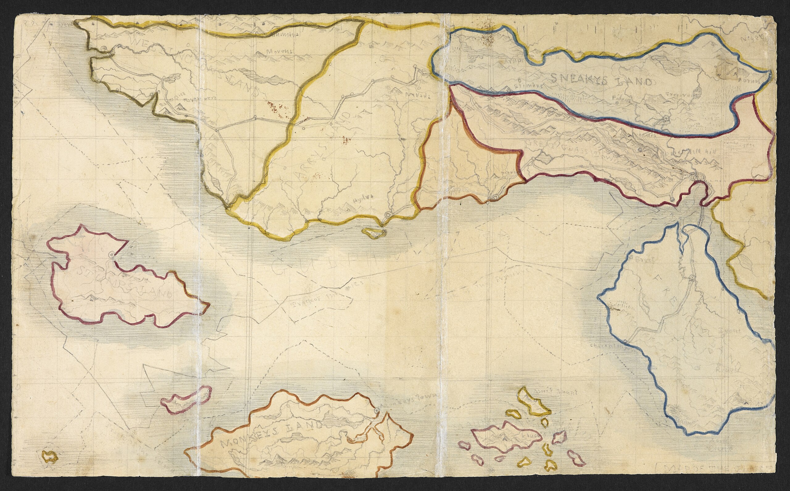
| Branwell Brontë: English: Map of the Glass Town Federation and surrounding lands
( |
|||||||||||||||||||||
|---|---|---|---|---|---|---|---|---|---|---|---|---|---|---|---|---|---|---|---|---|---|
| Artist |
|
||||||||||||||||||||
| Title | English: Map of the Glass Town Federation and surrounding lands |
||||||||||||||||||||
| Description | English: A hand-drawn map of the imaginary country, the Glass Town Federation, from Branwell and Charlotte Brontë's notebooks. The map is thought to have been created between 1830 and 1831 (probably no later than 8 May 1831). |
||||||||||||||||||||
| Date | between 1830 and 8 May 1831. | ||||||||||||||||||||
| References | [1]. | ||||||||||||||||||||
| Source/Photographer | Manuscript of The History of the Young Men from their First Settlement to the Present Time (British Library shelfmark Ashley2468). | ||||||||||||||||||||

Licensing
This is a faithful photographic reproduction of a two-dimensional, public domain work of art. The work of art itself is in the public domain for the following reason:
The official position taken by the Wikimedia Foundation is that "faithful reproductions of two-dimensional public domain works of art are public domain". This photographic reproduction is therefore also considered to be in the public domain in the United States. In other jurisdictions, re-use of this content may be restricted; see Reuse of PD-Art photographs for details. | ||||
File history
Click on a date/time to view the file as it appeared at that time.
| Date/Time | Thumbnail | Dimensions | User | Comment | |
|---|---|---|---|---|---|
| current | 07:17, 26 August 2011 | | 6,761 × 4,204 (15.92 MB) | NelsonDyar |
File usage
The following 2 pages use this file:
Global file usage
The following other wikis use this file:
- Usage on ca.wikipedia.org
.jpg)