
File:Aartalsperre-Lageplan.jpg

Size of this preview: 635 × 600 pixels. Other resolutions: 254 × 240 pixels | 508 × 480 pixels | 773 × 730 pixels.
Original file (773 × 730 pixels, file size: 141 KB, MIME type: image/jpeg)
Summary
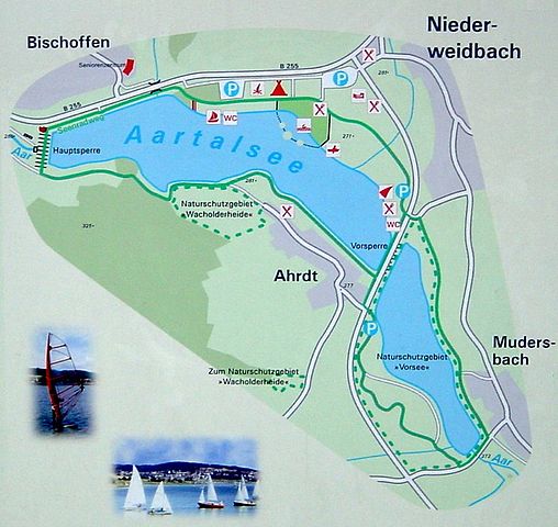
| Description | Deutsch: Lageplan der Aartalsperre |
| Date | Taken on 29 December 2008 |
| Source | Self-photographed |
| Author | ProfessorX |
| Permission (Reusing this file) |
Deutsch: Abfotografiert von einer Schautafel, durch Panoramafreiheit genehmigungsfrei |
Licensing
ProfessorX, the copyright holder of this work, hereby publishes it under the following license:

|
Permission is granted to copy, distribute and/or modify this document under the terms of the GNU Free Documentation License, Version 1.2 or any later version published by the Free Software Foundation; with no Invariant Sections, no Front-Cover Texts, and no Back-Cover Texts. A copy of the license is included in the section entitled GNU Free Documentation License. |
| This file is licensed under the Creative Commons Attribution-Share Alike 3.0 Unported license. | ||
| Attribution: ProfessorX | ||
| ||
| This licensing tag was added to this file as part of the GFDL licensing update. |
|
The photographical reproduction of this work is covered under the article § 59 of the German copyright law, which states that "It shall be permissible to reproduce, by painting, drawing, photography or cinematography, works which are permanently located on public ways, streets or places and to distribute and publicly communicate such copies. For works of architecture, this provision shall be applicable only to the external appearance."
As with all other “limits of copyright by legally permitted uses”, no changes to the actual work are permitted under § 62 of the German copyright law (UrhG). See Commons:Copyright rules by territory/Germany#Freedom of panorama for more information.
|
Original upload log
Transferred from de.wikipedia to Commons by Emha using CommonsHelper.
The original description page was here. All following user names refer to de.wikipedia.
- 2009-02-17 21:22 ProfessorX 773×730 (144825 bytes) {{Information |Beschreibung = Lageplan der Aartalsperre |Quelle = selbst fotografiert von einer Schautafel |Urheber = ~~~ |Datum = 29. Dezember 2008 |Genehmigung = durch [[Panoramafreiheit]] genehmigungsfrei |Andere Versionen = |Anmerkungen = }}
| Annotations | This image is annotated: View the annotations at Commons |
File history
Click on a date/time to view the file as it appeared at that time.
| Date/Time | Thumbnail | Dimensions | User | Comment | |
|---|---|---|---|---|---|
| current | 08:47, 10 September 2010 | | 773 × 730 (141 KB) | File Upload Bot (Magnus Manske) | {{BotMoveToCommons|de.wikipedia|year={{subst:CURRENTYEAR}}|month={{subst:CURRENTMONTHNAME}}|day={{subst:CURRENTDAY}}}} {{Information |Description={{de|Lageplan der Aartalsperre}} |Source=Transferred from [http://de.wikipedia.org de.wikipedia]; transferre |
File usage
The following page uses this file:
Global file usage
The following other wikis use this file:
- Usage on de.wikipedia.org
- Usage on id.wikipedia.org