
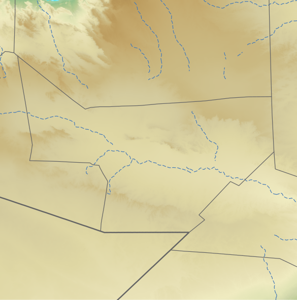
File:Sool location relief map.svg

Size of this PNG preview of this SVG file: 585 × 592 pixels. Other resolutions: 237 × 240 pixels | 474 × 480 pixels | 759 × 768 pixels | 1,012 × 1,024 pixels | 2,024 × 2,048 pixels.
Original file (SVG file, nominally 585 × 592 pixels, file size: 784 KB)
入手元:ETOPO Global Relief Model 作者:Assemblied by User:Freetrashbox 米国連邦政府独自の著作物
Summary
| Description | English: Sool region in Somaliland/Somalia 日本語: スール地域のLocation map用地図
|
| Date | |
| Source | See below |
| Author | See below (Assemblied by User:Freetrashbox) |
Sources
- Global Relief: ETOPO Global Relief Model / NOAA (2022-10-04). Ice surface elevation geotiff. Retrieved on 2022-12-13. / ETOPO_2022_v1_15s_N00W030_surface.tif, ETOPO_2022_v1_15s_N15E030_surface.tif
- International border: GSHHG data version 2.3.7 / NOAA (2017-06-15). Shoreline / Coastline Resources. Retrieved on 2022-12-13. / gshhg-shp-2.3.7\WDBII_shp\h\WDBII_border_h_L1.shp
- Intermittent rivers: GSHHG data version 2.3.7 / ibid. / gshhg-shp-2.3.7\WDBII_shp\h\WDBII_river_h_L08.shp
- Regional border of Somaliland: SOMALILAND VULNERABILITY INDEX MAP / Ministry of Planning and National Development of Somaliland. SOMALILAND VULNERABILITY INDEX MAP. Retrieved on 2022-12-13.
- Regional border of Somalia (without Somaliland): Google map
Design
- Global Relief: Wikipedia:Graphics Lab/Resources/GIS sources and palettes
- International border: R100 G100 B100, 2pts.
- Intermittent rivers: R72 G123 B182, 1pt, dash 5 pts, blank 3pts.
- Regional border of Somaliland: R100 G100 B100, 1pt.
Notes
- The boundaries marked on this map are the borders or region boundaries around this area. Because Somaliland claims the western border of Bari region as the border between Somaliland and Somalia, there is some dispute as to whether this line is a border or a state line.
Licensing
This image is in the public domain because it contains materials that originally came from the U.S. National Oceanic and Atmospheric Administration, taken or made as part of an employee's official duties.
|
File history
Click on a date/time to view the file as it appeared at that time.
| Date/Time | Thumbnail | Dimensions | User | Comment | |
|---|---|---|---|---|---|
| current | 21:28, 2 January 2023 | | 585 × 592 (784 KB) | Freetrashbox | Reverted to version as of 20:44, 1 January 2023 (UTC) See File talk:Sanaag location relief map.svg |
| 03:36, 2 January 2023 |  | 585 × 592 (790 KB) | Siirski | Reverted to version as of 20:49, 31 December 2022 (UTC) *Regional border of Somaliland: SOMALILAND VULNERABILITY INDEX MAP / {{Cite web |author=Ministry of Planning and National Development of Somaliland |date= |url=https://mopnd.govsomaliland.org/site/downloadfile/file/MjAyMS8wNy8yMDIxLTA3LTA0LTA5LTEzLTQ3LTgtMTYyNTQzMzIyNy5wZGY%3D|title=SOMALILAND VULNERABILITY INDEX MAP |accessdate=2022-12-13}} | |
| 20:44, 1 January 2023 |  | 585 × 592 (784 KB) | Freetrashbox | Reverted to version as of 11:50, 20 December 2022 (UTC) No source | |
| 20:49, 31 December 2022 |  | 585 × 592 (790 KB) | Siirski | Corrected eastern border | |
| 11:50, 20 December 2022 |  | 585 × 592 (784 KB) | Freetrashbox | Uploaded a work by Assemblied by User:Freetrashbox from ETOPO Global Relief Model with UploadWizard |
File usage
The following 15 pages use this file:
Global file usage
The following other wikis use this file:
- Usage on fr.wikipedia.org
- Usage on si.wikipedia.org
- Usage on uz.wikipedia.org