
File:Norfolk UK relief location map.jpg

Size of this preview: 800 × 497 pixels. Other resolutions: 320 × 199 pixels | 640 × 398 pixels | 1,024 × 636 pixels | 1,280 × 795 pixels | 1,999 × 1,242 pixels.
Original file (1,999 × 1,242 pixels, file size: 229 KB, MIME type: image/jpeg)
| Description |
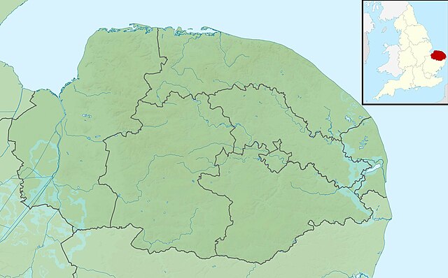
Relief map of Norfolk, UK. Equirectangular map projection on WGS 84 datum, with N/S stretched 160% Geographic limits:
|
| Date | |
| Source |
|
| Author | Nilfanion, created using Ordnance Survey data |
| Permission (Reusing this file) |
This file is licensed under the Creative Commons Attribution-Share Alike 3.0 Unported license. Attribution: Contains Ordnance Survey data © Crown copyright and database right
|
| Other versions | File:Norfolk UK district map (blank).svg - Blank map |
.svg)
File history
Click on a date/time to view the file as it appeared at that time.
| Date/Time | Thumbnail | Dimensions | User | Comment | |
|---|---|---|---|---|---|
| current | 01:46, 29 November 2011 | | 1,999 × 1,242 (229 KB) | Nilfanion | {{Information |Description=Relief map of Norfolk, UK. Equirectangular map projection on WGS 84 datum, with N/S stretched 160% Geographic limits: *West: 0.12E *East: 2.00E *North: 53.05N *South: 52.32N |Source=[[w:Ordnance Survey|Ordnance S |
File usage
The following 70 pages use this file:
- Beacon Hill, Norfolk
- Beeston Beck (Norfolk)
- Bintry Watermill
- Blakeney Point
- Brancaster Lifeboat Station
- Buxton Watermill
- Caister Lifeboat Station
- Cley Marshes
- Crome's Broad
- Cromer Lifeboat Station
- Filby Broad
- Fritton Lake
- Gaywood River
- Glandford Watermill
- Great Yarmouth and Gorleston Lifeboat Station
- Guildhall of St George
- Gur Beck
- Hagon Beck
- Happisburgh Lifeboat Station
- Heacham River
- Hempstead Watermill
- Holkham National Nature Reserve
- Horsey Mere
- Hoveton Great Broad
- Hunstanton Hall
- Hunstanton Lifeboat Station
- Letheringsett Watermill
- Malthouse Broad
- Masonic Hall, Sheringham
- Mundesley Volunteer Inshore Lifeboat
- Narborough Bone Mill
- Narborough Watermill
- Palling Lifeboat Station
- Palling Volunteer Rescue Service
- Panford Beck
- Penny Spot Beck
- River Ainse (or Eyn)
- River Ant
- River Burn, Norfolk
- River Chet
- River Cong (Norfolk)
- River Gadder
- River Glaven
- River Hor
- River Hun
- River Ingol
- River Mun
- River Stiffkey
- River Tas
- River Tat
- River Thet
- River Thurne
- River Tiffey
- River Tud
- River Yare
- Ryston Hall
- Salhouse Broad
- Sandringham House
- Scarrow Beck
- Shadwell Court
- Sheringham Lifeboat Station
- Titchwell Marsh
- Trafford Mausoleum, Wroxham
- Wells-next-the-Sea Lifeboat Station
- Wild Ken Hill
- Winterton Lifeboat Station
- User:Kaliforniyka/Narford Hall
- Module:Location map/data/Norfolk
- Module:Location map/data/United Kingdom Norfolk
- Module:Location map/data/United Kingdom Norfolk/doc
Global file usage
The following other wikis use this file:
- Usage on ar.wikipedia.org
- Usage on bg.wikipedia.org
- Usage on ceb.wikipedia.org
- Usage on cs.wikipedia.org
- Usage on es.wikipedia.org
- Usage on eu.wikipedia.org
- Usage on fa.wikipedia.org
- Usage on fr.wikipedia.org
- Usage on hr.wikipedia.org
- Usage on ja.wikipedia.org
- Usage on kn.wikipedia.org
- Usage on lv.wikipedia.org
- Usage on mk.wikipedia.org
- Usage on nl.wikipedia.org
- Usage on os.wikipedia.org
- Usage on pl.wikipedia.org
- Usage on pl.wikibooks.org
- Usage on ru.wikipedia.org
- Usage on sco.wikipedia.org
- Usage on simple.wikipedia.org
- Usage on si.wikipedia.org
View more global usage of this file.