Bridgend (hrabstwo)
| hrabstwo miejskie | |||
| |||
| Państwo | |||
|---|---|---|---|
| Księstwo | |||
| Siedziba | |||
| Powierzchnia |
246 km² | ||
| Populacja • liczba ludności |
| ||
| • gęstość |
530 os./km² | ||
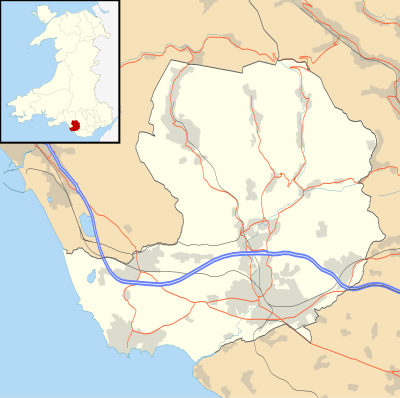
Położenie na mapie Walii
| |||
| Strona internetowa | |||
Bridgend (wal. Pen-y-bont ar Ogwr) – hrabstwo miejskie w południowej Walii. Od wschodu graniczy z Vale of Glamorgan i Rhondda Cynon Taf a od zachodu z Neath Port Talbot. Ośrodkiem administracyjnym jest miasto Bridgend.
Miejscowości
Na terenie hrabstwa znajdują się następujące miejscowości[1][2] (w nawiasach liczba ludności w 2011[3]):
- Bridgend (46 757)
- Maesteg (18 888)
- Porthcawl (15 672)
- Pyle (13 701)
- Sarn (10 805)
- Pencoed (9166)
- Pontycymer (4288)
- Ogmore Vale (3117)
- Nant-y-moel (2344)
- Bettws (2253)
- Pont Rhyd-y-cyff (1505)
- Cefn Cribwr (1324)
- Llangeinor (973)
- Trelales (818)
- Pant-yr-awel (734)
- Blackmill (654)
- Heol-y-Cyw (538)
- South Cornelly (471)
Mapa
Przypisy
- ↑ a b Office for National Statistics: Built-up Area to Local Authority District (December 2011) Lookup in England and Wales. [w:] Open Geography Portal [on-line]. [dostęp 2022-06-05]. (ang.).
- ↑ a b Office for National Statistics: Built-up Area Sub Divisions (December 2011) Boundaries. [w:] Open Geography Potal [on-line]. [dostęp 2022-06-05]. (ang.).
- ↑ a b Office for National Statistics: KS101EW - Usual resident population. [w:] 2011 Census [on-line]. Nomis – Official labour market statistics, 2013-02-12. [dostęp 2022-06-05]. (ang.).
Encyklopedie internetowe (principal area of Wales):


