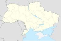
Zinkiv, Khmelnytskyi Oblast
Zinkiv | |
|---|---|
Village | |
 St. Michael's Church in Zinkiv, 2020 | |
| Coordinates: 49°4′37″N 27°4′20″E / 49.07694°N 27.07222°E | |
| Area | |
| • Land | 6,867 km2 (2,651 sq mi) |
| Population | |
• Total | 1,686 |
| • Density | 245.52/km2 (635.9/sq mi) |
| Area code | +380 3846 |
Zinkiv (Ukrainian: Зіньків Zinkiv) is a village in northern Ukraine, in Khmelnytskyi Raion of Khmelnytskyi Oblast. Its KOATUUI code is 6820683501. Its postal index is 32514. Its calling code is 3846. As of 2001, it has a population of 1,822.
Village council
The village council is located at 32514, Khmelnitskyi oblast, Zinkiv, str. Pisarenka, 46.
Name
In addition to the Ukrainian Зіньків (Zinkiv), in other languages the name of the city is Russian: Зиньков, romanized: Zinkov and Yiddish: זינקיוו.
History
[[Файл:Зіньків.png|link=https://uk.wikipedia.org/wiki/%D0%A4%D0%B0%D0%B9%D0%BB:%D0%97%D1%96%D0%BD%D1%8C%D0%BA%D1%96%D0%B2.png%7Cleft%7Cthumb%7CZinkiv Castle on Zygmund Gerstmann's 1863 map]] Jews had resettled in Zinkov by the early 18th century, but were murdered by the haidamaks, anti-Polish Ukrainian insurgents, in 1734. The arrival of Polish rabbi Avraham Yehoshua Heshel and his son Yitzchak Meir in the second half of the 18th century reinvigorated the Jewish presence, and Zinkiv became a leading center of Hasidic Judaism in the Podolia area.[1]
In 1897, the city's population was 7,017, 53 percent of whom were Jews.[1]
20th century
After the establishment of the Soviet Union, a kolkhoz collective farm was established in the city. Many of the city's Jews, who comprised 35 percent of the population, worked as artisans and craftsmen in state-owned cooperatives.[1]
World War II
At the outbreak of World War II in 1939, the city was home to 2,248 Jews.[1]
On June 22, 1941, Nazi Germany and many of its Axis allies invaded the Soviet Union as part of Operation Barbarossa. By July 10, the Nazis had occupied Zinkov. In August, the Nazis established a Judenrat, an administrative body that would oversee affairs of the city's Jews and coordinate dealings with the Nazi authorities.[1]
One of the Judenrat's responsibilities was to coordinate the Jews' sequestration into a ghetto, which in Zinkiv consisted only of a single house.[2] The Nazi authorities imposed a series of discriminatory measures against the Jewish population. Jews were also forced to pay ransoms and systematically dispossessed of their belongings and gold. Those over the age of 10 were required to wear a yellow badge on their chest and backs and were forbidden to walk on sidewalks. To humiliate the Jews, the Germans and their Ukrainian collaborators cut the beards and payos of religious Jews, including the city's rabbi, in a practice reportedly called "taking the Jews to the barber."[1]
In 1942, the Nazis ramped up their killing operations against Zinkiv's Jews. On May 9, 1942, approximately 600 Jews, many infirm, elderly, and women with children, were shot to death and buried in a mass grave approximately 1.5 kilometers outside the city.[1][3] On August 4, an additional 1,882 Jews were shot to death at the same site. Able-bodied men were sent to forced labor camps at Proskurov and Leznyevo, leaving 150 Jewish workers in the ghetto.[1]
The Soviet Red Army liberated Zinkov in March 1944, ending the Nazi occupation of Zinkiv.[1] Only approximately 30 Jews in Zinkiv survived the war.[3]
Languages
According to the 2001 Ukrainian Census, the following languages were spoken in Zinkiv:
| Language | Persons | Percentage |
|---|---|---|
| Ukrainian | 1,797 | 98.63% |
| Russian | 19 | 1.04% |
| Romanian | 2 | 0.11% |
| Yiddish | 1 | 0.05% |
| Other/NA | 3 | 0.17% |
| Total | 1,822 | 100% |
Gallery
- Trinity Church in Zinkiv, established 1450, photographed circa 1880- 1905
- Belfry of the Trinity Church in Zinkov, established in 1726, photographed circa 1880-1905
- Zinkiv District Hospital
- Remains of a fortress in Zinkiv
- Landscape of Zinkiv
- A city mansion in Zinkiv, 2016
Births
- Yitzhak Orpaz, Israeli writer
- Alla Mazur, Ukrainian journalist
See also
External links
References
- ^ a b c d e f g h i "Zinkov". Yad Vashem. Archived from the original on 24 May 2023. Retrieved 24 May 2023.
- ^ Berkhoff, Karel (2018). Basic Historical Narrative of the Babi Yar Holocaust Memorial Center (PDF). Kyiv, Ukraine: Babi Yar Holocaust Memorial Center. p. 100. Archived (PDF) from the original on 2023-03-25. Retrieved 2023-07-03.
- ^ a b "Pinchas Zinkiv". National Library of Israel. Archived from the original on 3 July 2023. Retrieved 9 June 2023.


