Zalana
Zalana | |
|---|---|
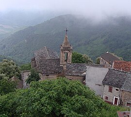
 The church of the Annunciation, before restoration, in A Belfasca | |
| Coordinates: 42°15′41″N 9°22′34″E / 42.2614°N 9.3761°E | |
| Country | France |
| Region | Corsica |
| Department | Haute-Corse |
| Arrondissement | Corte |
| Canton | Ghisonaccia |
| Intercommunality | Oriente |
| Government | |
| • Mayor (2020–2026) | Clément Baggioni[1] |
Area 1 | 13.2 km2 (5.1 sq mi) |
| Population (2021)[2] | 148 |
| • Density | 11/km2 (29/sq mi) |
| Demonym(s) | Zalanais, Zalanaises |
| Time zone | UTC+01:00 (CET) |
| • Summer (DST) | UTC+02:00 (CEST) |
| INSEE/Postal code | 2B356 /20272 |
| Elevation | 193–847 m (633–2,779 ft) (avg. 600 m or 2,000 ft) |
| 1 French Land Register data, which excludes lakes, ponds, glaciers > 1 km2 (0.386 sq mi or 247 acres) and river estuaries. | |
Zalana is a commune in the Haute-Corse department of France on the island of Corsica.
Geography
Zalana is in the Castagniccia region of Corsica in the Moïta-Verde canton. The village is located on the east coast of the island 22 km from the sea by road. The connecting road ends in the village. It is situated on the mountainside at an altitude of 675m and has a view over the sea. Located in the south of the Castagniccia region, it is a quiet, rural village away from the busy coastal cities and their tourists. Many pleasant walks begin in the village, including one that takes you to a typical Genoese bridge.
Population
|
| |||||||||||||||||||||||||||||||||||||||||||||||||||||||||||||||||||||||||||||||||||||||||||||||||||||||||||||||
| Source: EHESS (1793-1999)[3] and INSEE[4] | ||||||||||||||||||||||||||||||||||||||||||||||||||||||||||||||||||||||||||||||||||||||||||||||||||||||||||||||||
See also
References
- ^ "Répertoire national des élus: les maires" (in French). data.gouv.fr, Plateforme ouverte des données publiques françaises. 13 September 2022.
- ^ "Populations légales 2021" (in French). The National Institute of Statistics and Economic Studies. 28 December 2023.
- ^ Des villages de Cassini aux communes d'aujourd'hui: Commune data sheet Zalana, EHESS (in French).
- ^ Population en historique depuis 1968, INSEE


