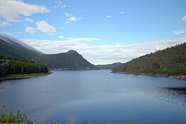
Vasslivatnet
Lake in Trøndelag, Norway
| Vasslivatnet | |
|---|---|
 | |
| Location | Heim, Trøndelag |
| Coordinates | 63°12′41″N 09°16′46″E / 63.21139°N 9.27944°E / 63.21139; 9.27944 |
| Primary inflows | Søvatnet lake |
| Primary outflows | Søo river |
| Basin countries | Norway |
| Max. length | 2.5 kilometres (1.6 mi) |
| Max. width | 1.5 kilometres (0.93 mi) |
| Surface area | 2.92 km2 (1.13 sq mi) |
| Shore length1 | 12.5 kilometres (7.8 mi) |
| Surface elevation | 280 metres (920 ft) |
| References | NVE |
| 1 Shore length is not a well-defined measure. | |
Vasslivatnet (English: Lake Vassli)[1] is a lake in the municipality of Heim in Trøndelag county, Norway. The 2.92-square-kilometre (1.13 sq mi) lake lies along European route E39, about 13 kilometres (8.1 mi) east of the village of Vinjeøra. The lake is a man-made lake along the river Søo. There is a dam on the west end that is part of a hydropower plant.[2]
See also
References
- ^ Gullick, C. F. W. R.; Aste, E. A. (1943). Norway. London: Naval Intelligence Division. p. 244.
- ^ Store norske leksikon. "Søa kraftverk" (in Norwegian). Retrieved 2010-12-19.


