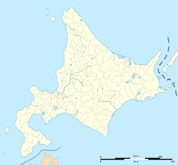
Tanfiliev Island
| Disputed island | |
|---|---|
 2016 Copernicus (ESA) satellite image of Tanfiliev | |
| Other names | Russian: Танфильева Japanese: 水晶島 |
| Geography | |
| Location | Pacific Ocean |
| Coordinates | 43°26′12″N 145°55′00″E / 43.436784°N 145.916760°E |
| Archipelago | Habomai Islands, Lesser Kuril Chain, Kuril Islands |
| Area | 12.1 km2 (4.7 sq mi)[1] |
| Highest elevation | 16 m (52 ft)[2] |
| Administration | |
| Federal subject | Sakhalin Oblast |
| District | Yuzhno-Kurilsky |
| Claimed by | |
| Prefecture | Hokkaido |
| Subprefecture | Nemuro |
| Demographics | |
| Population | 0 |

Tanfiliev (Russian: Танфильева, romanized: Tanfilyeva; Japanese: 水晶島, romanized: Suishō-tō) is an uninhabited island in the Habomai Islands, part of the Lesser Kuril Chain. It is administered by the Russian Federation as part of Yuzhno-Kurilsky District, Sakhalin Oblast. It is claimed by Japan, as part of Hokkaidō's Nemuro Subprefecture.[3] The island and its surrounding waters form part of the Malye Kurily zakaznik or Lesser Kurils State Nature Preserve.[4][5]
Geography
The southernmost island in the Lesser Kuriles, Tanfiliev lies some 7.8 kilometres (4.8 mi) from Cape Nosappu at the eastern end of the Nemuro Peninsula.[6][2]: 463 Extending 8 by 6 kilometres (5.0 mi × 3.7 mi), the island covers an area of 12.1 square kilometres (4.7 sq mi).[7] Relatively low-lying, 16 metres (52 ft) at its highest point, the island has a number of short streams and lagoon lakes.[2]: 463 Along the coast, with its capes and bays, there are grassy meadows.[2]: 463 Tanfiliev lies within the "Lesser Kuril Ridge and Kunashir Island" Important Bird and Biodiversity Area,[8] the island's flora and fauna protected as part of the Lesser Kurils Zakaznik.[5][9]
History

The Japanese name for the island, Suishō, is of Ainu origin.[6] In the 1834 Tenpō gōchō or Village Registers of the Tenpō Era, Suishō is listed as a settlement of Nemoro.[6][10] Visited by Matsuura Takeshirō and written about in his diaries, in the early Meiji period the island formed part of the village of Goyōmai [ja], later merged into Habomai.[6][11] Before the Pacific War, most of the population were involved in the fishing industry; they were joined by migrant workers from the area of Niigata Prefecture and Toyama Prefecture each spring.[7] Konbu (kelp) was the most important product, and there was also canning of salmon, trout, crabs, and shrimp.[7] At the end of the war, the population stood at 986, in 154 households, along with 325 horses.[7] Currently, the Habomai Islands as a whole are uninhabited, other than the stationing of Russian guards.[11]
See also
![]() Media related to Tanfiliev Island at Wikimedia Commons
Media related to Tanfiliev Island at Wikimedia Commons
References
- ^ "Outline of the Northern Territories" 北方領土の姿. Cabinet Office (Japan) (in Japanese). Retrieved 18 May 2022.
- ^ a b c d Ryndevich, S.K.; Prokin, A.A.; Makarov, K.V.; Sundukov, Yu.N. (2021). "The beetles of the families Helophoridae, Georissidae, Hydrophilidae, Hydraenidae, and Elmidae (Insecta: Coleoptera) of Kunashir Island and the Lesser Kurils". Journal of Asia-Pacific Biodiversity. 14 (4): 461–491. doi:10.1016/j.japb.2021.06.007. S2CID 237895269.
- ^ 根室の概要 地図 [Overview of Nemuro: Map]. Nemuro Subprefecture (in Japanese). Retrieved 18 May 2022.
- ^ "Malye Kurily". Protected Planet. Retrieved 18 May 2022.
- ^ a b Малые Курилы [Lesser Kurils]. ООПТ России (in Russian). Retrieved 18 May 2022.
- ^ a b c d Tagai Hideo [in Japanese], ed. (2003). 日本歴史地名大系 [Nihon Rekishi Chimei Taikei] (in Japanese). Vol. 1: Hokkaido. Heibonsha. p. 1544. ISBN 4-582-49001-8.
- ^ a b c d 歯舞群島の概要 [Overview of the Habomai Islands]. Northern Territories Issue Association (in Japanese). Retrieved 18 May 2022.
- ^ "Lesser Kuril Ridge and Kunashir Island". Birdlife International. Retrieved 18 May 2022.
- ^ Gage, S.; Joneson, S.L.; Barkalov, V.Yu.; Eremenko, N.A.; Takahashi, H. (March 2006). "A Newly Compiled Checklist of the Vascular Plants of the Habomais, the Little Kurils". Bulletin of the Hokkaido University Museum. 3: 67–91. hdl:2115/47827.
- ^ 天保郷帳>松前島郷帳 [Tenpō gōchō>Matsumae gōchō]. National Diet Library (in Japanese). 1834. Retrieved 18 May 2022.
- ^ a b "An Overview of the Northern Territories". Northern Territories Issue Association. Retrieved 18 May 2022.

