San Ramón (canton)
San Ramón | |
|---|---|
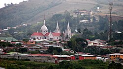
 View of San Ramón | |
| Nicknames: Tierra de Poetas (Land of Poets)[1] | |
 San Ramón canton | |
| Coordinates: 10°13′06″N 84°35′57″W / 10.2182301°N 84.5992384°W | |
| Country | |
| Province | Alajuela |
| Creation | 21 August 1856[2] |
| Head city | San Ramón |
| Districts | |
| Government | |
| • Type | Municipality |
| • Body | Municipalidad de San Ramón |
| Area | |
• Total | 1,018.64 km2 (393.30 sq mi) |
| Elevation | 974 m (3,196 ft) |
| Population (2011) | |
• Total | 80,566 |
| • Density | 79/km2 (200/sq mi) |
| Time zone | UTC−06:00 |
| Canton code | 202 |
| Website | {{URL|example.com|optional display text}} |
San Ramón is a canton in the Alajuela province of Costa Rica.[3][4] The head city is in San Ramón district.
History
San Ramón was created on 21 August 1856 by decree 17.[2]
Geography
San Ramón has an area of 1,018.64 km²[5] and a mean elevation of 974 metres.[3]
An oddly-shaped canton, San Ramon stretches north through the eastern heights of the Cordillera de Tilarán, looking down on the Central Valley (Valle Central) to its east. The canton forms the border with the province of Guanacaste to the west.
Districts
The canton of San Ramón is subdivided into the following districts:
- San Ramón
- Santiago
- San Juan
- Piedades Norte
- Piedades Sur
- San Rafael
- San Isidro
- Los Ángeles
- Alfaro
- Volio
- Concepción
- Zapotal
- Peñas Blancas
- San Lorenzo
Demographics
| Census | Pop. | ±% p.a. |
|---|---|---|
| 1864 | 5,045 | — |
| 1883 | 10,111 | +3.73% |
| 1892 | 9,928 | −0.20% |
| 1927 | 13,805 | +0.95% |
| 1950 | 19,951 | +1.61% |
| 1963 | 25,925 | +2.04% |
| 1973 | 33,155 | +2.49% |
| 1984 | 39,963 | +1.71% |
| 2000 | 67,975 | +3.38% |
| 2011 | 80,566 | +1.56% |
| 2022 | 93,264 | +1.34% |
| Source: Instituto Nacional de Estadística y Censos[6] Centro Centroamericano de Población[7] | ||
For the 2011 census, San Ramón had a population of 80,566 inhabitants. [8]
Transportation
Road transportation
The canton is covered by the following road routes:
References
- ^ Barrantes Araya, Trino. "San Ramón ¿Tierra de poetas?". sanramoncr.com (in Spanish). Comunidad de San Ramón, Alajuela. Retrieved 11 February 2023.
- ^ a b Hernández, Hermógenes (1985). Costa Rica: evolución territorial y principales censos de población 1502 - 1984 (in Spanish) (1 ed.). San José: Editorial Universidad Estatal a Distancia. pp. 164–173. ISBN 9977-64-243-5. Retrieved 5 October 2020.
- ^ a b "Declara oficial para efectos administrativos, la aprobación de la División Territorial Administrativa de la República N°41548-MGP". Sistema Costarricense de Información Jurídica (in Spanish). 19 March 2019. Retrieved 26 September 2020.
- ^ División Territorial Administrativa de la República de Costa Rica (PDF) (in Spanish). Editorial Digital de la Imprenta Nacional. 8 March 2017. ISBN 978-9977-58-477-5.
- ^ "Área en kilómetros cuadrados, según provincia, cantón y distrito administrativo". Instituto Nacional de Estadística y Censos (in Spanish). Retrieved 26 September 2020.
- ^ "Instituto Nacional de Estadística y Censos" (in Spanish).
- ^ Centro Centroamericano de Población de la Universidad de Costa Rica. "Sistema de Consulta a Bases de Datos Estadísticas" (in Spanish).
- ^ "Censo. 2011. Población total por zona y sexo, según provincia, cantón y distrito". Instituto Nacional de Estadística y Censos (in Spanish). Retrieved 26 September 2020.


