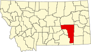
Rosebud, Montana
Rosebud | |
|---|---|
 | |
| Coordinates: 46°16′28″N 106°26′41″W / 46.27444°N 106.44472°W | |
| Country | United States |
| State | Montana |
| County | Rosebud County |
| Area | |
• Total | 0.77 sq mi (2.00 km2) |
| • Land | 0.76 sq mi (1.98 km2) |
| • Water | 0.01 sq mi (0.02 km2) |
| Elevation | 2,480 ft (760 m) |
| Population (2020) | |
• Total | 67 |
| • Density | 87.70/sq mi (33.85/km2) |
| Area code | 406 |
| FIPS code | 30-64375 |
| GNIS feature ID | 775943[2] |
| Website | http://www.rosebudmontana.com |
Rosebud is an unincorporated community, census-designated place and river town in Rosebud County, Montana, United States.[2] It is located approximately 1.5 miles east of the intersection of the Yellowstone River and Rosebud Creek. Interstate 94 passes south of the town.[3]
In 1878, Rosebud began as a small post office referred to as Beeman, on the Fort Keogh–Bozeman Stage Line. In 1882 the Northern Pacific Railroad and named the town Rosebud.[4]
The Rosebud High School is the highest level of education offered for the town. Enrollment is 31 with a student teacher ratio of 4:1.[5] The team name is the Wranglers.[6]
Media
The Forsyth-based Independent Press covers news for all of Rosebud County, which includes Rosebud.[7]
Notable person
- Captain William Clark led part of the Lewis and Clark Expedition through this area on the Yellowstone River in 1806
References
- ^ "ArcGIS REST Services Directory". United States Census Bureau. Retrieved September 18, 2022.
- ^ a b c U.S. Geological Survey Geographic Names Information System: Rosebud, Montana
- ^ Rosebud, Montana, 7.5 Minute Topographic Quadrangle, USGS, 1968 (1972 rev.)
- ^ "Rosebud". Montana Place Names Companion. Montana Historical Society. Retrieved April 9, 2021.
- ^ "Montana State GEMS School Database". Retrieved October 16, 2015.
- ^ "Member Schools". Montana High School Association. Retrieved April 19, 2021.
- ^ "Home page". Independent Press. Retrieved September 22, 2023.
| Census | Pop. | Note | %± |
|---|---|---|---|
| 2020 | 67 | — | |
| U.S. Decennial Census[1] | |||
- ^ "Census of Population and Housing". Census.gov. Retrieved June 4, 2016.

