Rae Loch
| Rae Loch | |
|---|---|
| Ardblair Loch | |
 Peaceful morning on Rae Loch | |
| Location | NO158445 |
| Coordinates | 56°35′07″N 3°22′15″W / 56.5853°N 3.3709°W |
| Type | freshwater loch |
| Primary outflows | Unnamed burn into Loch of Drumellie |
| Max. length | 0.804672 km (0.500000 mi)[1] |
| Max. width | 0.3218 km (0.2000 mi)[1] |
| Surface area | 3.9 ha (9.6 acres)[2] |
| Average depth | 6.5 ft (2.0 m)[1] |
| Max. depth | 16 ft (4.9 m)[1] |
| Water volume | 87,227,000 cu ft (2,470,000 m3)[1] |
| Shore length1 | 3.9 km (2.4 mi) [2] |
| Surface elevation | 65 m (213 ft)[2] |
| Max. temperature | 60.8 °F (16.0 °C) |
| Min. temperature | 57.1 °F (13.9 °C) |
| Islands | 0 |
| 1 Shore length is not a well-defined measure. | |
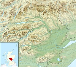
Rae Loch is a small lowland freshwater loch that sits directly to the east of Loch of Drumellie into which it flows and is 1.5 miles (2.4 km) to the west of Blairgowrie, in Perth and Kinross.[1][2] The loch is also a designated Site of Special Scientific Interest (SSSI), as well as forming part of a Special Area of Conservation.[3]
References
- ^ a b c d e f John, Murray; Lawrence, Pullar. Bathymetrical Survey of the Fresh-Water Lochs of Scotland, 1897-1909 Lochs of the Tay Basin Volume II - Rae Loch. National Library of Scotland. p. 106. Retrieved 25 March 2019.
 This article incorporates text from this source, which is in the public domain.
- ^ a b c d "Rae Loch". British Lakes. Retrieved 25 March 2019.
- ^ Dunkeld - Blairgowrie Lochs, Joint Nature Conservation Committee

