List of protected areas of Puerto Rico
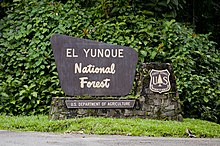
The protected areas of Puerto Rico include an array of natural areas in the archipelago of Puerto Rico, an unincorporated territory of the United States, managed by a number of agencies and entities belonging to both federal and commonwealth government bodies. Although Puerto Rico has no natural units in the National Park System, the biodiversity of the island is recognized and protected through a national forest, a national wildlife refuge, a national wilderness, and numerous state parks (called national parks in Puerto Rico[1]), nature reserves, state forests, wildlife preserves and other designations on state, municipal and public-private administration levels.[2][3][4]
Federal level

National Estuarine Research Reserves
National Forests

National Natural Landmarks
National Wild and Scenic Rivers
National Wilderness Preservation System
National Wildlife Refuge
- Caribbean Islands National Wildlife Refuge spanning Puerto Rico, the U.S. Virgin Islands and Navassa Island with the following units in Puerto Rico:
Commonwealth level
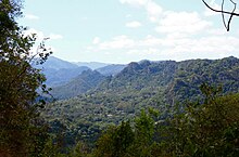
Compañía de Parques Nacionales (CPNPR)
- Boquerón
- Camuy River Caverns
- Caña Gorda
- Cerro Gordo
- Isla de Cabras
- Julio Enrique Monagas
- La Monserrate
- Lago Caonillas
- Luis Muñoz Rivera
- Manuel “Nolo” Morales
- Monte del Estado
- Punta Salinas
- Punta Santiago
- Seven Seas
- Sun Bay
- Tres Hermanos
Conservation Easement Sites (Servidumbres de conservación)
- Centro Espíritu Santo
- El Rabanal
- El Tambor
- Foreman Conservation Easement
- Gulín Farm
- Ledesma Moulier Farm
- María Luisa Farm
- Montes Oscuros
- Palmas del Mar Tropical Forest
- Picaflor Conservation Easement
- Siembra Tres Vidas
Conservation Zones
- Puerto Rico karst
Marine Reserves
- Desecheo Island Coastal Waters Marine Reserve
- Isla Verde Reef Marine Reserve
- Tres Palmas Marine Reserve
Nature Reserves (Reservas Naturales)
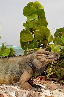
- Aguas Buenas Cave System
- Belvedere Farm (part of Boquerón State Forest)
- Caja de Muertos
- Caño La Boquilla
- Caño Martín Peña Nature Reserve
- Caño Tiburones
- Cayo Ratones (part of Boquerón State Forest)
- Cialitos River Nature Reserve
- Cibuco Swamp
- Condado Lagoon
- Cueva del Indio
- Espíritu Santo River Nature Reserve
- Guayama Reef
- Hacienda La Esperanza Nature Reserve
- Humacao Nature Reserve
- Joyuda Lagoon (part of Boquerón State Forest)
- La Cordillera Reef
- La Parguera (part of Boquerón State Forest)
- Las Cabachuelas Caves
- Las Cabezas de San Juan
- Las Cucharillas Swamp
- Las Piedras del Collado
- Luis Peña Channel
- Mata de Plátano Field Station
- Mona and Monito Islands Nature Reserve
- Northeast Ecological Corridor
- Planadas-Yeyesa Nature Reserve
- Playa Grande El Paraíso
- Pterocarpus Forest of Humacao
- Punta Ballenas Nature Reserve (part of Guánica State Forest)
- Punta Cucharas[5]
- Punta Petrona Nature Reserve
- Punta Tuna Mangrove
- Punta Vientos Wetland
- Punta Yeguas
- San Juan Ecological Corridor
- Tortuguero Lagoon
- Tourmaline Reef
- Vieques Bioluminescent Bay (Puerto Mosquito)
Protected Natural Areas (Áreas naturales protegidas)
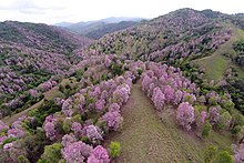
- Bairoa River Protected Natural Area
- Cerro Felíz
- Cerro La Tuna
- Cerro Las Mesas
- Cordillera Sabana Alta
- Culebras Protected Natural Area
- Dorado Pterocarpus Forest
- El Conuco Protected Natural Area
- El Convento Cave
- Encantado River Protected Natural Area
- Freddie Ramírez Protected Natural Area
- Guaynabo River Protected Natural Area
- Hacienda Buena Vista Protected Natural Area
- Hacienda Lago Protected Natural Area
- Hacienda Margarita Protected Natural Area
- Hacienda Pellejas Protected Natural Area
- Hermanas Sendra Protected Natural Area
- Jacaboa River Protected Natural Area
- Jájome
- Jorge Sotomayor del Toro Protected Natural Area
- La Pitahaya Protected Natural Area
- La Robleda Protected Natural Area
- Las Bocas Canyon
- Los Frailes Farm Protected Natural Area
- Los Llanos Protected Natural Area
- Luz Martínez de Benítez Protected Natural Area
- Maricao River Protected Natural Area
- Marín Alto Protected Natural Area
- Medio Mundo and Daguao Protected Natural Area
- Ojo de Agua Protected Natural Area
- Paraíso de las Lunas Protected Natural Area
- Punta Cabullones Protected Natural Area
- Punta Pozuelo Protected Natural Area
- Punta Soldado Protected Natural Area
- Quebrada Janer Protected Natural Area
- San Cristóbal Canyon
- San Juan Park Protected Natural Area
- Sana Muerto River Protected Natural Area
- Shapiro Protected Natural Area
- Sierra Pandura
- Toa Vaca River Protected Natural Area
- Toro Negro River Protected Natural Area
- Ulpiano Casal Protected Natural Area
Research Reserves (Áreas de investigación)
- Guayama Research Area
- Manatí Research Area
State Forests (Bosques Estatales)

- Aguirre
- Boquerón
- Cambalache
- Carite
- Ceiba
- Cerrillos
- Guajataca
- Guánica
- Guilarte
- Los Tres Picachos
- Maricao
- Monte Choca
- Nuevo Milenio
- Piñones
- del Pueblo
- Río Abajo
- San Patricio
- Susúa
- Toro Negro
- Vega
Wildlife Refuges (Refugios de Vida Silvestre)
- Boquerón Iris Alameda Wildlife Refuge (part of Boquerón State Forest)
- Cerrillos Lake Wildlife Refuge
- El Buey Natural Wildlife Refuge
- Lake Guajataca Wildlife Refuge
- Lake La Plata Wildlife Refuge
- Lake Luchetti Wildlife Refuge
Other protected areas
- Caguas Real Reserve (currently managed by the USFWS)[6]
- El Tallonal
- El Verde Farm
- Finca Longo (managed by the DRNA forest service)[6]
- José Santiago Farm
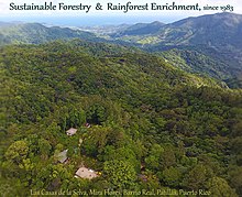
- Las Casas de la Selva
- Nolla Farm
Municipal level
- Caguas Regional Forest (Caguas)[6]
- Chalets de Bairoa Natural Area (Caguas)
- Cerro Borrás (Caguas)
- Río Hondo Community Forest (Mayagüez)
References
- ^ "Directorio de agencias - Compañía de Parques Nacionales de Puerto Rico (CPNPR)". pr.gov (in Spanish). Archived from the original on 2023-03-04. Retrieved 2021-11-29.
- ^ USDA, Forest Service. "Protected Natural Areas of Puerto Rico" (PDF). fs.usda.gov. Archived (PDF) from the original on 2021-08-13. Retrieved 2021-11-29.
- ^ "Natural Protected Areas of Puerto Rico (December 2016 Inventory) | The Caribbean LCC CPA". caribbeanlcc.databasin.org. Archived from the original on 2021-11-29. Retrieved 2021-11-29.
- ^ "Nuestras Áreas Naturales Protegidas". DRNA (in Spanish). 2019-04-24. Archived from the original on 2021-11-29. Retrieved 2021-11-29.
- ^ AN ACT To designate Punta Cucharas natural area of the Municipality of Ponce as a Natural Reserve Area of the Commonwealth of Puerto Rico, to be administered pursuant to the provisions of Act No. 150 of 4 August 1988, as amended, known as the "Puerto Rico Natural Patrimony Program Act." Legislature of Puerto Rico. Legislative Year 2008, Law No. 227. House Bill #3797. 9 August 2008. Accessed 8 June 2016. Archive.
- ^ a b c Municipio Autónomo de Caguas (12 June 2015). "Revisión Integral del Plan Territorial del Municipio Autónomo de Caguas" (PDF) (in Spanish). p. 42. Archived (PDF) from the original on 6 February 2022. Retrieved 7 February 2022.
External links
- DRNA - Puerto Rico Department of Natural and Environmental Resources (in Spanish)
- Para la Naturaleza - Puerto Rico Conservation Trust (in Spanish)
- NPS - United States National Park System (in English)
- USFS - United States Forest Service (in English)
