Portal:Scottish islands/Island
The following articles are currently featured as the Selected island at the Scottish Islands Portal. To suggest an article for inclusion, use the talk page

Barra Head, also known as Berneray (Scottish Gaelic: Beàrnaraigh; Scots: Barra Heid), is the southernmost island of the Outer Hebrides in Scotland. Within the Outer Hebrides, it forms part of the Barra Isles archipelago. Originally, Barra Head only referred to the southernmost headland of Berneray but is now a common name for the entire island. The highest point of the island is Sotan, a Marilyn.
There are numerous prehistoric structures on the island and permanent occupation by 20–50 individuals occurred throughout the historic period, peaking in the 19th century. The economy of the residents was based on agriculture, fishing and fowling. The cliffs provide nesting sites for seabirds in such profusion that Berneray has been designated as a Special Protection Area.
The Barra Head Lighthouse, designed by Robert Stevenson, has operated since 1833. From 1931 to 1980 Barra Head was inhabited only by the lighthouse keepers and their wives but the lighthouse is now automated and the island completely uninhabited. The rough seas that surround the island have been used to test prototype lifeboats. (Full article...)
Dubh Artach (/duː ˈɑːrtɑːx/; Scottish Gaelic: [t̪uh ˈarˠʃt̪əx]) is a remote skerry of basalt rock off the west coast of Scotland lying 18 miles (29 km) west of Colonsay and 15 miles (24 km) south-west of the Ross of Mull.
A lighthouse designed by Thomas Stevenson with a tower height of 145 feet (44 m) was erected between 1867 and 1872 with a shore station constructed on the isle of Erraid. The rock is subject to extraordinary sea conditions with waves of 92 feet (28 m) or more being encountered by the keepers. Despite these adverse conditions several men served the light for lengthy periods until it was automated in 1971. Dubh Artach is the official name of the lighthouse, although the skerry itself is also known as Dhu Heartach. Various interpretations have been provided for the original meaning of the Gaelic name, of which "The Black Rock" is the most likely. (Full article...)
Eday (/ˈiːdiː/, Scots: Aidee) is one of the islands of Orkney, which are located to the north of the Scottish mainland. One of the North Isles, Eday is about 24 kilometres (13 nautical miles) from the Orkney Mainland. With an area of 27 km2 (10 sq mi), it is the ninth-largest island of the archipelago. The bedrock of the island is Old Red Sandstone, which is exposed along the sea-cliffs.
There are various well-preserved Neolithic tombs, as well as evidence of Bronze Age settlement and the remains of a Norse-era castle. During the period of Scottish rule the substantial property of Carrick House was developed at Calfsound, which became a burgh for a short period. During the British era many agricultural improvements were introduced, although there has been a substantial decline in the population since the mid-nineteenth century. In the twenty-first century the Eday Partnership has had success in promoting the island's economy. Local placenames reflect the diverse linguistic heritage and the landscapes of the island and its surrounding seas attract abundant wildlife. (Full article...)
Eilean Donan (Scottish Gaelic: Eilean Donnain) is a small tidal island situated at the confluence of three sea lochs (Loch Duich, Loch Long and Loch Alsh) in the western Highlands of Scotland, about 1 kilometre (5⁄8 mi) from the village of Dornie. It is connected to the mainland by a footbridge that was installed early in the 20th century and is dominated by a picturesque castle that frequently appears in photographs, film and television. The island's original castle was built in the thirteenth century; it became a stronghold of the Clan Mackenzie and their allies, the Clan MacRae. In response to the Mackenzies' involvement in the Jacobite rebellions early in the 18th century, government ships destroyed the castle in 1719. The present-day castle is Lieutenant-Colonel John Macrae-Gilstrap's 20th-century reconstruction of the old castle.
Eilean Donan is part of the Kintail National Scenic Area, one of 40 in Scotland. In 2001, the island had a recorded population of just one person, but there were no "usual residents" at the time of the 2011 census.
Eilean Donan, which means simply "island of Donnán", is named after Donnán of Eigg, a Celtic saint who was martyred in 617. Donnán is said to have established a church on the island, though no trace of this remains. (Full article...)
Gigha (/ˈɡiːə/ GHEE-ə; Scottish Gaelic: Giogha; Scots: Gigha) or the Isle of Gigha (and formerly Gigha Island) is an island off the west coast of Kintyre in Scotland. The island forms part of Argyll and Bute and has a population of 163 people. The climate is mild with higher than average sunshine hours and the soils are fertile. The main settlement is Ardminish.
Gigha has been inhabited continuously since prehistoric times. It may have had an important role during the Kingdom of Dalriada and is the ancestral home of Clan MacNeill. It fell under the control of the Norse and the Lords of the Isles before becoming incorporated into modern Scotland and saw a variety of conflicts during the medieval period.
The population of Gigha peaked at over 700 in the eighteenth century, but during the 20th century the island had numerous owners, which caused various problems in developing the island. By the beginning of the 21st century the population had fallen to 98. However a "community buy-out" in 2002 has transformed the island, which now has a growing population and a variety of new commercial activities to complement farming and tourism.
Attractions on the island include Achamore Gardens and the abundant wildlife, especially seabirds. There have been numerous shipwrecks on the surrounding rocks and skerries. (Full article...)
Islay (/ˈaɪlə/ ⓘ EYE-lə; Scottish Gaelic: Ìle, Scots: Ila) is the southernmost island of the Inner Hebrides of Scotland. Known as "The Queen of the Hebrides", it lies in Argyll and Bute just south west of Jura and around 40 kilometres (22 nautical miles) north of the Northern Irish coast. The island's capital is Bowmore where the distinctive round Kilarrow Parish Church and a distillery are located. Port Ellen is the main port.
Islay is the fifth-largest Scottish island and the eighth-largest island of the British Isles, with a total area of almost 620 square kilometres (240 sq mi). There is ample evidence of the prehistoric settlement of Islay and the first written reference may have come in the first century AD. The island had become part of the Gaelic Kingdom of Dál Riata during the Early Middle Ages before being absorbed into the Norse Kingdom of the Isles.
The later medieval period marked a "cultural high point" with the transfer of the Hebrides to the Kingdom of Scotland and the emergence of the Clan Donald Lordship of the Isles, originally centred at Finlaggan. During the 17th century the power of Clan Donald waned, but improvements to agriculture and transport led to a rising population, which peaked in the mid-19th century. This was followed by substantial forced displacements and declining resident numbers.
Today, Islay has over 3,000 inhabitants, and the main commercial activities are agriculture, malt whisky distillation and tourism. The island has a long history of religious observance, and Scottish Gaelic is spoken by about a quarter of the population. Its landscapes have been celebrated through various art forms, and there is a growing interest in renewable energy in the form of wave power. Islay is home to many bird species such as the wintering populations of Greenland white-fronted and barnacle goose, and is a popular destination throughout the year for birdwatchers. The climate is mild and ameliorated by the Gulf Stream. (Full article...)
The Isle of Arran (/ˈærən/; Scottish Gaelic: Eilean Arainn) or simply Arran is an island off the west coast of Scotland. It is the largest island in the Firth of Clyde and the seventh-largest Scottish island, at 432 square kilometres (167 sq mi). Historically part of Buteshire, it is in the unitary council area of North Ayrshire. In the 2011 census it had a resident population of 4,629. Though culturally and physically similar to the Hebrides, it is separated from them by the Kintyre peninsula. Often referred to as "Scotland in Miniature", the Island is divided into highland and lowland areas by the Highland Boundary Fault and has been described as a "geologist's paradise".
Arran has been continuously inhabited since the early Neolithic period. Numerous prehistoric remains have been found. From the 6th century onwards, Goidelic-speaking peoples from Ireland colonised it and it became a centre of religious activity. In the troubled Viking Age, Arran became the property of the Norwegian crown, until formally absorbed by the kingdom of Scotland in the 13th century. The 19th-century "clearances" led to significant depopulation and the end of the Gaelic language and way of life. The economy and population have recovered in recent years, the main industry being tourism. However, the increase in tourism and people buying holiday homes on the Island, the second highest rate of such homes in the UK, has led to a shortage of affordable homes on the Island. There is a diversity of wildlife, including three species of tree endemic to the area.
The Island includes miles of coastal pathways, numerous hills and mountains, forested areas, rivers, small lochs and beaches. Its main beaches are at Brodick, Whiting Bay, Kildonan, Sannox and Blackwaterfoot. (Full article...)
Lismore (Scottish Gaelic: Lios Mòr, pronounced [ʎis̪ ˈmoːɾ] possibly meaning "great enclosure" or "garden") is an island of some 2,351 hectares (9.1 square miles) in the Inner Hebrides of Scotland. The climate is damp and mild, with over 166 centimetres (65 in) of rain recorded annually. This fertile, low-lying island was once a major centre of Celtic Christianity, with a 6th-century monastery associated with Saint Moluag, and later became the seat of the medieval Bishop of Argyll. There are numerous ruined structures, including a broch and two 13th-century castles.
During the 19th century, various new industries were introduced, including lime quarrying. During the early decades of the 20th century, the population exceeded 1,000, but this was followed by a lengthy decline. Although resident numbers are now less than 200, there was a small increase from 2001 to 2011. About a third of the population were recorded as Gaelic-speaking at the former date. The modern economy is largely based on farming, fishing and tourism, and the largest settlement is Achnacroish. Various shipwrecks have been recorded in the vicinity. (Full article...)

Mingulay (Scottish Gaelic: Miughalaigh) is the second largest of the Bishop's Isles in the Outer Hebrides of Scotland. Located 12 nautical miles (22 kilometres) south of Barra, it is known for an extensive Gaelic oral tradition incorporating folklore, song and stories and its important seabird populations, including puffins, black-legged kittiwakes, and razorbills, which nest in the sea-cliffs, amongst the highest in the British Isles.
There are Iron Age remains, and the culture of the island was influenced by early Christianity and the Vikings. Between the 15th and 19th centuries Mingulay was part of the lands of Clan MacNeil of Barra, but subsequently suffered at the hands of absentee landlords.
After two thousand years or more of continuous habitation, the island was abandoned by its Gaelic-speaking residents in 1912 and has remained uninhabited since. It is no longer used for grazing sheep. The island is also associated with the "Mingulay Boat Song", although that was composed in 1938. The National Trust for Scotland has owned Mingulay since 2000. (Full article...)
Papa Stour is one of the Shetland Islands in Scotland, with a population of under fifteen people, some of whom immigrated after an appeal for residents in the 1970s. Located to the west of mainland Shetland and with an area of 828 hectares (3.2 square miles), Papa Stour is the ninth largest island in Shetland. Erosion of the soft volcanic rocks by the sea has created an extraordinary variety of caves, stacks, arches, blowholes, and cliffs. The island and its surrounding seas harbour diverse populations of wildlife. The west side of the island is a Site of Special Scientific Interest and the seas around the island are a Special Area of Conservation.
The island has several Neolithic burial chamber sites, as well as the remains of Duke Hakon's 13th-century house dating from the Norse occupation of the island. The population reached 380 or more in the 19th century, when a fishing station was opened at Crabbaberry in West Voe. Subsequently, there was a steady decline in population.
Today the main settlement on the island is Biggings, just to the east of which is Housa Voe from where the Snolda ferry arrives from its base at West Burrafirth on the Shetland Mainland. Crofting, especially sheep rearing, is the mainstay of island life.
Numerous shipwrecks have occurred around the coast, and the celebrated poem Da Sang o da Papa Men by Vagaland recalls the drama of the days when Papa Stour was a centre for deep-sea fishing. (Full article...)
Raasay (/ˈrɑːseɪ/; Scottish Gaelic: Ratharsair), sometimes the Isle of Raasay, is an island between the Isle of Skye and the mainland of Scotland. It is separated from Skye by the Sound of Raasay and from Applecross by the Inner Sound. It is famous for being the birthplace of Gaelic poet Sorley MacLean, an important figure in the Scottish Renaissance.
Traditionally the home of Clan MacSween, the island was ruled by the MacLeods from the 15th to the 19th century. Subsequently, a series of private landlords held title to the island, which is now largely in public ownership. Raasay House, which was visited by James Boswell and Samuel Johnson in 1773, is now a hotel, restaurant, bar and outdoor activity centre. Raasay means "Isle of the Roe Deer" and the island is home to an endemic subspecies of bank vole. (Full article...)
Rùm (Scottish Gaelic pronunciation: [rˠuːm]), a Scottish Gaelic name often anglicised to Rum (/rʌm/ ⓘ rum), is one of the Small Isles of the Inner Hebrides, off the west coast of Scotland, in the district of Lochaber. For much of the 20th century the name became Rhum, a spelling invented by the former owner, Sir George Bullough, because he did not relish the idea of having the title "Laird of Rum".
It is the largest of the Small Isles, and the 15th largest Scottish island, and is inhabited by 40 people, all of whom live in the hamlet of Kinloch on the east coast. The island has been inhabited since the 8th millennium BC and provides some of the earliest known evidence of human occupation in Scotland. The early Celtic and Norse settlers left only a few written accounts and artefacts. From the 12th to 13th centuries on, the island was held by various clans including the MacLeans of Coll. The population grew to over 400 by the late 18th century but was cleared of its indigenous population between 1826 and 1828. The island then became a sporting estate, the exotic Kinloch Castle being constructed by the Bulloughs in 1900. Rùm was purchased by the Nature Conservancy Council in 1957.
Rùm is mainly igneous in origin, and its mountains have been eroded by Pleistocene glaciation. It is now an important study site for research in ecology, especially of red deer, and is the site of a successful reintroduction programme for the white-tailed sea eagle. Its economy is entirely dependent on NatureScot, a public body that now manages the island, and there have been calls for a greater diversity of housing provision. A Caledonian MacBrayne ferry links the island with the mainland town of Mallaig. (Full article...)
Skerryvore (from the Gaelic An Sgeir Mhòr meaning "The Great Skerry") is a remote island that lies off the west coast of Scotland, 11 nautical miles (20 kilometres) southwest of Tiree. Skerryvore Lighthouse is located on these rocks, built with some difficulty between 1838 and 1844 by Alan Stevenson.
At a height of 156 feet (48 metres) it is the tallest lighthouse in Scotland. The shore station was at Hynish on Tiree (which now houses the Skerryvore Lighthouse Museum); operations were later transferred to Erraid, west of Mull. The remoteness of the location led to the keepers receiving additional payments in kind. The light shone without a break from 1844 until a fire in 1954 shut down operations for five years. The lighthouse was automated in 1994. (Full article...)

The Isle of Skye, or simply Skye (/skaɪ/; Scottish Gaelic: An t-Eilean Sgitheanach or Eilean a' Cheò), is the largest and northernmost of the major islands in the Inner Hebrides of Scotland. The island's peninsulas radiate from a mountainous hub dominated by the Cuillin, the rocky slopes of which provide some of the most dramatic mountain scenery in the country. Although Sgitheanach has been suggested to describe a winged shape, no definitive agreement exists as to the name's origin.
The island has been occupied since the Mesolithic period, and over its history has been occupied at various times by Celtic tribes including the Picts and the Gaels, Scandinavian Vikings, and most notably the powerful integrated Norse-Gaels clans of MacLeod and MacDonald. The island was considered to be under Norwegian suzerainty until the 1266 Treaty of Perth, which transferred control over to Scotland.
The 18th-century Jacobite risings led to the breaking-up of the clan system and later clearances that replaced entire communities with sheep farms, some of which involved forced emigrations to distant lands. Resident numbers declined from over 20,000 in the early 19th century to just under 9,000 by the closing decade of the 20th century. Skye's population increased by 4% between 1991 and 2001. About a third of the residents were Gaelic speakers in 2001, and although their numbers are in decline, this aspect of island culture remains important. The main industries are tourism, agriculture, fishing, and forestry. Skye is part of the Highland Council local government area and wholly within the historic county of Inverness-shire. The island's largest settlement is Portree, which is also its capital, known for its picturesque harbour. Links to various nearby islands by ferry are available, and since 1995, to the mainland by a road bridge. The climate is mild, wet, and windy. The abundant wildlife includes the golden eagle, red deer, and Atlantic salmon. The local flora is dominated by heather moor, and nationally important invertebrate populations live on the surrounding sea bed. Skye has provided the locations for various novels and feature films and is celebrated in poetry and song. (Full article...)
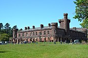
Shapinsay (/ˈʃæpɪnziː/, Scots: Shapinsee) is one of the Orkney Islands off the north coast of mainland Scotland. With an area of 29.5 square kilometres (11.4 sq mi), it is the eighth largest island in the Orkney archipelago. It is low-lying and, with a bedrock formed from Old Red Sandstone overlain by boulder clay, fertile, causing most of the area to be used for farming. Shapinsay has two nature reserves and is notable for its bird life. Balfour Castle, built in the Scottish Baronial style, is one of the island's most prominent features, a reminder of the Balfour family's domination of Shapinsay during the 18th and 19th centuries; the Balfours transformed life on the island by introducing new agricultural techniques. Other landmarks include a standing stone, an Iron Age broch, a souterrain and a salt-water shower.
There is one village on the island, Balfour, from which roll-on/roll-off car ferries sail to Kirkwall on the Orkney Mainland. At the 2011 census, Shapinsay had a population of 307. The economy of the island is primarily based on agriculture with the exception of a few small businesses that are largely tourism-related. A community-owned wind turbine was constructed in 2011. The island has a primary school but, in part due to improving transport links with mainland Orkney, no longer has a secondary school. Shapinsay's long history has given rise to various folk tales. (Full article...)
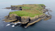
Staffa (Scottish Gaelic: Stafa, pronounced [ˈs̪t̪afa], from the Old Norse for stave or pillar island) is an island of the Inner Hebrides in Argyll and Bute, Scotland. The Vikings gave it this name as its columnar basalt reminded them of their houses, which were built from vertically placed tree-logs.
Staffa lies about 10 kilometres (6 miles) west of the Isle of Mull; its area is 33 hectares (82 acres) and the highest point is 42 metres (138 feet) above sea level.
The island came to prominence in the late 18th century after a visit by Sir Joseph Banks. He and his fellow-travellers extolled the natural beauty of the basalt columns in general and of the island's main sea cavern, which Banks renamed 'Fingal's Cave'. Their visit was followed by those of many other prominent personalities throughout the next two centuries, including Queen Victoria and Felix Mendelssohn. The latter's Hebrides Overture brought further fame to the island, which was by then uninhabited. It is now in the care of the National Trust for Scotland. (Full article...)
Stroma is an uninhabited island in the Pentland Firth, between Orkney and the mainland of Scotland. It forms part of the civil parish of Canisbay in Caithness, in the council area of Highland. The name comes from the Old Norse Straumey, meaning "island in the current".
Ancient stone structures testify to the presence of Stroma's earliest residents, while a Norse presence around 900–1,000 years ago is recorded in the Orkneyinga Saga. It has been politically united with Caithness since at least the 15th century. Although Stroma lies only a few miles off the Scottish coast, the savage weather and ferociously strong tides of the Pentland Firth meant that the island's inhabitants were very isolated, causing them to be largely self-sufficient, trading agricultural produce and fish with the mainlanders.
Most of the islanders were fishermen and crofters; some also worked as maritime pilots to guide vessels through the treacherous waters of the Pentland Firth. The tides and currents meant that shipwrecks were frequent—the most recent occurring in 1993—and salvage provided an additional though often illegal supplement to the islanders' incomes. A lighthouse was built on Stroma in 1890 and still operates under automation.
Stroma is now abandoned, with the houses of its former inhabitants unoccupied and falling into ruin. Its population fell gradually through the first half of the 20th century as inhabitants drifted away to seek opportunities elsewhere, as economic problems and Stroma's isolation made life on the island increasingly unsupportable. From an all-time peak of 375 people in 1901, the population fell to just 12 by 1961 and the last islanders left at the end of the following year. Stroma's final abandonment came in 1997 when the lighthouse keepers and their families departed. The island is now owned by one of its former inhabitants, who uses it to graze sheep. (Full article...)
Ulva (/ˈʌlvə/; Scottish Gaelic: Ulbha) is a small island in the Inner Hebrides of Scotland, off the west coast of Mull. It is separated from Mull by a narrow strait, and connected to the neighbouring island of Gometra by a bridge. Much of the island is formed from Cenozoic basalt rocks, which are formed into columns in places.
Ulva has been populated since the Mesolithic period, and there are various Neolithic remains on the island. The Norse occupation of the island in the Early Middle Ages has left few tangible artefacts but did bequeath the island its name, which is probably from Ulvoy, meaning "wolf island". Celtic culture was a major influence during both Pictish and Dalriadan times as well as the post-Norse period when the islands became part of modern Scotland. This long period, when Gaelic became the dominant language, was ended by the 19th-century Clearances. At its height, Ulva had a population of over 800, but by May 2019, this had declined to 5; some increase in the number of residents was expected in future, with the re-population plan that was to commence in 2020.
Numerous well-known individuals have connections with the island including David Livingstone, Samuel Johnson and Walter Scott, who drew inspiration from Ulva for his 1815 poem, The Lord of the Isles. Wildlife is abundant: cetaceans are regularly seen in the surrounding waters and over 500 species of plant have been recorded. Today there is a regular ferry service and tourism is the mainstay of the economy. In March 2018 the Scottish Land Fund pledged £4.4 million towards a community buyout of the island, and the North West Mull Community Woodland Company took ownership of the island on 21 June 2018. (Full article...)

Yell is one of the North Isles of Shetland, Scotland. In the 2011 census it had a usually resident population of 966. It is the second largest island in Shetland after the Mainland with an area of 82 square miles (212 km2), and is the third most populous in the archipelago (fifteenth out of the islands in Scotland), after the Mainland and Whalsay.
The island's bedrock is largely composed of Moine schist with a north–south grain, which was uplifted during the Caledonian mountain building period. Peat covers two-thirds of the island to an average depth of 1.5 metres (4.9 feet).
Yell has been inhabited since the Neolithic times, and a dozen broch sites have been identified from the pre-Norse period. Norse rule lasted from the 9th to 14th centuries until Scottish control was asserted. The modern economy of the island is based on crofting, fishing, transport and tourism. The island claims to be the "Otter Capital of Britain" and has a diverse bird life including breeding populations of great and Arctic skuas. At times, whales and dolphins also appear off the coast.
Notable buildings on the island include the 17th-century Old Haa of Brough in Burravoe, a merchant's house now converted to a museum and visitor centre. There are various folk tales and modern literary references to island life. (Full article...)


