Pommersfelden
Pommersfelden | |
|---|---|
 | |
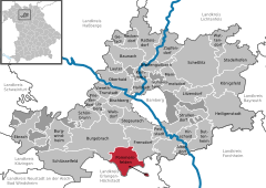
Location of Pommersfelden within Bamberg district  | |
| Coordinates: 49°46′N 10°49′E / 49.767°N 10.817°E | |
| Country | Germany |
| State | Bavaria |
| Admin. region | Oberfranken |
| District | Bamberg |
| Subdivisions | 10 Gemeindeteile |
| Government | |
| • Mayor (2020–26) | Gerd Dallner[1] |
| Area | |
• Total | 35.71 km2 (13.79 sq mi) |
| Elevation | 270 m (890 ft) |
| Population (2023-12-31)[2] | |
• Total | 3,105 |
| • Density | 87/km2 (230/sq mi) |
| Time zone | UTC+01:00 (CET) |
| • Summer (DST) | UTC+02:00 (CEST) |
| Postal codes | 96178 |
| Dialling codes | 09548, 09502 |
| Vehicle registration | BA |
| Website | www.pommersfelden.de |

Pommersfelden is a community in the Upper Franconian district of Bamberg in Germany.
Geography
The community lies north of Höchstadt an der Aisch on the river Reiche Ebrach.
Constituent communities
The community of Pommersfelden is subdivided into four Gemarkungen (traditional rural land units) with a total of ten settled centres, each given here with its own population figure:
- Gemarkung Oberndorf:
- Oberndorf 89
- Weiher (with Ziegelhütte) 102
- Gemarkung Pommersfelden:
- Limbach 273
- Pommersfelden 656
- Gemarkung Steppach:
- Steppach 922
- Stolzenroth 58
- Unterköst 39
- Gemarkung Sambach:
- Sambach 591
- Schweinbach 133
- Wind 62
The Gemarkungen have the same names as 4 of the constituent communities (it is traditional for a Gemarkung to be named after a town or village lying nearby, or in Pommersfelden’s case, within it).
History
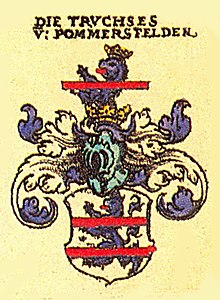
As of the 14th century, Pommersfelden was owned by the Truchseß von Nainsdorf und Pommersfelden family. After the family had died out in 1710, ownership passed to Lothar Franz von Schönborn, Elector of Mainz and Prince-Bishop of Bamberg. With the Act of the Confederation of the Rhine in 1806, the Counts of Schönborn saw their overlordship pass to Bavaria. In the course of administrative reform in Bavaria, today’s community came into being under the Gemeindeedikt (“Community Edict”) of 1818. Until 1972, Pommersfelden belonged to the district of Höchstadt an der Aisch.
Population development
Within municipal limits, 2,009 inhabitants were counted in 1970, 2,253 in 1987 and 2,653 in 2000. On 30 June 2007 it was 2,936.
Politics
The mayor is Gerd Dallner, elected in 2020.
The community council is made up of 14 members, listed here by voter community affiliation, and also with the number of seats that each holds:
- Wählerblock Sambach: 5
- Freie Wählergemeinschaft Steppach: 5
- Bürgerblock Pommersfelden: 3
- Einigkeit Limbach: 1
Coat of arms
Pommersfelden’s arms might heraldically be described thus: Party per fess argent and gules, argent a pale azure, thereon an uppercase T argent and flanked by two embattled towers gules, gules a lion passant Or with two tails armed, langued and crowned azure on a mount of three.
In 1999, municipal tax revenue, converted to euros, amounted to €990,000 of which business taxes amounted to €174,000.
Economy
Transport
Through the municipal area runs the Strullendorf–Schlüsselfeld railway line, although nowadays only goods are transported on it to and from Schlüsselfeld.
Culture and sightseeing
Buildings

In the south of the constituent community of Pommersfelden stands Schloss Weißenstein (palace), built by Lothar Franz von Schönborn between 1711 and 1716, which is nowadays in private family ownership. The Baroque palace houses an impressive stairway, an indoor grotto and a collection of paintings that is worth seeing.
In the middle of the constituent community of Pommersfelden are the remnants of an old castle with a moat, and in Sambach a Jesuit castle. Neither, however, is open to the public. Furthermore, the constituent communities of Limbach, Pommersfelden, Sambach, and Steppach each have a church.
Parks
Schloss Weißenstein has an English landscape park from the 19th century.
Famous people
Sons and daughters of the town
The painter, restorer and gallery inspector Joseph Dorn was born on 12 August 1759 in Kratz-Sambach, today’s Sambach. From 1802 he was an inspector at the Schloss Weißenstein gallery. Dorn died on 6 August 1841.
References
- ^ Liste der ersten Bürgermeister/Oberbürgermeister in kreisangehörigen Gemeinden, Bayerisches Landesamt für Statistik, 15 July 2021.
- ^ Genesis Online-Datenbank des Bayerischen Landesamtes für Statistik Tabelle 12411-003r Fortschreibung des Bevölkerungsstandes: Gemeinden, Stichtag (Einwohnerzahlen auf Grundlage des Zensus 2011).


