Placencia Airport
Placencia Airport | |||||||||||
|---|---|---|---|---|---|---|---|---|---|---|---|
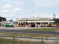
 A Maya Island Air Cessna Caravan at Placencia Airport | |||||||||||
| Summary | |||||||||||
| Airport type | Public | ||||||||||
| Serves | Placencia | ||||||||||
| Elevation AMSL | 3 ft / 1 m | ||||||||||
| Coordinates | 16°32′14″N 88°21′40″W / 16.53722°N 88.36111°W | ||||||||||
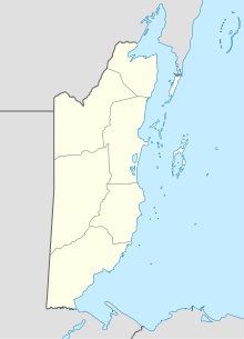
| Map | |||||||||||
 | |||||||||||
| Runways | |||||||||||
| |||||||||||
Placencia Airport (IATA: PLJ, ICAO: MZPL) is an airport that serves Placencia, Belize. It has a paved strip and crosses the peninsula from East to West.[3]
As of December 2012, the runway is paved in good condition. Due to the typical sea breeze, takeoffs and landings are typically done east-bound. Private flights are allowed. Parking should be coordinated with Tropic Air or Maya Island Air. The airport has no security.
Common traffic advisory frequency (CTAF) is 122.8 MHz.
Airlines and destinations
| Airlines | Destinations |
|---|---|
| Maya Island Air | Belize City–International, Belize City–Municipal, Dangriga, Punta Gorda |
| Tropic Air | Belize City–International, Belize City–Municipal, Dangriga, Punta Gorda |
Accidents and incidents
- 17 November 2017 - A Cessna 208B Grand Caravan of Tropic Air struck a vehicle shortly after take-off for Punta Gorda Airport and subsequently ditched in the sea. All seven people on board, including the Acting Prime Minister of Belize Patrick Faber and Agriculture Minister Godwin Hulse, survived.[4]
See also
References
- ^ Airport information for PLJ at Great Circle Mapper.
- ^ Google Maps - Placencia
- ^ Landing at Palencia YouTube
- ^ "Tropic Air Plane, with Ministers and Others Inside, Sinks after Clipping Vehicle at Airstrip". News 5. Great Belize Productions. 17 November 2017. Retrieved 18 November 2017.
External links
- OpenStreetMap - Placencia
- OurAirports - Placencia
- FallingRain - Placencia Airport
- Accident history for PLJ at Aviation Safety Network

