Portal:Scottish islands
The Scottish Islands Portal
Welcome! — Fàilte! — Walcome!

Scotland has around 900 offshore islands, most of which are to be found in four main groups: Shetland, Orkney, and the Hebrides, sub-divided into the Inner Hebrides and Outer Hebrides. There are also clusters of islands in the Firth of Clyde, Firth of Forth, and Solway Firth, and numerous small islands within the many bodies of fresh water in Scotland including Loch Lomond and Loch Maree. The largest island is Lewis and Harris, which extends to 2,179 square kilometres, and there are a further 200 islands which are greater than 40 hectares in area. Of the remainder, several, such as Staffa and the Flannan Isles, are well-known, despite their small size. Some 94 Scottish islands are permanently inhabited, of which 89 are offshore islands. Between 2001 and 2011, Scottish island populations as a whole grew by 4% to 103,702.
The geology and geomorphology of the islands is varied. Some, such as Skye and Mull, are mountainous, while others like Tiree and Sanday are relatively low-lying. Many have bedrock made from ancient Archaean Lewisian Gneiss which was formed 3 billion years ago; Shapinsay and other Orkney islands are formed from Old Red Sandstone, which is 400 million years old; and others such as Rùm from more recent Tertiary volcanoes. Many of the islands are swept by strong tides, and the Corryvreckan tide race between Scarba and Jura is one of the largest whirlpools in the world. Other strong tides are to be found in the Pentland Firth between mainland Scotland and Orkney, and another example is the "Grey Dog" between Scarba and Lunga. (More on Scottish islands...)
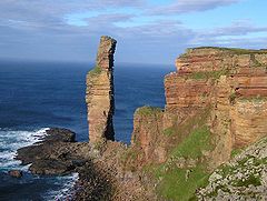
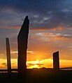
Selected picture
Selected island group
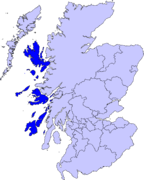
The Inner Hebrides (/ˈhɛbrɪdiːz/ HEB-rid-eez; Scottish Gaelic: na h-Eileanan a-staigh, lit. 'the Inner Isles') is an archipelago off the west coast of mainland Scotland, to the south east of the Outer Hebrides. Together these two island chains form the Hebrides, which experience a mild oceanic climate. The Inner Hebrides comprise 35 inhabited islands as well as 44 uninhabited islands with an area greater than 30 hectares (74 acres). Skye, Mull, and Islay are the three largest, and also have the highest populations. The main commercial activities are tourism, crofting, fishing and whisky distilling. In modern times the Inner Hebrides have formed part of two separate local government jurisdictions, one to the north and the other to the south. Together, the islands have an area of about 4,130 km2 (1,594 sq mi), and had a population of 18,948 in 2011. The population density is therefore about 4.6 inhabitants per square kilometre (12 inhabitants per square mile).
There are various important prehistoric structures, many of which pre-date the first written references to the islands by Roman and Greek authors. In the historic period the earliest known settlers were Picts to the north and Gaels in the southern kingdom of Dál Riada prior to the islands becoming part of the Suðreyjar kingdom of the Norse, who ruled for over 400 years until sovereignty was transferred to Scotland by the Treaty of Perth in 1266. Control of the islands was then held by various clan chiefs, principally the MacLeans, MacLeods and MacDonalds. The Highland Clearances of the 19th century had a devastating effect on many communities and it is only in recent years that population levels have ceased to decline.
Sea transport is crucial and a variety of ferry services operate to mainland Scotland and between the islands. The Gaelic language remains strong in some areas; the landscapes have inspired a variety of artists; and there is a diversity of wildlife. (Full article...)
News
- 12 February: The BiFab construction yard at Arnish near Stornoway, Isle of Lewis, is purchased by InfraStrata.
- 11 February: Wild fires occur in Benbecula; and at Achmore and Sildinish in the Isle of Lewis; Horsaclete in Harris; Brevig in Barra; and Eubhal in North Uist.
- 19 January: Barra and Vatersay are put under tier-4 restrictions after an outbreak of Covid-19.
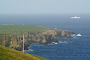
- 18 January: The Shetland Space Centre submits plans for a spaceport on Unst (proposed site pictured), Shetland, including three rocket launch pads.
- 8 January: Distilleries in Orkney and South Uist receive government grants to research ways of reducing their CO2 emissions.
- 4 January: After the UK leaves the European Union, the Northern Celt, an Irish fishing boat based out of Greencastle, County Donegal, is ordered to leave the 12-nautical-mile zone around Rockall by officers of Marine Scotland.
- 1 January: A total of 72 cases of Covid-19 are recorded in an ongoing outbreak in Shetland.
- 9 December: A review by a committee of MSPs into the commissioning and building of two new dual-fuel Caledonian MacBrayne ferries, MV Glen Sannox and "hull 802", criticises CMAL, Transport Scotland and the Scottish government, as well as the ship builders, Ferguson Marine.
- 3 December: North-east Lewis, Sea of the Hebrides and Shiant East Bank are designated Marine Protected Areas, while East Mainland Coast Shetland, Sound of Gigha, Coll and Tiree, Rùm, the west coast of the Outer Hebrides, and the waters off St Kilda and Foula are designated Special Protection Areas.
- 30 November: Michael Russell, MSP for Argyll and Bute, and David Stewart and John Finnie, MSPs for the Highlands and Islands region, will stand down at the 2021 election.
- 17 November: Phytophthora ramorum-infected larch trees in Arran are to be felled over a 543-acre area, to prevent the fungus-like pathogen from spreading.
- 4 November: The Scottish Wildlife Trust objects to a proposed salmon farm in the Marine Protected Area of Wester Ross, near Horse Island, Summer Isles, because of the potential impact on kelp forests and maerl beds.
Selected fauna
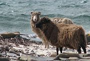
The North Ronaldsay or Orkney is a breed of sheep from North Ronaldsay, the northernmost island of Orkney, off the north coast of Scotland. It belongs to the Northern European short-tailed sheep group of breeds, and has evolved without much cross-breeding with modern breeds. It is a smaller sheep than most, with the rams (males) horned and ewes (females) mostly hornless. It was formerly kept primarily for wool, but now the two largest flocks are feral, one on North Ronaldsay and another on the Orkney island of Auskerry. The Rare Breeds Survival Trust lists the breed as a priority on its 2021–2022 watchlist, and they are in danger of extinction, with fewer than 600 registered breeding females in the United Kingdom.
The semi-feral flock on North Ronaldsay is the original flock that evolved to subsist almost entirely on seaweed – they are one of few mammals to do this. They are confined to the foreshore by a 1.8 m (6 ft) early 19th century drystane dyke, which completely encircles the island, forcing the sheep to evolve this unusual characteristic. The wall was built as kelping (the production of soda ash from seaweed) on the shore became uneconomical. Sheep were confined to the shore to protect the fields and crofts inside, and afterwards subsisted largely on seaweed.
This diet has caused a variety of adaptations in the sheep's digestive system. These sheep have to extract the trace element copper far more efficiently than other breeds as their diet has a limited supply of copper. This results in them being susceptible to copper toxicity, if fed on a grass diet, as copper is toxic to sheep in high quantities. Grazing habits have also changed to suit the sheep's environment. To reduce the chance of being stranded by an incoming tide, they graze at low tide and then ruminate at high tide.
A range of fleece colours are exhibited, including grey, brown and red. Meat from the North Ronaldsay has a distinctive flavour, described as "intense" and "gamey", possibly in part due to the high iodine content in their diet of seaweed. (Full article...)
Selected history & culture article

The nuckelavee ( /nʌklɑːˈviː/) or nuckalavee is a horse-like demon from Orcadian folklore that combines equine and human elements. British folklorist Katharine Briggs called it "the nastiest" of all the demons of Scotland's Northern Isles. The nuckelavee's breath was thought to wilt crops and sicken livestock, and the creature was held responsible for droughts and epidemics on land despite being predominantly a sea-dweller.
A graphic description of the nuckelavee as it appears on land was given by an islander who claimed to have had a confrontation with it, but accounts describing the details of the creature's appearance are inconsistent. In common with many other sea-monsters, it is unable to tolerate fresh water, therefore, those it is pursuing have only to cross a river or stream to be rid of it. The nuckelavee is kept in confinement during the summer months by the Mither o' the Sea, an ancient Orcadian spirit, and the only one able to control it.
Orcadian folklore had a strong Scandinavian influence, and it may be that the nuckelavee is a composite of a water horse from Celtic mythology and a creature imported by the Norsemen. As with similar malevolent entities such as the kelpie, it possibly offered an explanation for incidents that islanders in ancient times could not otherwise understand. (Full article...)
Selected island
Papa Stour is one of the Shetland Islands in Scotland, with a population of under fifteen people, some of whom immigrated after an appeal for residents in the 1970s. Located to the west of mainland Shetland and with an area of 828 hectares (3.2 square miles), Papa Stour is the ninth largest island in Shetland. Erosion of the soft volcanic rocks by the sea has created an extraordinary variety of caves, stacks, arches, blowholes, and cliffs. The island and its surrounding seas harbour diverse populations of wildlife. The west side of the island is a Site of Special Scientific Interest and the seas around the island are a Special Area of Conservation.
The island has several Neolithic burial chamber sites, as well as the remains of Duke Hakon's 13th-century house dating from the Norse occupation of the island. The population reached 380 or more in the 19th century, when a fishing station was opened at Crabbaberry in West Voe. Subsequently, there was a steady decline in population.
Today the main settlement on the island is Biggings, just to the east of which is Housa Voe from where the Snolda ferry arrives from its base at West Burrafirth on the Shetland Mainland. Crofting, especially sheep rearing, is the mainstay of island life.
Numerous shipwrecks have occurred around the coast, and the celebrated poem Da Sang o da Papa Men by Vagaland recalls the drama of the days when Papa Stour was a centre for deep-sea fishing. (Full article...)
Did you know?
- ... that the Carsaig Arches (pictured) are a natural formation to the west of Carsaig Bay on the Isle of Mull?
- ... that the name of the ruinous dun Dùn Beic may derive from the Gaelic personal name Béc?
- ... that the German battleship SMS Friedrich der Grosse was the flagship of the Imperial Navy during the majority of World War I, including the Battle of Jutland?
- ...that Séon Carsuel, Scottish Protestant reformer, Bishop of the Isles and author of the first book to be printed in any Goidelic language, was over seven foot tall?
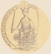
Selected portrait
Selected geography article
The Bell Rock Lighthouse, off the coast of Angus, Scotland, is the world's oldest surviving sea-washed lighthouse. It was built between 1807 and 1810 by Robert Stevenson on the Bell Rock (also known as Inchcape) in the North Sea, 11 miles (18 km) east of the Firth of Tay. Standing 35 metres (115 ft) tall, its light is visible from 35 statute miles (56 km) inland.
The masonry work on which the lighthouse rests was constructed to such a high standard that it has not been replaced or adapted in 200 years. The lamps and reflectors were replaced in 1843; the original ones are now in the lighthouse at Cape Bonavista, Newfoundland, where they are currently on display. The working of the lighthouse has been automated since 24 October 1988. The Northern Lighthouse Board, which has had its headquarters at 84 George Street in Edinburgh since 1832, remotely monitors the light.
The lighthouse previously operated in tandem with a shore station, the Bell Rock Signal Tower, built in 1813 at the mouth of Arbroath harbour. Today this building houses the Signal Tower Museum, a visitor centre that offers a detailed history of the lighthouse.
Because of the engineering challenges that were overcome to build the lighthouse, it has been described as one of the Seven Wonders of the Industrial World. (Full article...)
Selected biography
Haakon IV Haakonsson (c. March/April 1204 – 16 December 1263; Old Norse: Hákon Hákonarson [ˈhɑːˌkon ˈhɑːˌkonɑrˌson]; Norwegian: Håkon Håkonsson), sometimes called Haakon the Old in contrast to his namesake son, was King of Norway from 1217 to 1263. His reign lasted for 46 years, longer than any Norwegian king since Harald Fairhair. Haakon was born into the troubled civil war era in Norway, but his reign eventually managed to put an end to the internal conflicts. At the start of his reign, during his minority, Earl Skule Bårdsson served as regent. As a king of the Birkebeiner faction, Haakon defeated the uprising of the final Bagler royal pretender, Sigurd Ribbung, in 1227. He put a definitive end to the civil war era when he had Skule Bårdsson killed in 1240, a year after he had himself proclaimed king in opposition to Haakon. Haakon thereafter formally appointed his own eldest son, Haakon the Young, as his co-regent.
Under Haakon's rule, medieval Norway is considered to have reached its zenith or golden age. His reputation and formidable naval fleet allowed him to maintain friendships with both the pope and the Holy Roman Emperor, despite their conflict. He was at different points offered the imperial crown by the pope, the High Kingship of Ireland by a delegation of Irish kings, and the command of the French crusader fleet by the French king. He amplified the influence of European culture in Norway by importing and translating contemporary European literature into Old Norse, and by constructing monumental European-style stone buildings. In conjunction with this he employed an active and aggressive foreign policy, and at the end of his rule added Iceland and the Norse Greenland community to his kingdom, leaving the Norwegian realm at its territorial height. Although he for the moment managed to secure Norwegian control of the islands off the northern and western shores of Scotland, plus the Isle of Man, he fell ill and died when wintering in Orkney following some military engagements with the expanding Kingdom of Scotland. He was succeeded by his second son, Magnus VI. (Full article...)
Related portals
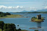
Selected panorama
Topics
Categories
The main category is Islands of Scotland, with subcategories

Things you can do
- Add new articles to the project by placing {{WPSI|class=|importance=}} on the talk page
- Add a link to the portal in the "See also" section of relevant articles with {{Portal|Scottish islands}}
- Take requested photographs or create requested pages, including Prehistoric Hebrides, Trialabreac, Dog Isle...
- Expand a Scottish Islands stub into a full article, adding images, citations, references and infoboxes; did you know that if you expand one 5x, you can nominate it for Did You Know?
- Improve one of the highest priority articles, including Mull, Bute, North & South Uist, Columba, Highland Clearances, Sorley MacLean, St Magnus Cathedral...
- Follow these hints to improve a B-class article and nominate it for Good Article

- Suggest articles, pictures, interesting facts, events and news to be featured here on the portal
Wikiproject
Associated Wikimedia
The following Wikimedia Foundation sister projects provide more on this subject:
 Commons
Free media repository Wikibooks
Free textbooks and manuals Wikidata
Free knowledge base Wikinews
Free-content news Wikiquote
Collection of quotations Wikisource
Free-content library Wikiversity
Free learning tools Wikivoyage
Free travel guide Wiktionary
Dictionary and thesaurus

