Naval Base, Western Australia
| Naval Base Perth, Western Australia | |||||||||||||||
|---|---|---|---|---|---|---|---|---|---|---|---|---|---|---|---|
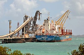
 Bulk carrier at Alcoa Jetty, Naval Base | |||||||||||||||
 | |||||||||||||||
| Coordinates | 32°11′46″S 115°46′52″E / 32.196°S 115.781°E | ||||||||||||||
| Population | 20 (SAL 2021)[1] | ||||||||||||||
| Postcode(s) | 6165 | ||||||||||||||
| Area | 5 km2 (1.9 sq mi)[2] | ||||||||||||||
| LGA(s) | City of Kwinana | ||||||||||||||
| State electorate(s) | Kwinana | ||||||||||||||
| Federal division(s) | Brand | ||||||||||||||
| |||||||||||||||
Naval Base is a coastal southwestern suburb of Perth, Western Australia, located within the City of Kwinana. It is a traditional industrial suburb in the Perth metropolitan region and contains a significant amount of heavy industry. It is named after Henderson Naval Base, partially constructed in 1913−1920 before being cancelled and eventually replaced by HMAS Stirling in 1978.[3]
The Naval Base campus of South Metropolitan TAFE houses the Western Australian Defence Industry Workforce Office and the Naval Shipbuilding College.[4]
Transport
Bus
- 548 Rockingham Station to Fremantle Station – serves Rockingham Road and Cockburn Road[5]
- 549 Rockingham Station to Fremantle Station – serves Rockingham Road[6]
References
- ^ Australian Bureau of Statistics (28 June 2022). "Naval Base (suburb and locality)". Australian Census 2021 QuickStats. Retrieved 28 June 2022.
- ^ Australian Bureau of Statistics (27 June 2017). "2016 Community Profiles: Naval Base (State Suburb)". 2016 Census of Population and Housing. Retrieved 30 November 2021.
- ^ "History of metropolitan suburb names – N". Western Australian Land Information Authority. Archived from the original on 16 March 2022. Retrieved 2 December 2021.
- ^ "Naval Base campus". Retrieved 25 October 2019.
- ^ "Route 548". Bus Timetable 126 (PDF). Transperth. 5 November 2024 [effective from 9 December 2024].
- ^ "Route 549". Bus Timetable 125 (PDF). Transperth. 9 October 2024 [effective from 9 December 2024].
External links
![]() Media related to Naval Base, Western Australia at Wikimedia Commons
Media related to Naval Base, Western Australia at Wikimedia Commons
