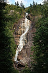
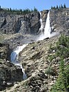
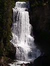
The following list of waterfalls of British Columbia include all waterfalls of superlative significance.
Tallest waterfalls
By overall height
As of 2020, there are 36 confirmed waterfalls with an overall height of at least 300 m (980 ft).[1]
| Waterfall
|
Image
|
Height
|
Location
|
Coordinates
|
| m
|
ft
|
| James Bruce Falls |
 |
840
|
2,760 |
Princess Louisa Marine Provincial Park |
50°13′08″N 123°46′57″W / 50.2189°N 123.7825°W / 50.2189; -123.7825 (James Bruce Falls)
|
| Madden Falls |
 |
579
|
1,900 |
Tantalus Provincial Park |
49°53′20″N 123°19′01″W / 49.8889°N 123.3170°W / 49.8889; -123.3170 (Madden Falls)
|
| Swiftcurrent Falls |
|
537
|
1,762 |
Mount Robson Provincial Park |
53°07′49″N 119°19′03″W / 53.1304°N 119.3176°W / 53.1304; -119.3176 (Swiftcurrent Falls)
|
| Kingcome Valley Falls |
|
520
|
1,710 |
Regional District of Mount Waddington |
51°16′10″N 126°12′46″W / 51.2695°N 126.2128°W / 51.2695; -126.2128 (Kingcome Valley Falls)
|
| Francis Falls |
|
518
|
1,699 |
qathet Regional District |
50°39′33″N 124°11′47″W / 50.6591°N 124.1965°W / 50.6591; -124.1965 (Francis Falls)
|
| Storey Peak Falls |
|
480
|
1,570 |
Squamish-Lillooet Regional District |
50°00′17″N 123°21′53″W / 50.0047°N 123.3648°W / 50.0047; -123.3648 (Storey Peak Falls)
|
| Cerberus Falls |
|
475
|
1,558 |
Columbia-Shuswap Regional District |
51°53′39″N 117°04′19″W / 51.8941°N 117.0720°W / 51.8941; -117.0720 (Cerberus Falls)
|
| Kiwi Falls |
|
475
|
1,558 |
Schoen Lake Provincial Park |
50°09′18″N 126°12′44″W / 50.1549°N 126.2122°W / 50.1549; -126.2122 (Kiwi Falls)
|
| Bush Mountain Falls |
|
466
|
1,529 |
Columbia-Shuswap Regional District |
51°49′22″N 117°08′01″W / 51.8228°N 117.1335°W / 51.8228; -117.1335 (Bush Mountain Falls)
|
| Unnamed waterfall |
|
460
|
1,510 |
Regional District of Mount Waddington |
51°17′56″N 125°44′16″W / 51.2989°N 125.7378°W / 51.2989; -125.7378 ("Unnamed")
|
| Bedard Falls |
|
457
|
1,499 |
Squamish-Lillooet Regional District |
49°58′53″N 123°20′49″W / 49.9815°N 123.3469°W / 49.9815; -123.3469 (Bedard Falls)
|
| Unnamed waterfall |
|
457
|
1,499 |
qathet Regional District |
50°18′45″N 123°56′09″W / 50.3124°N 123.9357°W / 50.3124; -123.9357 ("Unnamed")
|
| Harmony Falls |
|
444
|
1,457 |
qathet Regional District |
49°51′23″N 123°59′55″W / 49.8565°N 123.9985°W / 49.8565; -123.9985 (Harmony Falls)
|
| Michael Falls |
|
442
|
1,450 |
Yoho National Park |
51°28′25″N 116°31′07″W / 51.4736°N 116.5186°W / 51.4736; -116.5186 (Michael Falls)
|
| Della Falls |
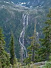 |
440
|
1,440 |
Strathcona Provincial Park |
49°27′16″N 125°32′11″W / 49.4544°N 125.5363°W / 49.4544; -125.5363 (Della Falls)
|
| South Phillips Glacier Falls |
|
427
|
1,401 |
Mount Robson Provincial Park |
53°07′24″N 119°13′23″W / 53.1232°N 119.2230°W / 53.1232; -119.2230 (South Phillips Glacier Falls)
|
| Bishop Falls |
|
410
|
1,350 |
Taku River/T'aḵú Téiú' Conservancy |
58°40′31″N 133°27′12″W / 58.6753°N 133.4534°W / 58.6753; -133.4534 (Bishop Falls)
|
| Potamoi Falls |
|
399
|
1,309 |
Columbia-Shuswap Regional District |
51°52′43″N 117°04′12″W / 51.8787°N 117.0700°W / 51.8787; -117.0700 (Potamoi Falls)
|
| Hugh Neave Falls |
|
396
|
1,299 |
Wells Gray Provincial Park |
52°31′05″N 120°09′38″W / 52.5181°N 120.1606°W / 52.5181; -120.1606 (Hugh Neave Falls)
|
| Qanadalais Falls |
|
396
|
1,299 |
Kitlope Heritage Conservancy |
53°03′40″N 127°31′24″W / 53.0610°N 127.5232°W / 53.0610; -127.5232 (Qanadalais Falls)
|
| Pétain Falls |
|
375
|
1,230 |
Elk Lakes Provincial Park |
50°32′20″N 115°08′57″W / 50.5389°N 115.1491°W / 50.5389; -115.1491 (Pétain Falls)
|
| Slollicum Creek Falls |
|
366
|
1,201 |
Fraser Valley Regional District |
49°24′00″N 121°44′27″W / 49.3999°N 121.7407°W / 49.3999; -121.7407 (Slollicum Creek Falls)
|
| Flood Falls |
|
366
|
1,201 |
Fraser Valley Regional District |
49°21′18″N 121°31′16″W / 49.3550°N 121.5212°W / 49.3550; -121.5212 (Flood Falls)
|
| Rostrum Falls |
|
366
|
1,201 |
Columbia-Shuswap Regional District |
51°50′14″N 117°08′19″W / 51.8373°N 117.1385°W / 51.8373; -117.1385 (Rostrum Falls)
|
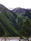
| Cinnamon Peak Falls |
 |
366
|
1,201 |
Mount Robson Provincial Park |
53°05′09″N 119°13′13″W / 53.0857°N 119.2204°W / 53.0857; -119.2204 (Cinnamon Peak Falls)
|
| Lyalli Lake Falls |
|
365
|
1,198 |
St. Mary's Alpine Provincial Park |
49°54′06″N 116°19′57″W / 49.9016°N 116.3324°W / 49.9016; -116.3324 (Lyalli Lake Falls)
|
| Helmet Falls |
 |
352
|
1,155 |
Kootenay National Park |
51°11′13″N 116°19′23″W / 51.1869°N 116.3231°W / 51.1869; -116.3231 (Helmet Falls)
|
| Mallory Glacier Falls |
|
350
|
1,150 |
Columbia-Shuswap Regional District |
52°18′14″N 117°57′42″W / 52.3038°N 117.9618°W / 52.3038; -117.9618 (Mallory Glacier Falls)
|
| Illecillewaet Glacier Falls |
|
320
|
1,050 |
Glacier National Park |
51°14′45″N 117°27′12″W / 51.2459°N 117.4533°W / 51.2459; -117.4533 (Illecillewaet Glacier Falls)
|
| Angel's Staircase Falls |
 |
305
|
1,001 |
Yoho National Park |
51°31′06″N 116°29′10″W / 51.5184°N 116.4860°W / 51.5184; -116.4860 (Angel's Staircase Falls)
|
| Blowing Box Falls |
|
305
|
1,001 |
Upper Rogers Kólii7 Conservancy |
50°05′38″N 122°15′56″W / 50.0939°N 122.2655°W / 50.0939; -122.2655 (Blowing Box Falls)
|
| Miliget Creek Falls |
|
305
|
1,001 |
Regional District of Kitimat-Stikine |
54°36′34″N 127°51′26″W / 54.6094°N 127.8573°W / 54.6094; -127.8573 (Miliget Creek Falls)
|
| Mount Moe Falls |
|
305
|
1,001 |
Squamish-Lillooet Regional District |
50°11′23″N 122°51′13″W / 50.1897°N 122.8537°W / 50.1897; -122.8537 (Mount Moe Falls)
|
| North Phillips Glacier Falls |
|
305
|
1,001 |
Mount Robson Provincial Park |
53°08′03″N 119°13′21″W / 53.1342°N 119.2225°W / 53.1342; -119.2225 (North Phillips Glacier Falls)
|
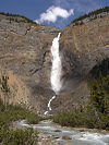
| Takakkaw Falls |
 |
302
|
991 |
Yoho National Park |
51°30′00″N 116°28′23″W / 51.5001°N 116.4730°W / 51.5001; -116.4730 (Takakkaw Falls)
|
| Wedgemount Creek Falls |
|
300
|
980 |
Garibaldi Provincial Park |
50°09′48″N 122°49′48″W / 50.1633°N 122.8300°W / 50.1633; -122.8300 (Wedgemount Creek Falls)
|
By tallest single drop
As of 2020, there are 26 confirmed waterfalls have a single unbroken drop with a height of at least 100 m (330 ft).[2]
Waterfalls by average flow rate
As of 2020, there are 10 confirmed waterfalls with an average flow rate or discharge of at least 50 m3/s (1,800 cu ft/s).[3]
| Waterfall
|
Image
|
Discharge
|
Location
|
Coordinates
|
| m3/s
|
ft3/s
|
| Rearguard Falls |
 |
171
|
6,000 |
Rearguard Falls Provincial Park |
52°58′24″N 119°21′51″W / 52.97333°N 119.3641°W / 52.97333; -119.3641 (Rearguard Falls)
|
| Baileys Chute |
 |
122
|
4,300 |
Wells Gray Provincial Park |
52°04′19″N 120°11′33″W / 52.07204°N 120.19255°W / 52.07204; -120.19255 (Baileys Chute)
|
| Marcus Falls |
|
122
|
4,300 |
Wells Gray Provincial Park |
52°04′28″N 120°12′00″W / 52.0744°N 120.1999°W / 52.0744; -120.1999 (Marcus Falls)
|
| Osprey Falls |
 |
113
|
4,000 |
Wells Gray Provincial Park |
52°08′24″N 120°11′36″W / 52.1400°N 120.1933°W / 52.1400; -120.1933 (Osprey Falls)
|
| Dawson Falls |
 |
107
|
3,800 |
Wells Gray Provincial Park |
51°57′55″N 120°07′25″W / 51.9654°N 120.1235°W / 51.9654; -120.1235 (Dawson Falls)
|
| Helmcken Falls |
 |
107
|
3,800 |
Wells Gray Provincial Park |
51°57′14″N 120°10′40″W / 51.9538°N 120.1779°W / 51.9538; -120.1779 (Helmcken Falls)
|
| The Mushbowl |
 |
107
|
3,800 |
Wells Gray Provincial Park |
51°57′51″N 120°07′48″W / 51.9643°N 120.1301°W / 51.9643; -120.1301 (The Mushbowl)
|
| Wapta Falls |
 |
96
|
3,400 |
Yoho National Park |
51°11′14″N 116°34′31″W / 51.1871°N 116.5752°W / 51.1871; -116.5752 (Wapta Falls)
|
| Overlander Falls |
 |
79
|
2,800 |
Mount Robson Provincial Park |
53°01′51″N 119°12′16″W / 53.0308°N 119.2044°W / 53.0308; -119.2044 (Overlander Falls)
|
| Nairn Falls |
 |
57
|
2,000 |
Nairn Falls Provincial Park |
50°17′23″N 122°50′02″W / 50.2897°N 122.8338°W / 50.2897; -122.8338 (Nairn Falls)
|
Other noteworthy waterfalls
- ^ Unconfirmed
- ^ Unconfirmed
See also
References
- ^ "Waterfalls in Canada - World Waterfall Database". www.worldwaterfalldatabase.com. Retrieved 2020-10-31.
- ^ "Tallest and Largest Waterfalls at the World Waterfall Database". www.worldwaterfalldatabase.com. Retrieved 2020-11-01.
- ^ "Waterfalls in Canada - World Waterfall Database". www.worldwaterfalldatabase.com. Retrieved 2020-11-01.
- ^ "Alexander Falls, British Columbia, Canada - World Waterfall Database". www.worldwaterfalldatabase.com. Retrieved 2020-11-02.
- ^ "Alfred Creek Falls, British Columbia, Canada - World Waterfall Database". www.worldwaterfalldatabase.com. Retrieved 2020-11-02.
- ^ "Ashlu Falls, British Columbia, Canada - World Waterfall Database". www.worldwaterfalldatabase.com. Retrieved 2020-11-02.
- ^ "Basalt Falls Natural Resources Canada ULKATCHO Quad, British Columbia, Topographic Map". TopoZone. Demand Media, Inc. Archived from the original on 2012-10-13. Retrieved 2008-11-07.
- ^ "British Columbia – Canada". World Waterfalls. Bryan Swan & Dean Goss. 1985–2008. Retrieved 2008-11-07.
- ^ "BCGNIS Geographical Name Details—BCGNIS Query Results". Geographic Data BC. 1999–2008. Retrieved 2008-11-07.
- ^ "Thompson Falls, British Columbia, Canada - World Waterfall Database". www.worldwaterfalldatabase.com. Retrieved 2020-12-02.
- ^ "Brandywine Falls BC". World Waterfalls. Bryan Swan & Dean Goss. 1985–2008. Retrieved 2008-11-07.
- ^ Turnbull, Leon. "Waterfalls of British Columbia—Bridal Veil Falls; Bridal Falls ..." Retrieved 2008-11-07.
- ^ "Bridal Veil Falls BC – British Columbia – Canada". World Waterfalls. Bryan Swan & Dean Goss. 1985–2008. Retrieved 2008-11-07.
- ^ "Canim Falls". Waterfalls of the Pacific Northwest. Retrieved 2008-11-07.
- ^ "Cascade Falls, British Columbia, Canada - World Waterfall Database". www.worldwaterfalldatabase.com. Retrieved 2020-11-30.
- ^ "BC Geographical Names - Cascade Falls". apps.gov.bc.ca. Retrieved 2020-11-30.
- ^ "Cascade Falls, British Columbia, Canada - World Waterfall Database". www.worldwaterfalldatabase.com. Retrieved 2020-12-02.
- ^ Swan, Bryan (2005). "Chatterbox Falls". Waterfalls of the Pacific Northwest. Retrieved 2008-11-07.
- ^ "Cliff Lake Falls – British Columbia – Canada". World Waterfalls. Bryan Swan & Dean Goss. 1985–2008. Retrieved 2008-11-07.
- ^ "Crooked Falls – British Columbia – Canada". World Waterfalls. Bryan Swan & Dean Goss. 1985–2008. Retrieved 2008-11-07.
- ^ "Englishman River Falls, British Columbia, Canada - World Waterfall Database". www.worldwaterfalldatabase.com. Retrieved 2020-11-02.
- ^ "Gold Creek Falls, British Columbia, Canada - World Waterfall Database". www.worldwaterfalldatabase.com. Retrieved 2020-11-02.
- ^ Swan, Bryan (2005). "Keyhole Falls". Waterfalls of the Pacific Northwest. Retrieved 2007-11-08.
- ^ "Kinuseo Falls, British Columbia, Canada - World Waterfall Database". www.worldwaterfalldatabase.com. Retrieved 2020-11-30.
- ^ "Moresby Falls, British Columbia, Canada - World Waterfall Database". www.worldwaterfalldatabase.com. Retrieved 2020-11-02.
- ^ Swan, Bryan (2005). "Nymph Falls". Waterfalls of the Pacific Northwest. Retrieved 2007-11-08.
- ^ "Peach Creek Falls – British Columbia – Canada". World Waterfalls. Bryan Swan & Dean Goss. 1985–2008. Retrieved 2008-11-07.
- ^ "Place Creek Falls, British Columbia, Canada - World Waterfall Database". www.worldwaterfalldatabase.com. Retrieved 2020-11-02.
- ^ "Pyramid Falls – British Columbia – Canada". World Waterfalls. Bryan Swan & Dean Goss. 1985–2008. Retrieved 2008-11-07.
- ^ "Smith River Falls, British Columbia, Canada - World Waterfall Database". www.worldwaterfalldatabase.com. Retrieved 2020-11-30.
- ^ Environment, Ministry of. "Smith River Falls - Fort Halkett Provincial Park - BC Parks". bcparks.ca. Retrieved 2020-11-30.
- ^ "Snowshoe Creek Falls". World Waterfalls. Bryan Swan & Dean Goss. 2004. Retrieved 2008-11-07.
- ^ "Spahats Creek Falls". World Waterfalls. Bryan Swan & Dean Goss. 2004. Retrieved 2008-11-07.
- ^ "Spahats Creek Falls". Waterfalls of the Pacific Northwest.
- ^ "Thunder Falls". World Waterfalls. Bryan Swan & Dean Goss. 2004. Retrieved 2008-11-07.
- ^ "Upper Little Qualicum Falls". World Waterfalls. Bryan Swan & Dean Goss. 1985–2008. Retrieved 2008-11-07.
- ^ "Whispering Falls". World Waterfalls. Bryan Swan & Dean Goss. 2004. Retrieved 2008-11-07.
External links


