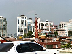
Hwayang-dong
Hwayang-dong | |
|---|---|
| Korean transcription(s) | |
| • Hangul | 화양동 |
| • Hanja | 華陽洞 |
| • Revised Romanization | Hwayang-dong |
| • McCune–Reischauer | Hwayang-tong |
 Hwayang-dong, Seoul | |
 | |
| Coordinates: 37°32′26.12″N 127°4′20.60″E / 37.5405889°N 127.0723889°E | |
| Country | South Korea |
| Area | |
• Total | 1.13 km2 (0.44 sq mi) |
| Population (2001)[1] | |
• Total | 25,570 |
| • Density | 23,000/km2 (59,000/sq mi) |

Hwayang-dong (Korean: 화양동) is a dong (neighborhood) located in west Gwangjin District, Seoul, South Korea.[1][2] It was incorporated into Gwangjin District on August 13, 1949. It is a mixed residential and small business area. Mojin-dong is also administered by Hwayang-dong and contains Konkuk University.
Name origin
The name "Hwayang-dong" is derived from Hwayangjeong (華陽亭), which was established during the Joseon period.
See also
References
- ^ a b 화양동 (Hwayang-dong 華陽洞) (in Korean). Doosan Encyclopedia. Retrieved April 22, 2008.[permanent dead link]
- ^ "The origin of Hwayang-dong" (in Korean). Gwangjin District official site. Retrieved April 22, 2008.[permanent dead link]
- "Chronicle of Beopjeong-dong and Haengjeong-dong" (in Korean). Guro District Official website. Archived from the original on October 6, 2014. Retrieved April 22, 2008.
External links
- Gwangjin District official website in English
- (in Korean) Map of Gwangjin District at the Gwangjin District official website
- (in Korean) Hwayang-dong resident office website

