Honduras–Nicaragua border


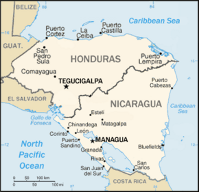
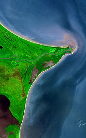
The Honduras–Nicaragua border is the roughly 950-kilometre-long (590 mi) international boundary[1] between Honduras and Nicaragua, running from the Gulf of Fonseca on the Pacific Ocean to the Caribbean Sea. The Coco River, which flows generally northeast to the Caribbean, forms more than half of the border.
The border passes between the following departments, from west to east:
- Honduras – Choluteca, Colón, Olancho, Gracias a Dios.
- Nicaragua – Chinandega, Madriz, Nueva Segovia, Jinotega and North Caribbean Coast Autonomous Region.
Honduras and Nicaragua, respectively, were part of the Central American Federation and the United Provinces of Central America[clarification needed]. Between 1823 and 1838, these federations fell apart and both nations gained their independence and defined their border.[2][3]
In 1937, the issuance of a stamp from Nicaragua with a sticker on part of Honduran territory indicating "territory in dispute" almost caused a war between the two countries.[4] The territory had been claimed by Nicaragua, but Honduras thought the matter closed in 1906 when an arbitration by King Alfonso XIII of Spain gave it the area.
Location
| Point | Coordinates (links to map & photo sources) |
Notes |
|---|---|---|
| Gulf of Fonseca | 12°59′10″N 87°18′11″W / 12.98621°N 87.30311°W | Elevation: 0 ft |
| Guasaule | 13°03′44″N 86°57′15″W / 13.06213°N 86.95421°W | Elev: 130 ft |
| El Espino | 13°26′47″N 86°43′20″W / 13.44635°N 86.72222°W | Elev: 2958 ft |
| Trojes | 14°04′26″N 86°00′18″W / 14.07392°N 86.00496°W | Elev: 2305 ft |
| Coco River joins border | 13°49′58″N 85°45′10″W / 13.8328°N 85.75278°W | Elev: 856 ft |
| Santa Isabel | 14°47′21″N 84°46′55″W / 14.78926°N 84.78206°W | Elev: 244 ft |
| Waspam | 14°44′45″N 83°58′20″W / 14.7458°N 83.9722°W | Elev: 83 ft |
| Cabo Gracias a Dios | 15°00′00″N 83°08′00″W / 15.00°N 83.1334°W | Elev: 0 ft |
See also
References
- ^ "Honduras-Nicaragua border". Google Maps. Retrieved 7 January 2019.
- ^ Munro, Dana. The Five Republics of Central America. New York: Oxford University Press, 1918. pp 24–34.
- ^ "Documentos de la Union Centroamericana" (PDF). Organization of American States – Foreign Trade Information System. Retrieved 12 October 2014.
- ^ "The Stamp that Almost Caused a War". 14 September 2012.
