Guajén, Cuba
Guajén | |
|---|---|
Settlement | |
| El Guajén | |
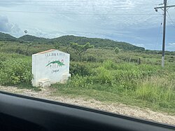
 CCS Julio Antonio Mella, located in Guajén | |
 OpenStreetMap of El Guajén | |
| Coordinates: 22°34′53″N 79°45′47″W / 22.58139°N 79.76306°W | |
| Country | Cuba |
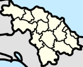
| Province | Villa Clara |
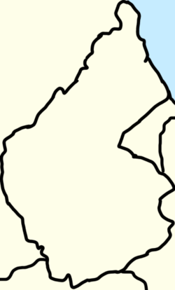
| Municipality | Camajuaní |
| Ward (consejo popular) | Aguada de Moya |
| Government | |
| • Constituency Delegate (40th of Camajuaní) | Lázaro González Marrero |
| Population (2022)[1] | |
• Total | 570 |
Guajén also known as El Guajén is a small community in Camajuaní, Cuba. It splits into the circunscripciónes of Guajén Camajuaní (on the Camajuani River) and Guía Guajén.[2]
The name “Guajén” is from Aboriginal origin.
Government
Camajuaní has multiple Constituency Delegate (Delegado Circunscripción) for every community, Guajén has Constituency Delegate #40 Lázaro González Marrero. [3]
Geography
Guajén is a part of the ward of Aguada de Moya.[3] Guajen has the CCS of "Julio Antonio Mella".[4]
Guajén shares the name with the Arroyo Guajén (Guajén Stream), located between Jarico and Aguada de Moya. [5]: 34
History
Guajén used to named "Finca El Guajén" (or "Farm of Guajén" in english) and be a part of the barrio of Aguada de Moya in the former Municipality of Vueltas until 1976.[6][7] El Guajén used to had the "ingenio Guajén" (Guajén sugarmill) near the Camajuani River. [8]: 33
In 2016, Rafael Santiesteban Pozo, member of the Council of State and national president of the National Association of Small Farmers organized the 50 year anniversary of the National Association of Small Farmers in CCS "Julio Antonio Mella".[4]
In 2018, Villa Clara was flooded throughout the entire province, in Camajuaní the places that were flooded were El Rincón, Guajén, Sagua la Chica, Macagual, Guerrero, Floridano, Vega Alta, and Vega de Palma. [9]
Economy
According at the DMPF (Departamento de control de la Dirección Municipal de Planificación Física or Management Control Department Municipal Physical Planning in English) of Camajuani, Guajén is a settlement not linked to any source of an economic or job development.[2]
Infrastructure
In Guajén there is the path of Guajén (Camino de Guajén) through the Camajuaní River and heads to Vega Alta and Paso Real.[5]
References
- ^ Granma. "Chequea Díaz-Canel la implementación de medidas económicas y proyectos sociales en Villa Clara". PORTAL DE LA RADIO CUBANA (in Spanish). Retrieved 2023-01-15.
- ^ a b Barroso, Joel Jiménez; Figueroa Vidal, Dr. Arq. Carlos. R. "Diagnóstico estratégico de la situación habitacional del municipio de Camajuaní" (PDF). p. 67.
- ^ a b Perera, Dalia Reyes. "Llama Díaz-Canel a reforzar la unidad, el optimismo y la voluntad de vencer en visita a Villa Clara (+Audio y Fotos)". CMHW (in European Spanish). Archived from the original on 2023-01-15. Retrieved 2023-01-15.
- ^ a b "Producir, máxima prioridad de los campesinos". Granma.cu (in Spanish). Retrieved 2023-04-13.
- ^ a b Tapia, Estéban Pichardo y (1865). Caminos de la isla de Cuba: Itinerarios (in Spanish). Impr. Militar de M. Soler.
- ^ Aires, Club Universitario de Buenos (1957-10-08). Gaceta Oficial (in Spanish).
- ^ Cuba (1946). Gaceta oficial de la República de Cuba (in Spanish).
- ^ Pichardo y Tapia, Estéban (1865). Caminos de la isla de Cuba. Itinerarios. Harvard University. Habana, Impr. Militar de M. Soler.
- ^ "Francisnet Díaz Rondón". www.facebook.com. Retrieved 2023-07-18.


