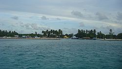
Goidhoo (Baa Atoll)
Goidhoo | |
|---|---|
 Goidhoo Harbor, When entering Goidhoo | |
| Coordinates: 04°52′25″N 72°59′59″E / 4.87361°N 72.99972°E | |
| Country | Maldives |
| Administrative atoll | Baa Atoll |
| Distance to Malé | 95.69 km (59.46 mi) |
| Area | |
• Total | 1.1354 km2 (0.4384 sq mi) |
| Dimensions | |
| • Length | 2.130 km (1.324 mi) |
| • Width | 1.580 km (0.982 mi) |
| Population (2014)[1] | |
• Total | 543 (including foreigners) |
| Time zone | UTC+05:00 (MST) |
Goidhoo (Dhivehi: ގޮއިދޫ) is one of the inhabited islands of Southern Maalhosmadulhu Atoll, code letter "Baa".
History
In the 19th century, a female African slave who had been bought by the king on his Hajj trip to Mecca was formally released from slavery and was settled in Goidhoo island. A house and a well were built for her. This African woman was called Salaamaa. She had been working for years at the palace in Malé before the ailing king released her in order to gain merit in the afterlife.[citation needed]
The freeing of slaves before the death of the owner was traditionally a common practice among the very high nobility in the Maldives. Now there are some families from Goidhoo that can trace their descendency to this African ancestor.[citation needed]
Geography
The island is 95.69 km (59 mi; 52 nmi) northwest of the country's capital, Malé.[2]
Horsburgh Atoll
Goidhu Island lies in a small separate atoll along with Fulhadu and Fehendhu. Goidhoo Atoll (also Goidu or Goifulhafehendhu), Horsburgh Atoll in the Admiralty Chart, is separated from South Maalhosmadulhu by a six-mile-broad (9.7 km) channel. This atoll is oval in shape and small, its greatest length being 10 miles (16 km). The inner lagoon has a depth of 17 to 20 fathoms; it has a sandy bottom mixed with mud and clay. Unlike the lagoons of most small atolls of the Maldives, this lagoon is free from coral heads in its centre.
In the Admiralty charts, this atoll is named after James Horsburgh, hydrographer to the East India Company and author of the long-titled Directions for Sailing to and from the East Indies, China, New Holland, Cape of Good Hope, and the interjacent Ports, compiled chiefly from original Journals and Observations made during 21 years' experience in navigating those Seas. Horsburgh's Directory was the standard work for oriental navigation in the first half of the 19th century, until Robert Moresby's survey of the Maldives when for the first time in history accurate maps of the atolls were published.
Demography
| Year | Pop. | ±% |
|---|---|---|
| 2006 | 503 | — |
| 2014 | 507 | +0.8% |
| 2006-2014: Census populations Source: [3] | ||
See also
References
- ^ "Table PP5: Resident Population by sex, nationality and locality (administrative islands), 2014" (PDF). Population and Households Census 2014. National Bureau of Statistics. p. 34. Retrieved 12 August 2018.
- ^ "Coordinate Distance Calculator". Boulter.com. Retrieved 12 August 2018.
- ^ "Table 3.3: Total Maldivian Population by Islands" (PDF). National Bureau of Statistics. Retrieved 12 August 2018.
- Divehiraajjege Jōgrafīge Vanavaru. Muhammadu Ibrahim Lutfee. G.Sōsanī.
- Xavier Romero-Frias, The Maldive Islanders, A Study of the Popular Culture of an Ancient Ocean Kingdom. Barcelona 1999.

