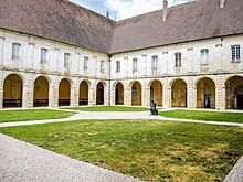
Forêts National Park
| Forêts National Park | |
|---|---|
| Parc national de forêts | |
 | |
 | |
| Location | Haute-Marne and Côte-d'Or, France |
| Nearest city | Châtillon-sur-Seine |
| Coordinates | 47°53′N 4°50′E / 47.89°N 4.83°E |
| Area | 560 km2 (216 sq mi) |
| Established | 6 November 2019 |
| Governing body | Parcs nationaux de France |
| Parc national de forêts (French) | |
Forêts National Park (French: Parc national de forêts) is a French national park located in the northeastern part of metropolitan France, not far from Dijon to the south. It protects the broad-leaved trees typical of the southeastern Paris Basin plateau.[1]
History

The idea for the park was put forth in 2009, with numerous working groups and studies involved in over a decade in identifying strengths and weaknesses for what it could accomplish, as well as otherwise developing and defining its boundaries so that it would be a coherent, sensible whole.
The park was formally established on 7 November 2019, by publication of an official decree signed by Prime Minister Édouard Philippe in the Journal Officiel de la République Française.[2] It is the eleventh national park of France to be created[3] and the second largest behind the Amazonian Park of Guiana in South America. Like a number of overseas areas, French Guiana is defined to be a department and region. Its park is officially the largest in the European Union.
Geography
Forêts National Park is 560 square kilometres (220 sq mi) in area; it spans the border between the departments of Haute-Marne in Grand Est and Côte-d'Or in Bourgogne-Franche-Comté, covering 59 communes partly or totally. It is the sole national park in both Grand Est and Bourgogne-Franche-Comté.
References
- ^ Andrea Romano (13 November 2019). "France Has a New National Park, and It's Only a Short Trip From Paris". Travel + Leisure. Retrieved 24 April 2020.
- ^ "Décret n° 2019-1132 du 6 novembre 2019 créant le Parc national de forêts".
- ^ "Découverte en avant-première du 11e Parc National dans les forêts de Champagne et Bourgogne"[permanent dead link] by Philippe Viguié-Desplaces, Le Figaro, 6 November 2019

