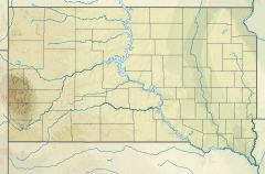
Flynn Creek
| Flynn Creek | |
|---|---|
| Etymology | Named for Ed Flynn, local settler |
| Physical characteristics | |
| Source | Flynn Creek Spring |
| • coordinates | 43°41′22″N 103°33′17″W / 43.6894281°N 103.5546387°W |
| • elevation | 5,581 ft (1,701 m) |
| Mouth | Lame Johnny Creek, South fork |
• coordinates | 43°39′18″N 103°24′38″W / 43.6549859°N 103.4104720°W |
• elevation | 4,101 ft (1,250 m) |
| Discharge | |
| • location | 43°39′10″N 103°25′10″W / 43.65278°N 103.41944°W (near mouth)[1] |
| • average | 11.8 cu ft/s (0.33 m3/s) |
| Basin features | |
| Progression | Lame Johnny Creek→ Cheyenne River→ Missouri River→ Mississippi River→ Gulf of Mexico |
| River system | Cheyenne River system |
Flynn Creek is a stream in Custer County, South Dakota.[2] Its source is the Flynn Creek spring near the unincorporated community of Sanator, and its mouth is at the south fork of the Lame Johnny Creek, which later flows into the Cheyenne River about 20 miles (32 km) away.
Flynn Creek is named for Ed Flynn, a pioneer settler.[3]
See also
References
- ^ "USGS Surface Water for South Dakota: Streamflow Measurements". waterdata.usgs.gov. Retrieved 2021-04-15.
- ^ U.S. Geological Survey Geographic Names Information System: Flynn Creek
- ^ Federal Writers' Project (1940). South Dakota place-names, v.3. University of South Dakota. p. 31.

