
File:Varsity-View-map.png
No higher resolution available.
Varsity-View-map.png (548 × 441 pixels, file size: 75 KB, MIME type: image/png)
Summary
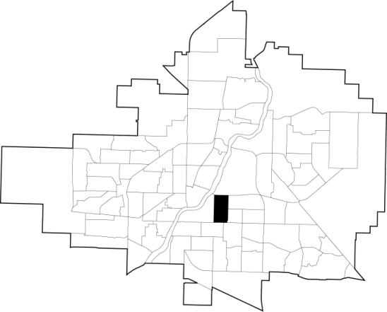
| Description | English: A map showing the location of the Varsity View neighbourhood in relation to the other neighbourhoods in Saskatoon. |
| Date | |
| Source | http://www.saskatoon.ca/DEPARTMENTS/Community%20Services/PlanningDevelopment/Documents/Research/Neighbourhood_profiles/2012/Varsity%20View.pdf |
| Author | City of Saskatoon - Planning and Development Branch |
| Permission (Reusing this file) |
|
Licensing
The City of Saskatoon - Planning and Development Branch, the copyright holder of this work, hereby publishes it under the following license:

|
Permission is granted to copy, distribute and/or modify this document under the terms of the GNU Free Documentation License, Version 1.2 or any later version published by the Free Software Foundation; with no Invariant Sections, no Front-Cover Texts, and no Back-Cover Texts. A copy of the license is included in the section entitled GNU Free Documentation License. |
| This file is licensed under the Creative Commons Attribution-Share Alike 3.0 Unported license. | ||
| Attribution: The City of Saskatoon - Planning and Development Branch | ||
| ||
| This licensing tag was added to this file as part of the GFDL licensing update. |
Original upload log
The original description page was here. All following user names refer to en.wikipedia.
| Date/Time | Dimensions | User | Comment |
|---|---|---|---|
| 2013-06-27 16:51 | 548×441× (77080 bytes) | Drm310 | Updated map from 2012 |
| 2007-11-01 20:20 | 330×250× (22581 bytes) | Drm310 | A map showing the location of the [[Varsity View, Saskatoon|Varsity View]] neighbourhood in relation to the other neighbourhoods in [[Saskatoon]].<br /> Original URL: http://www.saskatoon.ca/org/city_planning/resources/neighbourhood_demographics/varsity_v |
File history
Click on a date/time to view the file as it appeared at that time.
| Date/Time | Thumbnail | Dimensions | User | Comment | |
|---|---|---|---|---|---|
| current | 00:21, 22 July 2016 | | 548 × 441 (75 KB) | OgreBot | (BOT): Reverting to most recent version before archival |
| 00:21, 22 July 2016 |  | 330 × 250 (22 KB) | OgreBot | (BOT): Uploading old version of file from en.wikipedia; originally uploaded on 2007-11-01 20:20:51 by Drm310 | |
| 23:19, 21 July 2016 |  | 548 × 441 (75 KB) | Yamaha5 | Transferred from en.wikipedia |
File usage
The following page uses this file:
Global file usage
The following other wikis use this file:
- Usage on fa.wikipedia.org
- Usage on www.wikidata.org