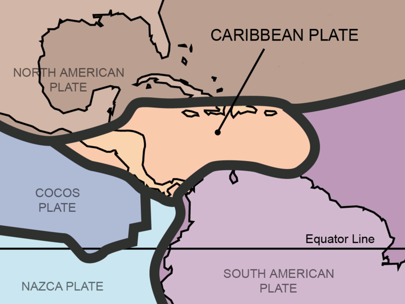
File:Tectonic plates Caribbean.png

Size of this preview: 800 × 600 pixels. Other resolutions: 320 × 240 pixels | 640 × 480 pixels | 1,024 × 768 pixels.
Original file (1,024 × 768 pixels, file size: 64 KB, MIME type: image/png)
File history
Click on a date/time to view the file as it appeared at that time.
| Date/Time | Thumbnail | Dimensions | User | Comment | |
|---|---|---|---|---|---|
| current | 01:32, 16 February 2013 |  | 1,024 × 768 (64 KB) | JohnnyMrNinja | reduce size over 3x with color indexing and slightly higher compression |
| 20:51, 31 August 2011 |  | 1,024 × 768 (211 KB) | AlexCovarrubias | Centered map on the Caribbean Plate. | |
| 16:30, 5 February 2006 |  | 3,000 × 2,250 (1.1 MB) | Maksim | La bildo estas kopiita de wikipedia:en. La originala priskribo estas: {{PD-self}} This work was derived from Image:Tectonic_plates.png, an image in the public domain (PD-USGov-Interior-USGS). {| border="1" ! date/time || username || edit summary |---- |
File usage
The following 10 pages use this file:
Global file usage
The following other wikis use this file:
- Usage on ar.wikipedia.org
- Usage on be.wikipedia.org
- Usage on bo.wikipedia.org
- Usage on bs.wikipedia.org
- Usage on ca.wikipedia.org
- Usage on da.wikipedia.org
- Usage on de.wikipedia.org
- Usage on eo.wikipedia.org
- Usage on es.wikipedia.org
- Usage on eu.wikipedia.org
- Usage on fa.wikipedia.org
- Usage on fi.wikipedia.org
- Usage on fr.wikipedia.org
- Usage on fy.wikipedia.org
- Usage on ga.wikipedia.org
- Usage on he.wikipedia.org
- Usage on hi.wikipedia.org
- Usage on hu.wikipedia.org
- Usage on hy.wikipedia.org
- Usage on it.wikipedia.org
- Usage on ja.wikipedia.org
- Usage on ka.wikipedia.org
- Usage on km.wikipedia.org
- Usage on ko.wikipedia.org
- Usage on ms.wikipedia.org
- Usage on mt.wikipedia.org
- Usage on nl.wikipedia.org
- Usage on no.wikipedia.org
- Usage on pap.wikipedia.org
- Usage on pl.wikipedia.org
View more global usage of this file.

