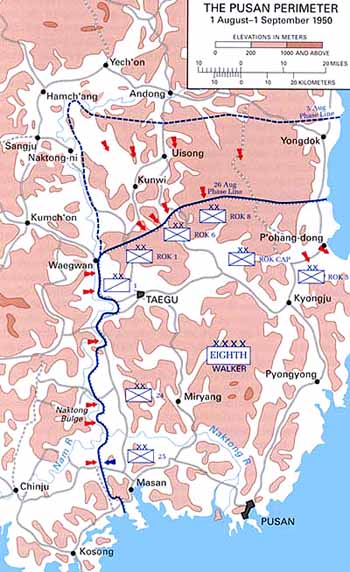
File:Pusan Perimeter.jpg
Pusan_Perimeter.jpg (350 × 572 pixels, file size: 52 KB, MIME type: image/jpeg)
File history
Click on a date/time to view the file as it appeared at that time.
| Date/Time | Thumbnail | Dimensions | User | Comment | |
|---|---|---|---|---|---|
| current | 01:13, 15 March 2008 |  | 350 × 572 (52 KB) | Donostiarra~commonswiki | {{Information |Description={{en|Map of the Pusan Perimeter, August 1950. This map was created by the Center for Military History and used in the brochure "The Korean War: The Outbreak" located at [http://www.army.mil/cmh-pg/brochures/KW-Outbreak/outbreak. |
File usage
The following 11 pages use this file:
Global file usage
The following other wikis use this file:
- Usage on ar.wikipedia.org
- Usage on cs.wikipedia.org
- Usage on de.wikipedia.org
- Usage on es.wikipedia.org
- Usage on fr.wikipedia.org
- Usage on he.wikipedia.org
- Usage on ko.wikipedia.org
- Usage on no.wikipedia.org
- Usage on pl.wikipedia.org
- Usage on pt.wikipedia.org
- Usage on ru.wikipedia.org
- Usage on simple.wikipedia.org
- Usage on uk.wikipedia.org
- Usage on vi.wikipedia.org


