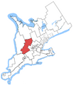
File:Perth-Wellington.png

Size of this preview: 476 × 599 pixels. Other resolutions: 191 × 240 pixels | 381 × 480 pixels | 682 × 858 pixels.
Original file (682 × 858 pixels, file size: 81 KB, MIME type: image/png)
File history
Click on a date/time to view the file as it appeared at that time.
| Date/Time | Thumbnail | Dimensions | User | Comment | |
|---|---|---|---|---|---|
| current | 04:44, 24 October 2015 |  | 682 × 858 (81 KB) | Djvarley | New map to reflect new boundaries of electoral districts after the 42nd Canadian general election on October 19, 2015. The boundaries of Perth—Wellington itself were not changed. |
| 02:25, 23 October 2005 |  | 1,046 × 1,215 (33 KB) | SimonP | Map of the Perth—Wellington electoral district. Based on User:Earl Andrew's maps, created by ~~~. |
File usage
The following 3 pages use this file:
