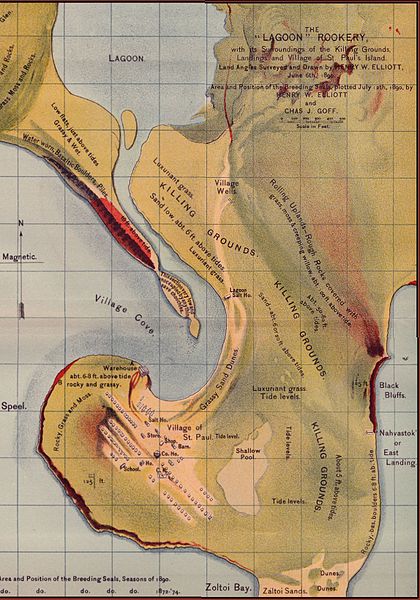
File:NOAA Saint Paul Island elliott4.jpg

Size of this preview: 420 × 600 pixels. Other resolutions: 168 × 240 pixels | 336 × 480 pixels | 538 × 768 pixels | 1,148 × 1,639 pixels.
Original file (1,148 × 1,639 pixels, file size: 494 KB, MIME type: image/jpeg)
File history
Click on a date/time to view the file as it appeared at that time.
| Date/Time | Thumbnail | Dimensions | User | Comment | |
|---|---|---|---|---|---|
| current | 14:54, 23 July 2005 |  | 1,148 × 1,639 (494 KB) | Harmil~commonswiki | Elliot's Old Saint Paul Island Map, a map of seal breeding grounds near Saint Paul Village. Survey and drawing by Henry W. Elliot, acquired from NOAA: :http://response.restoration.noaa.gov/pribilof/elliott/elliott.htm Stitched together from four scans |
File usage
The following 3 pages use this file:
Global file usage
The following other wikis use this file:
- Usage on ar.wikipedia.org
- Usage on ca.wikipedia.org
- Usage on eo.wikipedia.org
- Usage on ig.wikipedia.org
- Usage on ja.wikipedia.org
- Usage on zh.wikipedia.org

