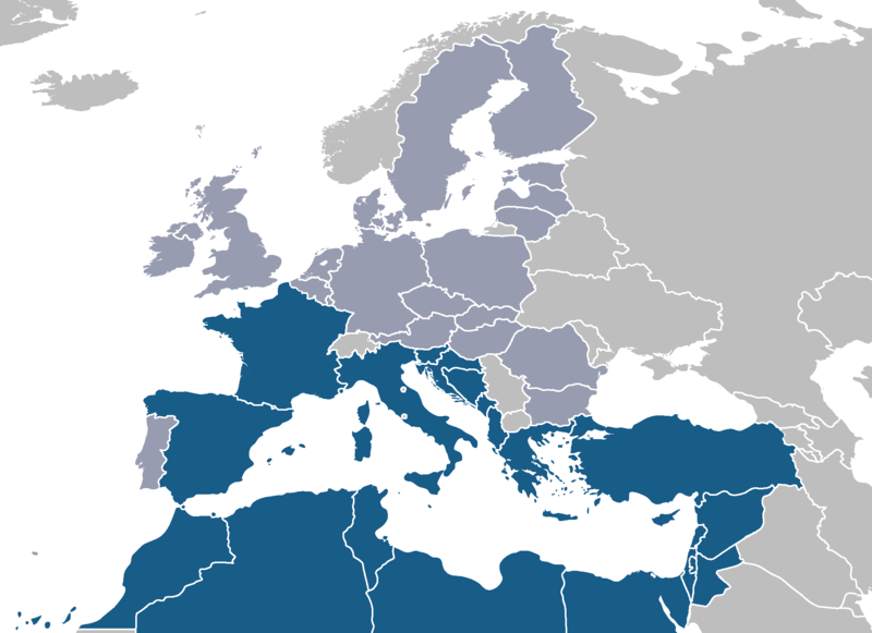
File:MedU.png

Size of this preview: 800 × 581 pixels. Other resolutions: 320 × 232 pixels | 640 × 465 pixels | 1,024 × 744 pixels | 1,280 × 930 pixels | 2,100 × 1,525 pixels.
Original file (2,100 × 1,525 pixels, file size: 129 KB, MIME type: image/png)
File history
Click on a date/time to view the file as it appeared at that time.
| Date/Time | Thumbnail | Dimensions | User | Comment | |
|---|---|---|---|---|---|
| current | 16:10, 23 May 2008 |  | 2,100 × 1,525 (129 KB) | Nightstallion | latest proposal foresees all neighbour countries as part |
| 09:18, 16 March 2008 |  | 2,100 × 1,525 (120 KB) | J. Patrick Fischer | Slovenija has a coast to Med. | |
| 11:10, 14 March 2008 |  | 2,100 × 1,525 (44 KB) | J. Patrick Fischer | Portugal is not bordering the Mediteranian Sea | |
| 22:48, 18 January 2008 |  | 2,100 × 1,525 (60 KB) | JLogan | changed ministates from EU dark grey to light grey and added Pal. | |
| 09:35, 24 August 2007 |  | 2,100 × 1,525 (43 KB) | Roke~commonswiki | ||
| 09:22, 24 August 2007 |  | 2,100 × 1,525 (132 KB) | Roke~commonswiki | fix low countries | |
| 10:04, 17 August 2007 |  | 2,100 × 1,525 (75 KB) | Roke~commonswiki | better base map, same colours | |
| 21:34, 16 April 2007 |  | 534 × 534 (15 KB) | JLogan | Map of Sarkozy's proposed Mediterranean Union. Own work, adapted from from public image on wikicommons: Image:Euro-med.png |
File usage
No pages on the English Wikipedia use this file (pages on other projects are not listed).
Global file usage
The following other wikis use this file:
- Usage on be.wikipedia.org
- Usage on ca.wikipedia.org
- Usage on de.wikipedia.org
- Usage on zh.wikipedia.org


