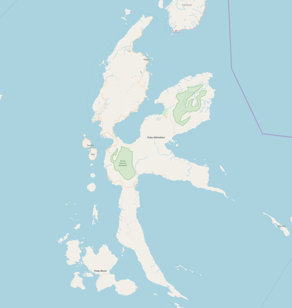
File:Location map Halmahera.png

Size of this preview: 569 × 599 pixels. Other resolutions: 228 × 240 pixels | 456 × 480 pixels | 729 × 768 pixels | 973 × 1,024 pixels | 1,948 × 2,051 pixels.
Original file (1,948 × 2,051 pixels, file size: 326 KB, MIME type: image/png)
File history
Click on a date/time to view the file as it appeared at that time.
| Date/Time | Thumbnail | Dimensions | User | Comment | |
|---|---|---|---|---|---|
| current | 20:32, 15 May 2018 |  | 1,948 × 2,051 (326 KB) | Juxlos | Reverted to version as of 20:18, 15 May 2018 (UTC) |
| 20:21, 15 May 2018 |  | 1,948 × 2,051 (394 KB) | Juxlos | didn't work last time | |
| 20:18, 15 May 2018 |  | 1,948 × 2,051 (326 KB) | Juxlos | higher res version, with 8 years' worth of OSM data | |
| 09:40, 17 June 2010 |  | 729 × 768 (32 KB) | Dr. Blofeld~commonswiki | {{Information |Description={{en|1=g}} |Source=g |Author=g |Date=g |Permission= |other_versions= }} |
File usage
The following 24 pages use this file:
- Central Halmahera Regency
- Desa Gamtala
- East Halmahera Regency
- Galela (city)
- Gelora Kie Raha Stadium
- Kao, Indonesia
- Kuabang Airport
- Labuha
- Leo Wattimena Airport
- Maba, Indonesia
- North Halmahera Regency
- Patani, Indonesia
- Pekaulang
- Soasiu
- Sofifi
- South Halmahera Regency
- Sultan Babullah Airport
- Ternate
- Tidore
- Tobelo
- Weda
- West Halmahera Regency
- Module:Location map/data/Indonesia Halmahera
- Module:Location map/data/Indonesia Halmahera/doc
Global file usage
The following other wikis use this file:
- Usage on ar.wikipedia.org
- Usage on ban.wikipedia.org
- Usage on ceb.wikipedia.org
- Usage on fa.wikipedia.org
- Usage on hi.wikipedia.org
- Usage on id.wikipedia.org
- Usage on ja.wikipedia.org
- Usage on kn.wikipedia.org
- Usage on ml.wikipedia.org
- Usage on ru.wikipedia.org
- Usage on simple.wikipedia.org
- Usage on si.wikipedia.org
- Usage on th.wikipedia.org
- Usage on tr.wikipedia.org
- Usage on ur.wikipedia.org
- Usage on uz.wikipedia.org
- Usage on vi.wikipedia.org
- Usage on war.wikipedia.org
- Usage on zh.wikipedia.org
