File:Kaitak tchn.svg

Size of this PNG preview of this SVG file: 494 × 600 pixels. Other resolutions: 198 × 240 pixels | 395 × 480 pixels | 632 × 768 pixels | 843 × 1,024 pixels | 1,686 × 2,048 pixels | 988 × 1,200 pixels.
Original file (SVG file, nominally 988 × 1,200 pixels, file size: 230 KB)
File history
Click on a date/time to view the file as it appeared at that time.
| Date/Time | Thumbnail | Dimensions | User | Comment | |
|---|---|---|---|---|---|
| current | 05:54, 26 January 2010 |  | 988 × 1,200 (230 KB) | Mikepanhu | Layer fixed. |
| 05:51, 26 January 2010 |  | 988 × 1,200 (230 KB) | Mikepanhu | Font outlined. | |
| 05:47, 26 January 2010 |  | 988 × 1,200 (82 KB) | Mikepanhu | Small modification about the fonts and graphics. | |
| 02:00, 24 December 2006 |  | 988 × 1,200 (253 KB) | Antilived | kaitak -> kai tak, corrected simp. chinese in trad. chinese version | |
| 03:12, 23 December 2006 |  | 988 × 1,200 (248 KB) | Antilived | moving the label that I missed from last time... | |
| 03:07, 23 December 2006 |  | 988 × 1,200 (248 KB) | Antilived | changed position of some label so they fit into the image | |
| 03:02, 23 December 2006 |  | 988 × 1,200 (248 KB) | Antilived | added english labels | |
| 07:01, 9 July 2006 |  | 988 × 1,200 (237 KB) | Antilived | converted all text to paths to combat the server rendering problem | |
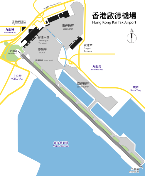
| 06:56, 9 July 2006 |  | 988 × 1,200 (43 KB) | Antilived | {{Information |Description= Plan view of Hong Kong Kai Tak Airport with Traditional Chinese text. Originaly PNG by Toblerone, traced by me using Inkscape. |Source= Image:Kaitak-Airport-Plan.png |Date= 2006-07-09 |Au |
File usage
The following 3 pages use this file:
Global file usage
The following other wikis use this file:
- Usage on de.wikipedia.org
- Usage on fr.wikipedia.org
- Usage on he.wikipedia.org
- Usage on id.wikipedia.org
- Usage on it.wikipedia.org
- Usage on ko.wikipedia.org
- Usage on no.wikipedia.org
- Usage on pl.wikipedia.org
- Usage on ru.wikipedia.org
- Usage on vi.wikipedia.org
- Usage on zh-yue.wikipedia.org
- Usage on zh.wikipedia.org
