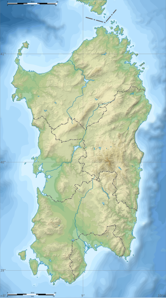
File:Italy Sardinia relief location map.svg

Size of this PNG preview of this SVG file: 334 × 599 pixels. Other resolutions: 134 × 240 pixels | 267 × 480 pixels | 428 × 768 pixels | 571 × 1,024 pixels | 1,142 × 2,048 pixels | 601 × 1,078 pixels.
Original file (SVG file, nominally 601 × 1,078 pixels, file size: 1.62 MB)
File history
Click on a date/time to view the file as it appeared at that time.
| Date/Time | Thumbnail | Dimensions | User | Comment | |
|---|---|---|---|---|---|
| current | 15:26, 4 March 2018 |  | 601 × 1,078 (1.62 MB) | Ruthven | c:User:Rillke/bigChunkedUpload.js: |
| 09:29, 25 February 2018 |  | 601 × 1,078 (1.62 MB) | Ruthven | New province boundaries (2016) | |
| 15:29, 24 January 2010 |  | 601 × 1,078 (1.63 MB) | Sémhur | == {{int:filedesc}} == {{Information |Description= {{en|Blank physical map of Sardinia, Italy, for geo-location purpose, with province boundaries. Altitude levels : 25m, 50, 100, 200, 400, 600, etc. (same for bathymetry)}} {{fr|Carte topo |
File usage
The following 29 pages use this file:
- 184th Infantry Division "Nembo"
- 2019 European Ladies' Team Championship
- 203rd Coastal Division (Italy)
- 204th Coastal Division (Italy)
- 205th Coastal Division (Italy)
- Budelli
- Gulf of Oristano
- Is Molas Challenge
- Is Molas Senior Open
- Lake Baratz
- Lake Coghinas
- Lake Gusana
- Lake Liscia
- Lake Omodeo
- Lake Temo
- Languages of Italy
- Mechanized Brigade "Sassari"
- Punta La Marmora
- Punta Sardegna
- San Pietro Island
- Santo Stefano (island)
- User:Broc/sandbox/Capo Malfatano
- User:Michael!/Project:Location map templates/Italy
- User:Noclador/sandbox/Royal Italian Army - Italy - September 1943
- User:Noclador/sandbox/Royal Italian Army expansion 1939
- Template:Sardinia regional languages labelled map
- Module:Location map/data/Italy Sardinia
- Module:Location map/data/Italy Sardinia/doc
- Module:Location map/data/Sardinia
Global file usage
The following other wikis use this file:
- Usage on ar.wikipedia.org
- Usage on az.wikipedia.org
- Usage on ba.wikipedia.org
- Usage on be.wikipedia.org
- Usage on bn.wikipedia.org
- Usage on bs.wikipedia.org
- Usage on ca.wikipedia.org
- Usage on ceb.wikipedia.org
- Usage on ce.wikipedia.org
- Usage on cs.wikipedia.org
- Usage on de.wikipedia.org
- Usage on de.wikivoyage.org
- Cagliari
- Olbia
- Alghero
- Sassari
- Oristano
- Nuoro
- Arbatax
- Sinis-Halbinsel
- Modul:Location map data it-88
- Modul:Location map data it-88/Doku
- Orosei
- Sos Alinos
- Budoni
- Posada (Sardinien)
- Valledoria
- Golfo Aranci
- Argentiera
- Porto Torres
- Bosa
- Cuglieri
- Macomer
- Abbasanta
- Arborea
- Terralba
- Tharros
- San Giovanni di Sinis
- Santuario nuragico Santa Cristina
- Carbonia
- Iglesias
- Villacidro
- Guspini
View more global usage of this file.

