
File:HurstvilleNSWmap.jpg

Size of this preview: 799 × 600 pixels. Other resolutions: 320 × 240 pixels | 639 × 480 pixels | 851 × 639 pixels.
Original file (851 × 639 pixels, file size: 239 KB, MIME type: image/jpeg)
Summary
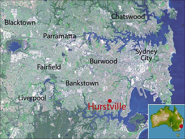
| Description |
Map of Sydney, highlighting location of Hurstville, New South Wales |
|---|---|
| Source |
NASA satellite maps PIA03498 (main) and PIA06665 (inset) |
| Date |
21 May 2008 |
| Author |
crico |
| Permission (Reusing this file) |
See below.
|
Licensing:
File history
Click on a date/time to view the file as it appeared at that time.
| Date/Time | Thumbnail | Dimensions | User | Comment | |
|---|---|---|---|---|---|
| current | 05:06, 21 May 2008 | | 851 × 639 (239 KB) | Crico (talk | contribs) | {{Information |Description=Map of Sydney, highlighting location of Hurstville, New South Wales |Source=NASA satellite maps PIA03498 (main) and PIA06665 (inset) |Date=21 May 2008 |Author=crico |Permission= |other_versions= }} |
You cannot overwrite this file.
File usage
The following 2 pages use this file: