
File:Farringdon Platform (disused).jpg
No higher resolution available.
Farringdon_Platform_(disused).jpg (640 × 428 pixels, file size: 75 KB, MIME type: image/jpeg)
Summary
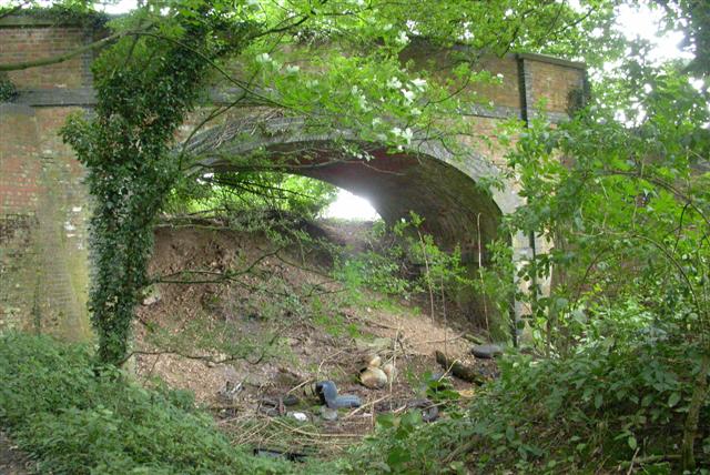
| Description | English: End of the Line The footpath along this disused railway line ends at this bridge. |
| Date | |
| Source | From geograph.org.uk |
| Author | Ben Gamble |
| Permission (Reusing this file) |
Creative Commons Attribution Share-alike license 2.0 |
| Attribution (required by the license) | Ben Gamble / End of the Line / |
| Object location | | View this and other nearby images on: OpenStreetMap |
|---|
.jpg¶ms=051.113060_N_-000.998670_E_globe:Earth_class:object_type:object_source:geograph-osgb36(SU70193534)_&language=en)
Licensing

|
This image was taken from the Geograph project collection. See this photograph's page on the Geograph website for the photographer's contact details. The copyright on this image is owned by Ben Gamble and is licensed for reuse under the Creative Commons Attribution-ShareAlike 2.0 license. |
This file is licensed under the Creative Commons Attribution-Share Alike 2.0 Generic license.
Attribution: Ben Gamble
- You are free:
- to share – to copy, distribute and transmit the work
- to remix – to adapt the work
- Under the following conditions:
- attribution – You must give appropriate credit, provide a link to the license, and indicate if changes were made. You may do so in any reasonable manner, but not in any way that suggests the licensor endorses you or your use.
- share alike – If you remix, transform, or build upon the material, you must distribute your contributions under the same or compatible license as the original.
Original upload log
The original description page was here. All following user names refer to en.wikipedia.
- 2008-02-09 09:06 Bashereyre 640×428× (77109 bytes) {{Information |Description=Disused railway line, Farringdon |Source=Geograph- Photograph every Grid Square |Date=14 August 2005 |Location=UK Grid refeenceSU 701353 |Author=Ben Gamble |Permission=Yes |other_versions=Yes }}
File history
Click on a date/time to view the file as it appeared at that time.
| Date/Time | Thumbnail | Dimensions | User | Comment | |
|---|---|---|---|---|---|
| current | 16:34, 6 July 2009 | | 640 × 428 (75 KB) | File Upload Bot (Magnus Manske) | {{BotMoveToCommons|en.wikipedia|year={{subst:CURRENTYEAR}}|month={{subst:CURRENTMONTHNAME}}|day={{subst:CURRENTDAY}}}} {{Information |Description={{en|Disused railway line, Farringdon}} |Source=Transferred from [http://en.wikipedia.org en.wikipedia]; tra |
File usage
The following page uses this file:
Global file usage
The following other wikis use this file:
- Usage on www.wikidata.org
.jpg)