File:East coast sst track.jpg

Size of this preview: 686 × 599 pixels. Other resolutions: 275 × 240 pixels | 549 × 480 pixels | 689 × 602 pixels.
Original file (689 × 602 pixels, file size: 79 KB, MIME type: image/jpeg)
Summary
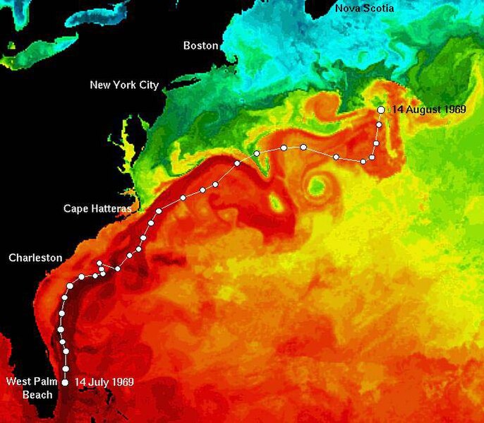
The satellite map of sea surface temperature of the east coast of the United States showing the path of the Ben Franklin during its 30 day Gulf Stream Drift Mission.
Licensing:
File history
Click on a date/time to view the file as it appeared at that time.
| Date/Time | Thumbnail | Dimensions | User | Comment | |
|---|---|---|---|---|---|
| current | 18:18, 26 January 2009 |  | 689 × 602 (79 KB) | Urbankayaker (talk | contribs) | The satellite map of sea surface temperature of the east coast of the United States showing the path of the Ben Franklin during its 30 day Gulf Stream Drift Mission. |
You cannot overwrite this file.
File usage
The following page uses this file:
